Download
1 / 8
80 likes | 297 Vues
GPS Radio Occultation Receiver For CLARREO FY 2009 Tasks. Anthony J. Mannucci Jet Propulsion Laboratory, California Institute Of Technology. TriG Overview. A new GPS receiver design is needed for Decadal Survey missions, including CLARREO Track modernized GPS and other systems (Galileo)

E N D
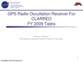
GPS Radio Occultation Receiver For CLARREOFY 2009 Tasks Anthony J. Mannucci Jet Propulsion Laboratory, California Institute Of Technology
TriG Overview • A new GPS receiver design is needed for Decadal Survey missions, including CLARREO • Track modernized GPS and other systems (Galileo) • Track all-in-view • Improved precision and accuracy via higher antenna gain • The TriG design meets stringent climate requirements for CLARREO • Meets requirements for NOAA GPS-RO mission • Also meets the most stringent mission navigation requirements from DESDynI and ICESAT-2 • Continues climate time series started with COSMIC constellation of GPS receivers TriG
GPS Study Goals • Define Level 1 requirements for GPS receiver on CLARREO • Traceable to science objectives • Define implementation options • COTS? TriG? Other? • Trades: new signals, all in view, antenna, etc. • Constellation descope implications • What constellation is required for RO science? • Project-specific cost estimate and implementation timeline • Integration and test – scope and cost estimate for CLARREO • Antenna deployment environment • Nominal schedule for delivery, test, operations • Operations and data analysis plan
Determining Level 1 Requirements • Relevant science objectives • Poleward motion of baroclinic zones (Leroy document Nov ‘08) • Other objectives (temperature trends, refractivity trends, what altitude range?) • Level 1: • Refractivity accuracy and precision on a per-profile basis • Altitude range • Number of profiles/day in a given altitude range from the receiver • Method for estimating accuracy and precision
Flowdown From Level 1 • Instrument and processing system requirements • Phase and range precision and accuracy vs. boresight angle • Antenna gain and phase error versus boresight angle • On-board processing requirements (# occs/day) • Occultation scheduling • Tracking algorithms • Processing system requirements: orbit determination accuracy, ionospheric calibration, etc.
Trades • Key instrument trades: • Which signals? All-in-view? • Antenna gain requirements: precision and accuracy • Radiation tolerance/hardness • Parts reliability • Software class and methodology • Constellation trades – sampling error • CLARREO may meet certain science objectives with one satellite (e.g. annual climatology) • Leveraging NOAA constellation • Recommendation: CLARREO keep the GPS receiver and develops design to stringent climate specifications • Multipath environment, data processing strategy, testing and mission assurance methodology
Recent Activities • Implementation plan for TriG receiver • Detailed cost and schedule ready in ~3 weeks • Descope options • Partnership with Broad Reach Engineering • April workshop • Draft Level 1 requirements at a top level (broad view of objectives) • Systems engineering discussion • NOAA participation (other constellations)
Plans • Goals for May 2009 • Define a baseline instrument, traceable to science objectives • Define baseline science data system • Baseline accommodation requirements (antenna placement) • Baseline integration and test strategy • Cost estimate, with uncertainties • Goals following May 2009 • Constellation strategy and trades – which objectives are met with which constellation/sampling approach • Finalize GPS strategy – clearly justify GPS decision and possible coordination with NOAA constellation • Mission assurance approach and software class • Additional details on GPS receiver design and processing system • Coordination plan with Geodetic Observing System