Download
1 / 46
470 likes | 651 Vues
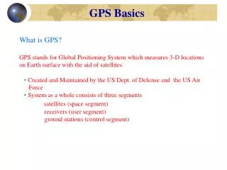
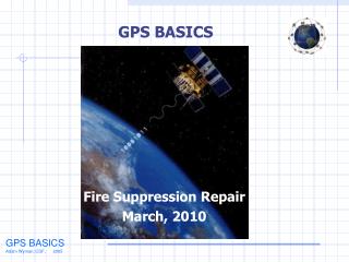
GPS BASICS. What is GPS?. Developed by Oklahoma 4-H . GPS. G lobal P ositioning S ystem Network of 24 satellites (with spares) Developed by Department of Defense Operational 24 hours/day Available worldwide Land, sea and air Works in all weather conditions It is FREE!!.

E N D
What is GPS? Developed by Oklahoma 4-H
GPS • Global Positioning System • Network of 24 satellites (with spares) • Developed by Department of Defense • Operational 24 hours/day • Available worldwide • Land, sea and air • Works in all weather conditions • It is FREE!!
Navigation Tools of the Past Sextant Chronometer
Beginnings • TRANSIT developed by Navy in 1960s • Used to track nuclear submarines • Air Force created own system • Used to locate vehicles on land or in air
NAVSTAR • Combined Navy and Air Force systems in 1973 • NAVigation Satellite Timing And Ranging (NAVSTAR) • First used in combat during Operation Desert Storm – 1991 • Full Operational Capability – April 27, 1995
GPS System • Space Segment – Satellite Constellation • Control Segment– Monitoring Stations and Ground Antennas • User Segment – Receivers
Satellite Information • Weighs approximately 2,000 lbs • Travels 7,000 mph • 17 feet across with solar panels extended • Last 10 years • Orbit 12,500 miles above Earth • Circle the Earth twice daily
In the next lesson we will learn: • How GPS works • Coordinates – Latitude and Longitude • Creating and Finding Waypoints using a GPS receiver
How it works • Satellite circles the Earth and transmits signal • Signal contains time it was sent and its location • All satellites send their signal at the same time • Difference in time to reach receivers is used to determine location
Formula: Distance = Speed x Time • Signal travels at the speed of light – 186,282.3976 miles per second • Speed and Time are known, use to calculate Distance
Trilateration • Process of measuring the distance from at least three satellites • Three satellites calculate 2D position (Latitude and Longitude) • Four or more satellites calculate 3D position (Latitude, Longitude, and Altitude)
One satellite can locate a receiver’s position somewhere on a sphere Two satellites can locate a receiver’s position to a circle representing the intersection of two spheres Three satellites can locate a receiver’s position to one of two points represented by the intersection of three spheres.
Latitude • Latitude lines run horizontal • Equator is 0° • North and South Poles are 90°
Longitude • Also known as meridians, run vertical • The Prime Meridian in Greenwich, England is 0° • Lines range from 0° to 180° • International Date Line is 180°
Now for the fun part!
Click Stick Page Button Zoom In button Power Button Zoom Out button Find button
Satellite Page Map Page Navigation Page
Trip Page Main Menu
The next lesson we will talk about limitations and accuracy with a GPS receiver.
Accuracy Problems • Atmosphere Delay • Signal Multipath • Receiver Clock Errors • Number of Satellites Visible • Satellite Geometry and shading • Selective Availability – Turned off
WAAS • Developed by the FAA • Wide Area Augmentation System • Increases the accuracy of GPS receivers • Full Operational Capacity on July 10, 2003
Wide Area Augmentation System WAAS Corrected Signal WAAS Master Station WAAS Reference Station Receiver
Differential Correction • Developed by the Coast Guard • Also known as DGPS • Ten meter or less accuracy • Full Operational Capacity March 15, 1999
Differential GPS Correction Signal Stationary Receiver
Now what do we do with this information? The next section discusses the uses of GPS
Uses of GPS Locating Tracking Navigating Mapping Timing
Using GPS • What are uses you can think of? Boating Fishing Hunting Camping Hiking Biking Rafting
Using GPS continued • Scouting from land or air, Horseback riding, Hot air ballooning, Aviation, Snowmobiling, Skiing, Search and Rescue, Four wheeling, Emergency Vehicle Tracking, Highway Driving • Geocaching, Surveying, Military, Precision Agriculture
Using GPS continued • Survey disaster areas, Map movement of environmental disasters (Oil spills, wild fires, floods, etc) • Mapping fallout shelters, sidewalks, streets, trees, trails, etc. • Measuring the growth or decline of mountains
How does GPS improve these activities? • Makes the location more precise • User Friendly • Mapping is easier • Universal system • Fun!
What can you do with GPS?
GPS/GIS and 4-H • Potential Projects • Youth Favorite Places • www.youthfavoriteplaces.org • Geocaching • www.geocaching.com • National GPS / GIS Integration Team • http://www.4-h.org/ • The National Map Corps • http://nationalmap.gov/TheNationalMapCorps/
GPS/GIS and 4-H • Community Atlas • ESRI Grants • http://www.esri.com/industries/k-12/atlas/index.html • http://gis.esri.com/industries/k-12/commatlas/browse.cfm • Environmental Impact Team • Waterwell Mapping • The Globe Project • www.globe.gov
GPS/GIS and 4-H • Oklahoma Project Ideas • Danger Signs • Historic Downtown Areas • Illegal Dump locations • Health and Wellness benefits • Storm Shelters • Nature Trails and/or Vegetation