THE NORTH AMERICAN MANUFACTURING CORE
220 likes | 516 Vues
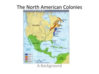
THE NORTH AMERICAN MANUFACTURING CORE. (CHAPTER 5: PART 1). INTRODUCTION. The manufacturing core is outlined on the map on page 89 of the text. Although it straddles the U.S.- Canadian boarder, the international boundary has little impact on the region's shape.

THE NORTH AMERICAN MANUFACTURING CORE
E N D
Presentation Transcript
THE NORTH AMERICANMANUFACTURING CORE (CHAPTER 5: PART 1)
INTRODUCTION • The manufacturing core is outlined on the map on page 89 of the text. • Although it straddles the U.S.- Canadian boarder, the international boundary has little impact on the region's shape. • Heavy manufacturing is concentrated throughout the Ohio Valley, Megalopolis, and along the southern shores of the Great Lakes. • The western part of the region blends with the agricultural core.
KEY TERMS • Core area • Accessibility resources • Heavy industry • Hinterland
KEY TERMS • Core Area • The portion of a country that contains its economic, political, intellectual, and cultural focus • Often the center of creativity and change • Can be approximated by viewing the region of greatest overlap among the cultural, political and economic heartlands • Accessibility Resources • Naturally occurring landscape features that facilitate the interaction between places. • Navigable waterways - rivers and the Great Lakes • Provided distinct advantages to the manufacturing core
KEY TERMS(continued) • Heavy Industry • The conversion of large volumes of raw materials and partially processed materials into products of higher value • Involves considerable capital investments in large machinery and heavy energy consumption • Relatively small acreages of heavy industrial activity may account for enormous percentages of overall production. • Only 3% of the total land area of the U.S. and Canada accounts for >50% of the steel production and 71% of all cars.
STEEL PRODUCTION
KEY TERMS(continued) • Hinterland • The area tributary to a place, which is linked to that place through lines of exchange or interaction • Usually refers to "the country behind" • A surrounding area that is served by an urban center
MANUFACTURING CORE • Location - Examine the map on page 88. • MILLION DOLLAR QUESTION: Why is the manufacturing core located as depicted? • HINT: The location of any manufacturing center depends upon the availability of the following basic requirements: • raw materials • labor • a market • transportation • energy availability
KEY ADVANTAGES(of the Manufacturing Core) • 1. Raw Materials - Enormous reserves of coal and iron ore are available within the core region. • 2. Labor - In its infancy, the core benefited from thousands of immigrants in search of manual labor type jobs. Today, the region still houses a major concentration of the country's population. • 3. Market - The core possesses a large internal market as well as being accessible to other regional markets, Canada, and abroad.
KEY ADVANTAGES(of the Manufacturing Core) • 4. Transportation - The Ohio River System and the Great Lakes have proved to be tremendous accessibility resources. Major valleys (such as the Ohio, Mohawk, and Susquehanna) have facilitated the construction of railroads, and more recently, interstate highways. • 5. Energy - Water power, later oil, and now coal for burning in power plants, make this an energy rich region.
PHYSIOGRAPHIC REGIONS
NORTH AMERICA’S FOSSIL FUELS
MORPOLOGY OF THE US URBAN-INDUSTRIAL LANDSCAPE • WHEN did the pattern evolve? • WHERE were the key hubs? • WHY were these places important? • HOW did individual cities contribute to regional and national patterns? • WHAT were the underlying processes?
BORCHERT'S MODEL • The historical growth of the U.S. urban system • Based on key changes in transportation and industrial energy • 1790-1830 (Sail Wagon Epoch) • An era characterized by slow, primitive overland and waterway movement • Boston, New York, and Philadelphia • 1830-1870 (Iron Horse Epoch) • The period that witnessed the arrival and spread of the steam powered railroad and small-scale industry • Pittsburgh, Chicago, and Detroit
BORCHERT'S MODEL(continued) -1870-1920 (Steel Rail Epoch) • Coincided with the American industrial revolution. • The steel industry thrived. -1920-1960 (Auto-Air Amenity Epoch) • Marked the final stage of industrial urbanization and maturation of the U.S. urban system. • The gasoline engine made a significant impact. • Automobiles, trucks, and airplanes served to enhance mobility and accessibility.
INFORMATION TECHNOLOGY EPOCH (1960-PRESENT) • As an extension of Borchert's Model • Applies to the U.S. and Canada • Economies have become more dependent on the production and exchange of information, rather than manufacturing. • Earlier locational advantages may not necessarily provide developmental advantages during the information technology era.
THE NORTH AMERICANMANUFACTURING CORE (CHAPTER 5: PART 1)