Chapter 4
Chapter 4. GMDSS (Global Maritime Distress and Safety System). Overview. History Carriage Requirements Digital Selective Calling (DSC) Sea Areas Maritime Mobile Service Identity (MMSI) Emergency Position Indicating Radio Beacon (EPIRB) Navigational Text Messages (NAVTEX)

Chapter 4
E N D
Presentation Transcript
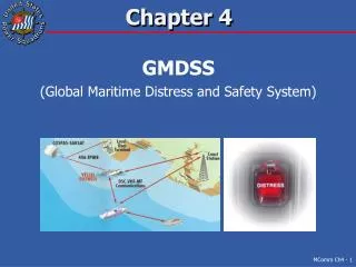
Chapter 4 GMDSS (Global Maritime Distress and Safety System)
Overview • History • Carriage Requirements • Digital Selective Calling (DSC) • Sea Areas • Maritime Mobile Service Identity (MMSI) • Emergency Position Indicating Radio Beacon (EPIRB) • Navigational Text Messages (NAVTEX) • Automatic Identification System (AIS) • Search and Rescue Transponder (SART) • Summary >>
History • Analog VHF-FM dates back to post WWII • 1978 SOLAS adopted digital standards • which became GMDSS • Adds digital calling and identification to marine radio • Scenario • GMDSS takes the “Search” out of Search and Rescue >>
Carriage Requirements • GMDSS is mandatory, since 1999, for • Commercial vessels • Large vessels • Large private vessels on international voyages • Voluntary for • Recreational boaters • USCG • Vessels are GMDSS equipped (compliant) • CONUS VHF will be GMDSS compliant by 2009 >>
GMDSS Basic Concept • Digital Selective Calling for MF, HF, VHF & INMARSAT Radios • Digital Maritime Mobile Service Identity (MMSI) is embedded in radio transmissions >>
Digital Selective Calling • DSC and GMDSS • Why DSC Distress Calling • Classes of DSC radios • GMDSS Distress Call Elements • Nature of Distress Options • Distress DSC Calling • Routine DSC Calling >>
DSC and GMDSS • Digital Selective Calling is a key feature • Combined with VHF, MF and HF radios • Combined with INMARSAT satellite radios • New radios, since 1999, must have DSC • VHF-FM/DSC uses Channel 70 • Automatic transmission of distress call • By pressing • Automatically resent until acknowledged >>
VHF-FM/DSC Radio • All normal VHF-FM functions plus DSC • Automatic distress calling • Individual and group DSC calling >>
Why DSC Distress Calling • Increased reliability • Distress call is repeated until acknowledged • Automatic transmission of vessel’s location • When interfaced to a GPS receiver • Information on captain and vessel • From the MMSI database • Reduced incidences of hoax distress calls • From MMSI they know who you are • False distress alert is a felony offense • Fines of up to $5,000 • Plus cost incurred by SAR forces >>
Classes of DSC Radios • Class D is for VHF radios carried by: • Recreational boaters • Commercial fishing vessels • Other non-SOLAS regulated vessels • Internally, it has two receivers • One dedicated to DSC Channel 70 • Other for general voice communications • Class SC101 is discouraged • Other classes are described in “The Boatowner’s Guide to GMDSS and Marine Radio” >>
DSC Distress Signal • Basic Elements • MMSI • Nature of distress • Operator selected • Default is “Undesignated” • Vessel’s position (fix) • If interfaced with GPS receiver • If entered manually • Time of fix • If interfaced with GPS receiver • If entered manually • Interface DSC radio with GPS receiver! • NMEA 0183 >>
Nature of Distress • Abandoning • Adrift • Capsizing • Collision • Disabled • Explosion • Fire • Flooding • Grounding • Listing • MOB (Man Overboard) • Piracy • Sinking • Undesignated >>
DSC Distress Calling - 1 • Press & hold “DISTRESS” button for 5 sec • Then switch to channel 16 and initiate voice MAYDAY call • Say “Mayday” three times, followed by “this is” and the boat’s name • Give MMSI (only once) • Say “over” • DSC automatically continues to send channel 70 DSC distress call until acknowledged • Initially 5 times • Then repeated every 3 to 4 min until acknowledged >>
DSC Demo #1 • Distress call without GPS • Distress call with interfaced GPS Link to DSC Simulator >>
DSC Distress Calling - 2 • Remember DSC distress alert includes • MMSI • Nature of distress • “Undesignated” suggests most dire emergency • If time – select nature of distress from list • Vessel’s position • Time of fix • From the MMSI, the Rescue Coordination Center retrieves information about the captain and vessel >>
Accidental Distress Alert • Immediately turn off DSC transceiver • Then, turn the radio back on • Make a voice broadcast on channel 16: “All Stations” giving the vessel’s name, call sign and MMSI Cancel the distress alert verbally, giving date and time • False distress alert is a felony offense • Fines of up to $5,000 • Plus cost incurred by SAR forces >>
Routine DSC Calling • First, enter MMSI of vessel to be called • Next enter a desired working frequency • Then press “SEND” or “ENTER” key • Digital hail transmitted on Channel 70 • Target radio sounds incoming call alert • To answer, press “SEND” or “ENTER” key • Radios automatically switch to working freq • Both parties talk on working frequency • If called radio does not answered • Logs incoming call (like an answering machine) >>
DSC Demo #2 • DSC hail, followed by voice on working channel • Position request Link to DSC Simulator >>
Sea Areas • A1 - Shore out to 20 nm • A2 - From 20 out to 100 nm from shore • A3 - Over 100 nm from shore 70º N to 70º S • A4 - Polar regions above 70º >>
Sea Area A1 • Within range of USCG shore-based VHF DSC radios – typically out to at least 20 nm • Channel 70 for DSC calling and distress • Channel 16 for voice calling and distress >>
Sea Area A2 • Within range of USCG shore-based MF DSC radios – typically out to 100 nm • Excludes Sea Area A1 • 2187.5 KHz for DSC calling and distress • 2182.0 KHz for voice calling and distress >>
Sea Area A3 • Within INMARSAT satellite coverage • Between 70º N to 70º S • Excludes Sea Areas A1 and A2 >>
Sea Area A4 • Polar Regions (above 70º) • Excludes Sea Areas A1, A2 and A3 • No assured communications • Use High Frequency SSB voice (6216 / 8291 KHz) • FYI - Arctic / Antarctic circles are at 66º 34’ >>
MMSI Maritime Mobile Service Number (MMSI) • Structure • Obtaining • Duration • Programming >>
MMSI Structure • Maritime Mobile Service Identity (MMSI) • Unique to each vessel • EPIRB emergency beacons use a different registration number • Obtained from NOAA • See chapter 8 • Nine digit number • Country prefix (MID) of 3 digits • Station identifier of 6 digits • Ends in “0” if boating internationally • Ends in 1 to 9 if boating only domestically >>
Obtaining a MMSI • International boaters: • Includes to Canada, Mexico and Bahamas • Electronically at: www.fcc.gov/formpage.html • Or mail FCC Form 605 Schedule B to FCC • Domestic boaters, normally electronically at: • BoatUs: www.boatus.com/mmsi • Sea Tow: www.seatow.com • USPS at: www.usps4mmsi.com • Or mail FCC Form 605 Schedule B to FCC >>
FCC Form 605 Schedule B Page 1 >>
FCC Form 605 Schedule B Page 2 >>
Duration of MMSI • Valid for 10 years if issued by FCC • Renew within 60 days of expiration • No limit if issued by Registered Agent • Will be contacted every 3 years to see if information is still current • KEEP IT CURRENT! • Search and Rescue information >>
Programming MMSI • Register one MMSI per entire vessel • Consult your users guide & follow instructions • Test calls with another DSC radio • DO NOT TEST “Distress Alerts” (DO NOT PRESS “Distress” button) >>
EPIRBEmergency Position Indicating Radio Beacon • Cat I – 406 / 121.5 MHz beacon • Float free • Automatically activated • Cat II – 406 / 121.5 MHz beacon • Removed from storage bracket • Manually activated • Cat I or II with GPS • Improved position reporting • Some include a strobe light >>
SARSAT System • Search And Rescue Satellite Aided Tracking >>
USCG for Maritime Alerts USAF for Inland Alerts RCCs and their AORs AKRCC ELMENDORF RCC CLEVELAND RCC TRENTON RCC HALIFAX RCC VICTORIA RCC JUNEAU RCC SEATTLE RCC BOSTON AFRCC LANGLEY RCC HONOLULU (CG / PACOM) RCC NORFOLK RCC ALAMEDA RCC MIAMI RCC NEW ORLEANS RSC SAN JUAN >>
406 MHz with GPS Search Area Minimal Search Time 406 MHz-only Search Area 2 to 3 hours Search Time EPIRB with GPS • 406 MHZ search area approx 2.6 nm wide • 406 MHz with GPS search area 100 meters wide >>
EPIRB Registration • Must be done immediately after purchase • $10,000 fine if unregistered EPIRB activated • Can be done online at: • www. beaconregisteration.noaa.gov • Required information • 15 digit EPIRB ID number • Type of EPIRB • Owners name, address, and contact info • Vessel info (name, color, size, homeport, etc.) • Primary and alternate 24-hour emergency contact phone numbers >>
EPIRB Utilization • EPIRBs with internal GPS are best • Register with NOAA after purchase • Cat I is float free; automatically activates • Cat II have to be released and manually activated (turned on) • Once turned on, leave it on! • Until rescued • Will operate for minimum of 48 hours • Take with you if you abandon the vessel >>
EPIRB Technical – 1 • Actual frequency of 406.028 MHz • Beacon and data picked up by satellite • Hex character is a digitally encoded signal • 5 watts for at least 48 hours • 121.5 MHz • Used for homing by SAR • 50 to 100 milliwatts for at least 48 hours • Uses lithium battery • Shelf life of 5 years • Replace (by dealer) before expiration date >>
EPIRB Technical - 2 • EPIRB digital transmission gives: • Country of beacon registration • ID of vessel or airplane • If internal GPS, position information • Store and forward LEO satellite • LUT, using Doppler, calculates search area • MCC retrieves and forwards registration info to the RCC >>
EPIRB Rental • From Boat US • Cat II EPIRB • They do the registration • Details on their web site at: www.boatus.com/foundation/EPIRB/ >>
Personal Locator Beacons • 406 / 121.5 EPIRB with internal GPS • Must be registered as an EPIRB • Size and weight of a cellular phone • Can also be used on land when: hiking, skiing, camping, hunting, etc. • Not for use in cities or cars • Severe penalties for deliberate misuse >>
NAVTEX • Navigation warnings, weather forecasts and warnings, search and rescue notices, and Notices to Mariners • Part of GMDSS at 518 kHz • Daytime range of about 400 nm • Nighttime range of up to 600 nm All messages are in English >>
USCG NAVTEX Sites Canadian coverage of much of Great Lakes Kodiak, Ala Guam (not shown) Honolulu, HI Astoria, OR Pt. Reyes, CA Cambria, CA Chesapeake, VA Savannah, GA Miami, FL Cape Cod, Mass New Orleans, LA San Juan, PR >>
NAVTEX Messages • Four character header • 1st character identifies the transmitting station • 2nd character identifies the subject A = Navigational warning B = Meteorological warning D = Search & Rescue information E = Meteorological forecasts • 3rd & 4th characters are the message number • Header is transmitted twice per message • Modulation 170 Hz FSK at 100 baud • Some countries also broadcast NAVTEX, in their local language, on 490 kHz >>
Automatic Identification System • AIS shares positions & intentions • Collision avoidance • In Vessel Traffic Service (VTS) Sea Area A1 >>
AIS Displays • Similar to Radar • With info tag provided by other vessel • Check out www.marinetraffic.com/ais/ Our Vessel Near collision warning >>
AIS Data • From ship’s GPS and other sensors • Data transmitted: • Vessel identification • Speed • Heading • Other information for Class A vessels • Time sensitive data every 2 to 10 seconds • Other data every 6 minutes >>
AIS Additional Info • Class A for commercial vessels • Required since 31 Dec 2004 • Class B for recreational boats • FCC type accepted in 2008 • Not required by Dept of Homeland Security • Receive-only AIS installations • Master (shore) station • Also identifies buoys and other NavAids • Can create virtual NavAids >>