Hurricane Presentation
Hurricane Presentation.
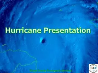

Hurricane Presentation
E N D
Presentation Transcript
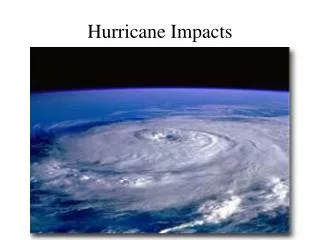
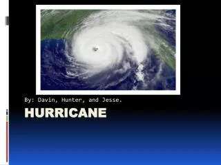
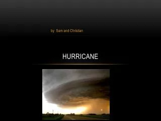
What is a Hurricane?A hurricane is a type of tropical cyclone–an organized rotating weather system that develops in the tropics. Hurricanes rotate counterclockwise in the Northern Hemisphere. Tropical cyclones are classified as follows:Tropical Depression—An organized system of persistent clouds and thunderstorms with a closed low-level circulation and maximum sustained winds of 38 mph (33 knots) or less.TropicalStorm—An organized system of strong thunderstorms with a well defined circulation and maximum sustained winds of 39 to 73 mph (34-63 knots).Hurricane—An intense tropical weathersystem with a well defined circulation and sustained winds of 74 mph (64 knots) or higher. In the western North Pacific, hurricanes arecalled typhoons, and similar in the IndianOcean are called cyclones.
Dr. Gray's ATLANTIC BASIN SEASONAL HURRICANE FORECAST FOR 2013
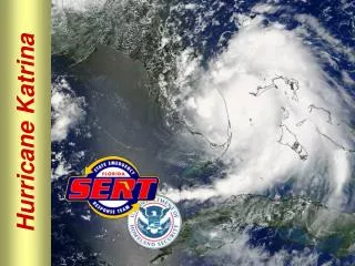
3 major hurricanes struck GA coast in the 1890’s
Oct 1898 – Georgia Hurricane Landfall near Brunswick as a Cat. 4 with max winds of 135 mph 180 dead; $56.5 million in damage (2004 dollars) Max storm surge was 13-18 ft. in Darien http://www.srh.noaa.gov/jax/research/hurricanes/history/1898/
Risks to Coastal Georgia • 3 major landfalls in the 1890’s (but none since 1900) • Potential for big storm surge owing to shallow shelf • Barrier islands at extra risk associated with sea level rise
Impacts of floods • Immediate impacts: property damage, injuries, death • Health issues: infectious diseases, exposure to toxins • Key water quality issues: • Floodwater tainted with raw sewage, pesticides, agricultural waste, petroleum products, dead animals • Flooding of animal waste retention pools from hog, cattle, dairy, poultry farms Hurricane Frances (2004) caused $41M damage to Atlanta from flooding
Case Study: Hurricane Ivan (2004) From National Climatic Data Center Satellite Archives • Category 3 hurricane that made landfall just west of Gulf Shores, AL • Produced 25 tornadoes in GA resulting in 2 deaths and 10 injuries. • Rainfall in excess of 5 to 10 in. and high winds destroyed 50% pecan and 15% cotton crop in GA. • Property damage in GA $68.8 M.
Hurricane Risks to Georgia • While no major hurricane strikes since 1900, increases in # of Atlantic storms increases the probability of a GA landfall • Landfall on GA coast has potential for big storm surge owing to shallow shelf • Barrier islands at extra risk associated with sea level rise • Heavy rainfall associated with storms that make landfall in the Gulf; rainfall in hurricanes is expected to increase • Tornadoes likely to be spawned in GA by increasingly intense storms that make landfall in the Gulf
Hurricane Watch A Hurricane Watch is Issued for a Coastal Area When There is a Threat of Hurricane Conditions Within 24 - 36 Hours Check often for official bulletins on radio, TV, or NOAA Weather Radio. Fuel car. Check mobile home tie-downs. Moor small craft or move to safe shelter. Stock up on canned provisions. Check batteries for radio and flashlights. Secure lawn furniture and other loose material outdoors. Board or shutter windows to prevent shattering. Wedge sliding glass doors to prevent their lifting from their tracks.
Stayed turned to radio, TV, or NOAA Weather Radio for official bulletins Stay home if sturdy and on high ground Board up garage and porch doors Move valuables to upper floors Bring in pets Fill containers (bathtub) with several days supply of drinking water Turn up refrigerator to maximum cold and don't open unless necessary Use phone only for emergencies (Continued)
(Continued) Stay indoors on the downwind side of house away from windows Beware of the eye of the hurricane Leave mobile homes Leave areas which might be affected by storm tide or stream flooding Leave early in daylight if possible Shut off water and electricity at main stations Take small valuables and papers but travel light Have food and water for pets (shelters will not take them) Lock up house Drive carefully to nearest designated shelter using recommended evacuation routes
In the event an evacuation order is necessary for any area of Bryan County local radio as well as television station will be utilized to make this announcement.
Georgia Broadcast Radio will broadcast evacuation and other emergency Information over Georgia Broadcast Radio stations. Since these stations are all over the state, you can receive emergency information just about anywhere. ALBANY 91.7 ATHENS 91.7 / 97.9 AUGUSTA 90.7 BRUNSWICK 89.1 CARROLLTON 90.7 COLUMBUS 88.1 DAHLONEGA 89.5 DEMOREST 88.3 FORT GAINS 90.9 MACON 89.7 SAVANNAH 91.1 TIFTON 91.1 VALDOSTA 91.7 WAYCROSS 90.1
www.srh.noaa.gov/jax/index.shtml www.weather.com http://www.nhc.noaa.gov/ Anyone with a computer, who has on-line capabilities, may receive up to the minute information from a number of Internet Weather Services. These listed here are the most popular.
EVACUATION Tropical Cyclones pose a significant threat to the State of Georgia. The Decision to evacuate rest with the Chairman of the Bryan County Commissioners
Evacuation Clearance Time The maximum clearance time for Southern Bryan County during high occupancy time is 18 hours. Evacuations should be completed PRIOR to the onset of Tropical Storm Force Winds.
All Counties along the Georgia Coast employ a phased approach to evacuations and include: Voluntary-Partial: Tropical Storm Voluntary-Full: Category 1 & 2 Storms Mandatory Partial: Category 3-5 Storms Mandatory Full: Category 3-5 Storms Radio, TV and loud speakers from law enforcement vehicles will all be utilized in announcing an evacuation order
"An Evacuation Order has been issued for Bryan County"
Evacuation Routes Persons leaving Bryan County Should follow the following pre-designated routes: From North Bryan US 280 to US 341 to I-75 From South Bryan SR 144 to Glennville to Reidsville turn left on US 280 to US 341 to I-75
Go West Leave Early Leaving North Bryan and City of Pembroke Hwy 280 west to US 341 to I-75 Leaving South Bryan County and the City of Richmond Hill Hwy 144 West through Ft. Stewart to Glennville and then take Hwy 23 to Reidsville. Continue West on Hwy 280 to US 341 to I-75
EVACUATE EARLY Leave when asked to do so
THIS IS WHY WE PREPARE. (Hurricane Wilma in comparison to GA)
Re-Entry Plan A phased approach to re-entry is designed to allow only those personnel involved in a response access to impacted areas and is a necessity due to safety concerns. Phase 1 consists of entering affected areas to conduct damage assessments and to allow critical work force entry to conduct facilities assessments. When impacted areas are deemed safe for public entry, citizens who present evidence of business ownership or residency in affected areas will be allowed entry. Officials and residents should be reminded that the time between Phase 1 and Phase 2 could be several days.
Phase 1 - State & Local Authorized Re-entry Response Level 1 (Emergency Crew Entry) Aerial reconnaissance will be used to delineate affected areas. This will be coordinated by GEMA using a Mobile Communications Vehicle (MCV) through the Evacuation and Re-Entry Branch (ERB) located in Jesup. While affected areas are being determined, emergency response crews will depart staging areas along pre-designated re-entry routes to clear a path into the affected areas. Construction personnel and bridge crews will conduct damage assessments of roads and bridges. Information on areas deemed safe for travel will be relayed to the ERB to coordinate the multiagency response. Once damaged roads are repaired and re-entry routes and bridges are deemed safe for travel, Response Level 2 will be initiated. Phase I
No citizens or property ownerswill be readmitted until the following objectives have been met: Utility items have been surveyed and deemed to be safe, passable, or operational. Natural gas, water, sewer and electric lines must be surveyed for damage and checked for possible breaks. Water lines must have adequate pressure and present no health risks from raw sewage contamination. Downed power lines that pose safety or health problems to residents must be removed. The structural integrity of bridges and overpasses to provide routes for county public works and transportation crews must be determined to be safe and structurally sound. Critical portions of the transportation network must be cleared of as much debris as possible or deemed to be safe for vehicular traffic in damaged areas. Phase I Response Level 2 Continued
Phase II Phase 2 - Limited Public Re-entry After the impacted areas have been secured by local officials and deemed safe for access, citizens who present evidence of business ownership or residency in the impacted areas will be allowed entry. Re-entry access may be terminated at any time. During the early portions of phase 2, a curfew is likely to be imposed to citizens entering impacted areas.
Re-entry Routes Once tropical storm force winds have subsided, re-entry operations begin. GDOT has pre-identified re-entry routes for operations. Tropical cyclones threaten the state from landfalls along either the Atlantic or Gulf Coasts. Therefore, sets of reentry routes have been pre-identified for both threats. Table 3 below presents reentry routes for an Atlantic Coast threat. Re-entry routes for an Atlantic Coast threat. 1-16 to 1-95 Metter to Savannah SR 129 to US 280 to SR 30/SR 204 Metter to Claxton to Pembroke to Savannah SR 129 to US 280 to US 301 to SR 144 Metter to Richmond Hill SR 121 to SR 21 Millen to Savannah SR 121 to US 80 Metter to Statesboro to Savannah SR 129 to US 280 to US 301 to SR 57 to 1-95 Metter to Claxton to Glennville to Ludowici SR 129 to US 280 to US 301 to SR 196 to US 84 to 195 Metter to Claxton to Glennville to Hinesville SR 520 Waycross to Brunswick US 1 to US 40 Waycross to Folkston to St. Mary’s US 84 to SR 32 to SR 99 to US 341 US 84 to US 341 Waycross to Patterson to Sterling to Brunswick
What to Expect Depending on the track and intensity of the Storm you should prepare for wide spread damage. There may not be any place to buy food, gas, etc. Commodities (ice, water and MRE’s) will be distributed at pre-determined Points of Distribution or POD’s The parking lot at Kroger is designated as a POD but could change depending on extent of damage. POD Location will be announced as you enter through the re-entry points
Please remember that your safety is foremost the most important thought during this time. Depending on the extent of damage it could be days to weeks before you are allowed back into the area. It is our desire to return our community to normal as quickly as possible so we ask that you be patient should we be faced with this type of disaster. Safety First
HURRICANE PREPAREDNESS EFFORTS FOR 2013