2007 HURRICANE PRESENTATION
Glynn County Emergency Management Agency. 2007 HURRICANE PRESENTATION. Richard Strickland, Director. WHAT IS A HURRICANE? A hurricane is a type of tropical cyclone–an organized rotating weather system that develops in the tropics. TROPICAL DEPRESSION An organized system of

2007 HURRICANE PRESENTATION
E N D
Presentation Transcript
Glynn County Emergency Management Agency 2007 HURRICANE PRESENTATION Richard Strickland, Director
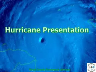
WHAT IS A HURRICANE?A hurricane is a type of tropical cyclone–an organized rotating weather system that develops in the tropics. TROPICAL DEPRESSION An organized system of persistent clouds and thunderstorms with a closed low-level circulation and maximum sustained winds of 38 mph (33 knots) or less. HURRICANE An intense tropical weather system with a well-defined circulation and sustained winds of 74 mph (64 knots) or higher. TROPICAL STORM An organized system of strong thunderstorms with a well defined circulation and maximum sustained winds of 39 to 73 mph (34-63 knots).
NORTH ATLANTIC HURRICANE SEASON • The North Atlantic hurricane season officially runs from June 1st to November 30th. • The vast majority of tropical storm and hurricane activity typically occurs during the August-October peak of the hurricane season. • An average hurricane season features approximately 11 named storms. * An above average hurricane cycle began in 1995.
The Saffir-SimpsonHurricane Scale Category One Hurricane: Winds 74-95 mph Category Two Hurricane: Winds 96-110 mph Category Three Hurricane: Winds 111-130 mph Category Four Hurricane: Winds 131-155 mph Category Five Hurricane: Winds greater than 155 mph
Hurricane Watch A Hurricane Watch is issued for a Coastal Area when there is a threat of Hurricane Conditions within 24-36 hours • Check often for official bulletins on radio, TV, or NOAA Weather Radio • Fuel car • Have cash available • Stock up on canned provisions • Check batteries for radio and flashlights • Secure lawn furniture and other loose material outdoors
Hurricane Warning A Hurricane Warning is issued when hurricane conditions are expected in a specified coastal area in 24 hours or less. Hurricane conditions include winds of 74 miles an hour (64 knots) and/or dangerously high tides and waves. Actions for protection of life and property should begin immediately when the warning is issued.
“A Hurricane Warning Is Being Issued for Your Area!” • Stay tuned to radio, TV, or NOAA Weather Radio for official bulletins • Make arrangement for pets • Fill containers with several days supply of drinking water • OTC/Prescriptions for 14-30 days • Shut off water and electricity at main stations • Take small valuables and papers but travel light • Lock up house • Drive carefully to nearest designated shelter using recommended evacuation routes
RADIO All local radio stations, on a regular basis, are provided updates on the storm, including its position, projected path and intensity. Information on any evacuations that may be in effect, and current road conditions. Monitor any of the Peach State Radio Stations for hurricane broadcast. FM 106.7 Local Station
GeorgiaBroadcastRadiowill broadcast evacuation and other emergency information over Georgia Broadcast Radio stations. Since these stations are all over the state, you can receive emergency information just about anywhere. The locations and frequencies of which are FM, are listed as follows: ALBANY 91.7 ATHENS 91.7 / 97.9 AUGUSTA 90.7 BRUNSWICK 89.1 CARROLLTON 90.7 COLUMBUS 88.1 DAHLONEGA 89.5 DEMOREST 88.3 FORT GAINS 90.9 MACON 89.7 SAVANNAH 91.1 TIFTON 91.1 VALDOSTA 91.7 WAYCROSS 90.1
NOAA RADIO Glynn County has a NOAA weather station broadcasting 24 hours a day. This information is provided by the National Weather Service and is updated regularly. The frequency of the NOAA station is 162.425, the call sign is WWH-39. Radios that receive these broadcasts can be purchased locally at Radio Shack. NOAA Glynn County has a NOAA weather station broadcasting 24 hours a day. This information is provided by the National Weather Service and is updated regularly. The frequency of the NOAA station is 162.425, the call sign is WWH-39. Radios that receive these broadcasts can be purchased locally at Radio Shack. RADIO
Anyone with a computer, who has on-line capabilities, may receive up to the minute information from a number of Internet Weather Services. These listed here are the most popular: www.srh.noaa.gov/jax/index.shtml www.weather.com http://www.nhc.noaa.gov/
Television stations inSavannahandJacksonvillewill be furnished information concerning the local situation, but we can only expect a limited amount of information specific toGlynnCounty, as they will be airing information for their local areas.
Go West Leave Early Leaving Glynn County and the City of Brunswick US 341 North through Jesup and continue NW to Baxley and Hazlehurst -or- SR 32 West through Alma and on to Douglas -or- US 82/SR 520 West to Waycross and W towards Tifton
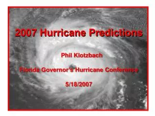
Dr. Gray's ATLANTIC BASIN SEASONAL HURRICANE FORECAST FOR 2007
HURRICANES are named to provide ease of communication between forecasters and the general public regarding forecasts, watches, and warnings. Since the storms can often last a week or longer and that more than one can be occurring in the same basin at the same time, names can reduce the confusion about what storm is being described. Why are Hurricanes Named?
Introducing “The Hurricanes Names for 2007” Chantal Felix Ingrid Lorenzo Olga Sabastien Wendy Andrea Dean Gabrielle Jerry Melissa Pablo Tanya Barry Erin Humberto Karen Noel Rebekah Van
The following two slides are before and after photos of Hurricane Katrina’s devastation.
The photos you will see now are of Downtown Brunswick after the 1898 Hurricane.
Richard Strickland Glynn County Emergency Management Agency Office: 912-554-7826 Pager: 912-262-7227 Have a nice day! Cell: 912-269-1506 rstrickland@glynncounty-ga.gov