Hydraulic Fracturing
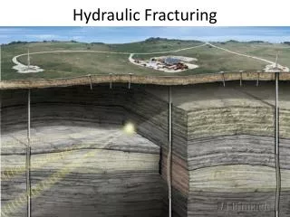
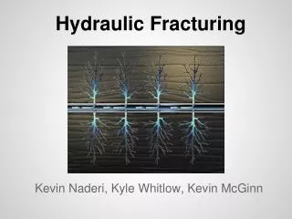
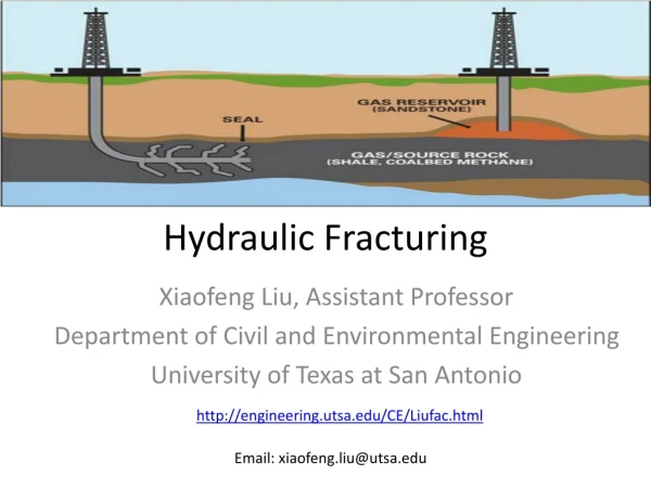
A GIS Analysis of Surface Disturbance and Invasive Species Associated with Hydraulic Fracturing Operations in the Marcellus Shale Ashley Hayes MGIS Program advisor: Patrick Drohan, ESM Penn State University GEOG 596A, Fall 2012. Hydraulic Fracturing. www.h2odistributors.com.

Hydraulic Fracturing
E N D
Presentation Transcript
A GIS Analysis of Surface Disturbance and Invasive Species Associated with Hydraulic Fracturing Operations in the Marcellus Shale Ashley Hayes MGIS Program advisor: Patrick Drohan, ESM Penn State University GEOG 596A, Fall 2012
Hydraulic Fracturing www.h2odistributors.com
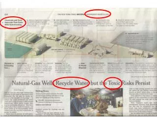
Important and abundant domestic source of energy … but how to minimize the impact of this resource extraction on the environment?
Landscape Disturbance • Well pads, ponds, staging areas, roads, etc. • ~12 ha/pad
Forest Fragmentation & Edge Effects Scarlet Tanager Disturbance Light Wind Invasive Species
My Study • Hypothesis: Hydraulic fracturing well pad locations that are near a previously disturbed landscape may be more likely to currently contain invasive species now, and be more susceptible to future invasions • Importance: Understanding spatial patterns associated with species invasion may lead to the development of more effective predictive detection models and facilitate management planning and responses
Supervised Classification • 2005 NAIP to classify disturbances prior to shale-gas drilling • ArcGIS Bing Maps Aerial base map to classify current disturbances • Disturbances categories: shale-gas well pads, roads, conventional gas wells, water storage ponds, staging areas, barren ground, utility corridors, residential, and regrowth Disturbances Unclassified Disturbances Classified
Distance to Disturbances • ArcGIS Near tool: • Distance to nearest non-road disturbances • Distance to paved and unpaved roads
Configuration of Disturbances • FRAGSTATS: • Contagion Index 0.0 0.5 1.0 www.k-state.edu
Forest Classification • ArcGIS Landscape Fragmentation Tool • Core: > 100m from non-forest disturbances • Edge: < 100m from non-forest disturbances and adjacent to core forest • Patch: <100m from non-forest disturbances and not adjacent to core forest • Perforated: <100m from small non-forest disturbances within core forest
Invasive Plant Species Japanese Stiltgrass (Microstegium vimineum) Mile-a-Minute (Persicaria perfoliata) http://www.forestryimages.org http://gobotany.newenglandwild.org/
Statistical Analysis • Test for significant differences in disturbances between sites with and without invasive species • Distance to nearest non-road disturbances and distance to nearest paved and unpaved roads • Contagion Index • Forest types
Anticipated Results: • An understanding of the relationship between the presence or absence of invasive species at current well pad sites and previous disturbance • Information that can be used to help predict where invasive species may be most likely to appear in the future and assist with management planning and enable responsible gas extraction
Acknowledgements Patrick Drohan Katy Barlow Penn State MGIS Faculty & Classmates