Download
1 / 24
250 likes | 447 Vues
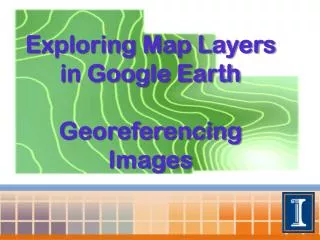
Exploring Map Layers in Google Earth Georeferencing Images. Google Earth . An interface that facilitates an exploration of geographic information from a computer Ability to fly anywhere and view satellite imagery, maps and terrain . Layers in Google Earth .

E N D
Exploring Map Layers in Google Earth GeoreferencingImages
Google Earth • An interface that facilitates an exploration of geographic information from a computer • Ability to fly anywhere and view satellite imagery, maps and terrain
Layers in Google Earth • The layers tool allows one to choose information to display over the place of interest. • Information to choose from includes: borders, places, roads, 3D buildings, ocean, weather, locations of global organizations, volcanoes, ocean observations, photos, webcams, and much more
Exploring Layers • Fly to Sierra Leone by typing “Sierra Leone” in the search bar
Exploring Layers • Zoom in to Freetown by double clicking on the 3D map
Exploring Layers • Check the boxes under the layers tab next to each category to explore available information for Freetown
Exploring Layers: Borders and Labels • When we select the “borders and labels” layer, borders and labels appear on the map Name of place are now labeled
Exploring Layers: Borders and Labels • One can zoom out, and view country borders
Exploring Layers: Roads • When we select the roads layer, roads appear on the map • Zoom back in for more detail
Exploring Layers: Weather • Select the weather layer and zoom out to see clouds • Locate and zoom back in on a thermometer for current weather
Exploring Layers: Photos • Select the photo layer and click on any one of the photo options that appears to view a photo • Click fly to location to move to where the photo was taken
Exploring Layers • Click on Earth Gallery and Select Natural Earth Features Map • Under layers, you should now have a geographic features map • Now, geographic features are color coded on your map
Exploring Layers • Spend time exploring other layers that interest you
Georeferencing an Image • You can georeference an image from Google Earth in MapWindow GIS • The tool used in MapWindow enables georeferencing an image by specifying the location of 3 points on the image
Choose a location to Georeference • Fly to Lake Mabesi
Select Three Points • Add 3 placemarks to the image • Note the latitude and longitude of the 3 placemark points • Use decimal degrees
Saving the Image • Save the Image in an uncompressed format(BMP)
Access Georeferencing Tool in MapWindow • Access the GIS tool and click raster, then georeference an image or grid
Load the Image Load the BMP Image by selecting Load File
Select Noted Points Click Select Points and then select the locations of three known points on the image
Type in Longitude and Latitude Specify the location of the known points in decimal degrees
Click the Georeference Button Deselect Rectify such that north is straight up and then click Georeferenceand then close