Download
1 / 24
240 likes | 375 Vues
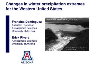
Changes in winter precipitation extremes for the Western United States. Horseshoe Reservoir AZ, Feb. 1993. Francina Dominguez Assistant Professor Atmospheric Sciences University of Arizona Erick Rivera Atmospheric Sciences University of Arizona.

E N D
Changes in winter precipitation extremes for the Western United States HorseshoeReservoir AZ, Feb. 1993 Francina Dominguez Assistant Professor Atmospheric Sciences University of Arizona Erick Rivera Atmospheric Sciences University of Arizona Providedby Phil Pearthree and Ann Youberg AZ Geological Survey
HorseshoeReservoir AZ, Feb. 1993 1) Model Projections of Changes in Extreme Winter Precipitation 2) Physical Mechanisms causing changes in Extreme Winter Precipitation Providedby Phil Pearthree and Ann Youberg AZ Geological Survey
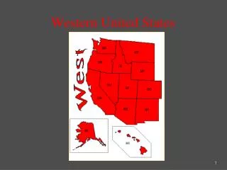
Can regional climate models reproduce historical extreme events, over the Western US? Can they provide useful information about future hydrologic conditions under increased greenhouse gas forcing conditions? Regions where disproportionate changes in heavy and very heavy precipitation during the past decades were documented as either an increase (+) or decrese (-) compared to the change in the annual and/or seasonal precipitation (updated from Groisman et al, 2005), taken from Trenberth et al. (2007) DOE-funded project: Hydrologic Extremes in a changing climate: how much information can regional climate models provide? PIs: F. Dominguez, D. Lettenmaier, C. Castro 12
We use eight different regional climate model simulations (NARCCAP + UofA) over the Western US. Global Climate Models Regional Climate Models Dominguezet al., 2012. Geophys. Res. Lett.
We use a ‘‘Poisson–GP model’’ to characterize the statistical distribution of extreme events. (Katz et al. 1999, 2002, 2010). We don’t use GEV theory because it is limited to block maxima. • Historical • Future • Historical • Future Poisson process models the occurrence. Generalized Pareto (GP) models the excess over the threshold. Example Salt River Basin, AZ Dominguezet al., 2012. Geophys. Res. Lett.
The models realistically represent the spatial distribution of mean and extreme precipitation (1979-2000 period) All models have a positive bias in the mean. Mean Winter Precipitation mm/day 0 1 2 3 4 5 Eight Model Ensemble Observations Assimilated Observations Dominguezet al., 2012. Geophys. Res. Lett.
The models realistically represent the spatial distribution of mean and extreme precipitation (1979-2000 period) All models have a positive bias in the mean. Mean Winter Precipitation mm/day 0 1 2 3 4 5 50-yr Return Period Winter Precipitation All models have a positive bias in the extremes. mm/day 0 20 40 60 80 Dominguezet al., 2012. Geophys. Res. Lett.
Mean winter precipitation is projected to increase in the north and decrease in the south and west. Mean Winter Precipitation Ensemble change of models that pass significance t-test. Dominguezet al., 2012. Geophys. Res. Lett.
Mean winter precipitation is projected to increase in the north and decrease in the south and west. Mean Winter Precipitation Extreme precipitation is projected to increase throughout the domain. 50-yr Return Period Winter Precipitation Bootstrappng significance test. Dominguezet al., 2012. Geophys. Res. Lett.
However, 24-hour 100-year events behave very differently than 3-hour 100-year events. Bias for 24-hour 100-year return period events. Ensemble mean bias +-10% Bias has a clear geographical pattern, For Annual Maximum, 26% are acceptable for design. Mishra, V., Dominguez, F. and Lettenmaier, D., 2012. Geophys. Res. Lett.
However, 24-hour 100-year events behave very differently than 3-hour 100-year events. Bias for 24-hour 100-year return period events. Bias for 3-hour 100-year return period events. Bias has a clear geographical pattern, 26% are acceptable for design. Generalized underestimation and 12% acceptable for design purposes. Mishra, V., Dominguez, F. and Lettenmaier, D., 2012. Geophys. Res. Lett.
Future: We are evaluating the effect of model resolution on the representation of extreme events. 50 km resolution 3-hrly 10 km resolution 1-hrly Use NCEP/DOE Reanalysis II data as boundary conditions (with spectral nudging). Period 1979-2010. Tripathi, O. and F. Dominguez In Preparation
Future: We are evaluating the effect of model resolution on the representation of extreme events. % Hits 24-hourly accumulated precipitation 10km. We find that the 10km runs more adequately capture the intensity of extreme events. We find that the 10km runs also have a higher “hit/miss” ratio than the 50km runs. % Hits 24-hourly accumulated precipitation 50km. Tripathi, O. and F. Dominguez In Preparation
Future: We are studying the physical mechanisms that could lead to the intensification of extreme events. UofA model Extreme Precip Change Atmospheric Rivers cm ? Integrated water vapor (IWV) The Special Sensor Microwave/Imager (SSM/I) AR Mogollon Rim Rivera, E. and F. Dominguez In Preparation
For the Verde River Basin, we used NARR precipitation data to obtain a list of events that exceeded a high threshold. Daily winter (DJFM) precipitation at the Verde River Basin (1979-2010) Mogollon Rim VRB 98th percentile We identified the most important spatial patterns of integrated water vapor transport (IVT) associated to these extreme events. Rivera, E. and F. Dominguez In Preparation
The most dominant pattern shows the characteristic water vapor transport/corridor associated with ARs 1st Pattern of Integrated Water Vapor Explained variance: 29.4% SSM/I water vapor cm kg m-1 s-1 The Special Sensor Microwave/Imager (SSM/I) is located on the DoD satellites EOF 1 Rivera, E. and F. Dominguez In Preparation
The second pattern of the integrated water vapor transport shows meridional oriented ARs 2nd Pattern of Integrated Water Vapor Explained variance: 13.9% SSM/I water vapor cm kg m-1 s-1 EOF 2 Rivera, E. and F. Dominguez In Preparation
RCM simulations show a consistent and statistically significant increase in extreme events in the Western US. RCMs still have problems simulating sub-daily timescale events. We are currently investigating the physical mechanisms and the effects of spatial scale on these projections. HorseshoeReservoir AZ, Feb. 1993 Providedby Phil Pearthree and Ann Youberg AZ Geological Survey
We are comparing our WRF-HadCM3 simulation with observations throughout the Colorado River Basin.
The regions of strongest declines in snowfall roughly correspond to the region of migration of the zero degree Celsius line.