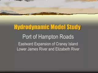
Hydrodynamic Model Study
Hydrodynamic Model Study. Port of Hampton Roads Eastward Expansion of Craney Island Lower James River and Elizabeth River. Virginia Institute of Marine Science Department of Physical Sciences College of William and Mary. J.D. Boon, A.Y. Kuo, H.V. Wang, S.C. Kim,

Hydrodynamic Model Study
E N D
Presentation Transcript
Hydrodynamic Model Study Port of Hampton Roads Eastward Expansion of Craney Island Lower James River and Elizabeth River
Virginia Institute of Marine ScienceDepartment of Physical SciencesCollege of William and Mary J.D. Boon, A.Y. Kuo, H.V. Wang, S.C. Kim, G.M. Sisson, J.M. Brubaker, J.P. Maa
SINGLE VARIABLE MODEL RESULTS Overall Ranking for Changes in: Water level - current – salinity – sedimentation • North Expansion (Option 6) • Northeast Expansion (Option 9)* • Westward Expansion (Option 5)* • Eastward Expansion (Option 7)* * Channel deepening not significant Elizabeth River flushing not impaired
HISTORICALMODEL RESULTS Overall Ranking for Changes in: Water level - current – salinity – sedimentation • East/West Expansion (Option 7/5a)* • Eastward Expansion (Option 7)* * Channel deepening not significant Elizabeth River flushing not impaired
Hydrodynamic Models Simulate: tides and currents salinity, stratification sedimentation potential flushing and contaminant transport
Why models are important : When building a project that will modify some part of an estuary, only models can evaluate the hydrodynamic changes that may result before the project is built.
VIMS HEM-3D Hydrodynamic Model • 3D hydrodynamics Dual-scale horizontal grid Six vertical layers • Calibrated for James River And the Elizabeth River • Previous Applications in Hampton Roads: Tidal front research Larval transport studies VDOT Third Crossing study
BASE CASE This is the condition against which each of the proposed expansion’s primary and alternative designs are tested
TEST CASES • Expansion Option 5 – Westward Expansion • Expansion Option 6 – Northward Expansion • Expansion Option 7 – Eastward Expansion • Expansion Option 9 – North/East Expansion • Expansion Option 7/5a – East/West Expansion
TEST CASES • Expansion Option 5 – Westward Expansion • Expansion Option 6 – Northward Expansion • Expansion Option 7 – Eastward Expansion • Expansion Option 9 – North/East Expansion • Expansion Option 7/5a – East/West Expansion • Each option tested with 50 and 55 ft channel
SINGLE VARIABLE MODEL RUNS Case 1 – Base Case w/ 50-ft channel Case 2 – Eastward Expansion w/ 50-ft channel Case 3 – Eastward Expansion w/ 55-ft channel Case 4 – Westward Expansion w/ 50-ft channel Case 5 – Westward Expansion w/ 55-ft channel Case 6 – Northward Expansion w/ 50-ft channel Case 7 – Northward Expansion w/ 55-ft channel Case 8 – North/East Expansion w/ 50-ft channel Case 9 – North/East Expansion w/ 55-ft channel
HISTORICAL MODEL RUNS Case 1 –Base Case w/ 50-ft channel Case 2 –Eastward Expansion w/ 50-ft channel Case 3 –Eastward Expansion w/ 55-ft channel Case 10 –East/West Expansion w/ 50-ft channel Case 11 –East/West Expansion w/ 55-ft channel
Three Phases of Craney Island Hydrodynamic Model Study • Model Calibration/Verification • Single Variable Runs • Historical Runs
Elizabeth River Calibration Data • Tidal Range and Phase
Mean Tidal Range (1960-1978 Tidal Epoch) Elizabeth River GRBR WEST EAST MNPT PNSY FORT HRVA
Elizabeth River Verification Data • Tidal and Non-Tidal Current
B Residual Current A Lamberts Point Plan View A B Lamberts Point Cross Section
Elizabeth River Verification Data • Salinity
Sewells Point 24Apr2000 8Jun2000
May 1, 2000 (JD 122) OBSERVED PREDICTED
June 7, 2000 (JD 159) OBSERVED PREDICTED
Three Phases of Craney Island Hydrodynamic Model Study • Model Calibration/Verification • Single Variable Runs • Historical Runs
GLOBAL ANALYSIS Using a Geographical Information System(GIS) to determine the Percentage Change by Area
Variables Analyzed: • Water Level • Surface & Bottom Salinity • Surface & Bottom Current • Surface & Bottom Residual Current • Sedimentation Potential
JR1 ER1