Comprehensive Guide to Unmanned Aircraft Systems for Aerial Surveying and Inspections
This guide covers all aspects of utilizing Unmanned Aircraft Systems (UAS) for surveying and inspections. Topics include airspace regulations, weather considerations, operating limitations, camera payloads, and post-flight data processing. Contact James Taggart for support before purchasing drones.

Comprehensive Guide to Unmanned Aircraft Systems for Aerial Surveying and Inspections
E N D
Presentation Transcript
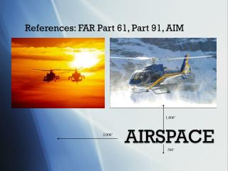
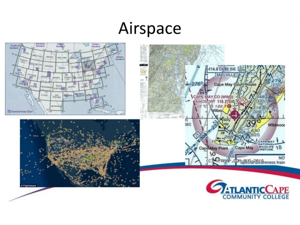
Airspace • Controlled • Needs authorization • Uncontrolled • Up to 400 Ft. Above Ground Level • Within 400 Ft. of a structure can go 400 Ft. above structure
Weather • Operating limitations • Visibility • Distance from clouds • Impact performance • Government sources • http://1800WXBrief.com • http://AviationWeather.gov
Cameras/Payload • Digital cameras • Still/Video • Infrared • Variations of hot/cold • Remotely take temperature • Multi/Hyper-spectral • Vegetation • Agriculture
Unmanned Aircraft Systems James Taggart jtaggart@atlantic.edu 609-892-9909
Before You Buy • Let support drive decision • More than just a drone • Software • Hardware • Cameras • Batteries
Know Before You Fly • Airspace • Weather • Operating limitations • Over people • Time of day • Local restrictions
Start to Finish • Preflight planning • Flight • Post flight • Data processing • Data storage
Surveying • Geographic Information Systems • Determine accuracy needs • Relative/absolute • Software • Hardware demands • Data storage