Airspace
Understand the classifications (A-G) of airspace, entry requirements, and services provided within. Learn about dimensions, restrictions, and communication necessities for each class.

Airspace
E N D
Presentation Transcript
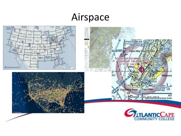
Overview of Airspace • The following are general descriptions and dimensions. The markings are standardized but the size and shape of the airspace is varied according to the need for that particular area. • Airspace dimensions are as depicted on the current sectional, world and/or terminal charts.
Airspace at a Glance 60,000 ft msl 18,000 ft msl Class A No VFR Class E no radio requirement/no communication requirements no transponder requirements except above 10,000 ft msl E 14,500 ft msl Class G uncontrolled/ no requirements for radio or transponder except above 10,000 ft msl E 1,200 ft agl Class B E 700 ft agl Class C E Surface E Surface Class D Class B clearance trans/alt Class C 2 way contact trans/alt Class D 2 way contact
60,000 ft msl (FL60) 18,000 ft msl • Class A Airspace exists over the entire country at 18,000 ft msl up to 60,000 ft msl (the military takes over at the higher altitudes) • No VFR flight is allowed • An IFR flight plan is required • A transponder with altitude encoding is required • A 2 way radio and an IFR clearance are required • Class A Airspace is not depicted on charts
Class B Airspace • Pilot must have at least a Private Pilot Rating, or Student Pilot with an endorsement for that particular Class B Airspace • Requirements: 2 way radio, transponder with altitude encoding and a clearance before entering • When inbound, first contact is made with approach control, Max speed 250 • Airspace is served by radar from primary airport 30 nm radius 10,000 ft msl height
Seattle Class B Airspace as depicted on sectional Requirements to Enter Transponder/alt encoding clearance/2 way radio private/student B endorsed or higher Note; Transponder required in, below and above within 30 nm mode C veil Solid blue lines indicate Class B Airspace • Mode C Veil • solid magenta line Maximum Elevation Figure highest obstacle plus 300 ft
Top number indicates 10,000 ft msl for Class B top Airport Information Bottom number indicates 6,000 ft msl for Class B base
Class C Airspace • Requirements; 2 way radio, transponder with altitude encoding and established radio contact prior to entry into middle or inner area • Outer area doesn’t require radio or transponder but the transponder is required above Class C Airspace (radar service is available in outer area not depicted on sectional chart but appears here in darker blue) • Class C primary airport has radar and therefore initial contact should be made with approach control prior to entry Middle Area 10 nm radius Outer Area 20 nm radius 4,000 ft agl Inner Area 5 nm radius 1,200 ft agl
Class C Airspace The following services are provided within Class C airspace: • Sequencing of all arriving aircraft to the primary airport • Standard IFR separation between IFR aircraft • Between IFR and VFR aircraft – traffic advisories and conflict resolution • Between VFR aircraft – traffic advisories and as appropriate, safety alerts Middle Area 10 nm radius Outer Area 20 nm radius 4,000 ft agl Inner Area 5 nm radius 1,200 ft agl
This portion of Class C Airspace has a height of 4,000 ft msl and a base of 2,000 ft msl This portion of Class C Airspace has a height of 4,000 ft msl and a base of 1,300 ft msl Inner Area 4,000 ft msl height down to surface • Middle Area Solid magenta lines indicate Class C Airspace
Class D Airspace • Requirements; 2 way radio, establish 2 way radio contact with tower prior to entry • No transponder requirements • Class D Airspace does not have radar at primary airport therefore there is no approach control • Max speed 200 kias w/in 4nm • Generally reverts to Class E when the tower closes 4 nm radius 2,500 ft height agl
Requirements; 2 way radio, contact tower prior to entry Note; No primary radar Dashed blue line indicates Class D Airspace Segmented Box indicates top of Class D - Here 2,700 ft msl
Class D Airspace surface to 4,000 ft msl Here Class D Airspace has an extension
Class E Airspace • By definition is controlled airspace which is not A, B, C or D • No transponder or radio is required below 10,000 ft msl but a transponder is required above 10,000 ft msl • No communication is required • Class E Airspace extends upwards from it’s designated base until encountering other controlled airspace with greater restrictions and/ or requirements
Class E Airspace Class A Airspace beginning18,000 ft msl Class E at 14,500 msl if no other indications, this has no color coding on charts Class E airspace Class G Airspace Class E at the surface up with dashed magenta line Class E at 1,200 ft agl up with haze blue line Class E at 700 ft agl up with haze magenta line
Indicates Class E starting at the surface upwards Indicates Class E starting at 1,200 ft agl upwards Indicates Class E starting at 700 ft agl upwards
Chain used to indicate Class E with base in this case 8,200 ft msl upward
Victor Airways are Class E Airspace 8 nm wide (4 nm either side of center) 1,200 agl upwards
Special Use Airspace • Prohibited Areas (blue comb line) • Restricted Areas (blue comb line) • Warning Areas (blue comb line) • Alert Areas (blue comb line) • Military Operations Areas (MOA) (magenta comb line)
Prohibited Areas • These are established for national security • No flight operations are allowed within them
Restricted Areas • Flight operations are subject to limitations • There may exist hazards to aircraft as missile firing, artillery and other often invisible dangers associated with military training • Prior permission from controlling agency must be obtain before entering Restricted Areas
Warning Areas • These are the same as restricted areas in regards to hazards but are located over international waters • Technically the U.S. government cannot require that aircraft obtain permission prior to entry but since hazards may exist, it is standard operating procedure
Alert Areas • Indicates area to contain high volume pilot training or unusual type of aerial activity • Flight is not restricted but extreme caution should be exercised
Military Operation Area (MOA) • Flight is not restricted • Area may contain military training activities • Although not required, contacting controlling agency is helpful prior to entry to help with collision avoidance while MOA is active
Prohibited, Warning, Alert Areas and Restricted Airspace indicated by blue comb line and written indication of type, here Restricted up to 20,000 ft msl Military Operations Area indicated by magenta comb line
Other Airspace • Military Training Routes (MTR) • Air Defense Identification Zones (ADIZ) • Temporary Flight Restrictions (TFR)
Military Training Routes (MTR) • High volume/high speed (possibly in excess of 250 knots) military aircraft • IR indicates IFR training route • VR indicate VFR training route • If MTR has 3 numbers, it has portions above and sometimes below 1,500 ft agl • If MTR has 4 numbers, all portions should be below 1,500 ft agl • There are no restrictions on aircraft concerning communication or equipment
Military Training Routes IR indicates IFR, VR indicates VFR 3 numbers indicate surface up 4 indicates no segment above 1,500 ft agl
Air Defense Identification Zone(ADIZ) • Aircraft entering U.S. airspace must be identified prior to entry • Enter w/in +5 Min of estimate and w/in 10 mi over land and 20 mi over water • Aircraft must file a flight plan (IFR or DVFR) prior to entry • You must have a transponder with altitude encoding • A 2 way radio to give periodic reports of position to ATC is required
Class G Airspace • All uncontrolled airspace • Usually exists only at low altitudes • No radio, transponder or communications required • Chart has no direct indication of existence • Uncontrolled airspace is where no IFR traffic exists with a clearance • Aircraft may fly IFR in those areas but PIC assumes all risks without the assistance of ATC
Airspace at a Glance 60,000 ft msl 18,000 ft msl Class A No VFR Class E no radio requirement/no communication requirements no transponder requirements except above 10,000 ft msl E 14,500 ft msl Class G uncontrolled/ no requirements for radio or transponder except above 10,000 ft msl E 1,200 ft agl C 4,000 ft Class B E 700 ft agl Class C D 2,500 ft E Surface E Surface Class D Class B clearance trans/alt Class C 2 way contact trans/alt Class D 2 way contact
Other Airspace • Off Route Obstruction Clearance Altitude (OROCA): provides obstruction clearance with 1,000 ft buffer/2,000 ft in mtn ter. • Minimum Vectoring Altitudes (MVA): Established for use by ATC; 1,000/2,000 ft clearance • Min Safe/Sector Altitudes (MSA): 1,000 ft obstacle clearance w/in specified distance from the listed Navaid.
Other Airspace VFR-On-Top: • Clearance is an IFR auth to fly cleared route at the VFR altitude • Must maintain VFR visibility and cloud clearance • May be done above, below or between clouds • Pilot expected to comply with IFR rules • ATC will provide advisories only • Not authorized in Class A airpsace