Download
1 / 41
440 likes | 632 Vues
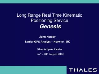
Long Range Real Time Kinematic Positioning Service Genesis. John Hanley Senior GPS Analyst – Norwich, UK. Stennis Space Centre 26 th – 28 th August 2002. Outline of Presentation. Introduction. Overview - General Background & Applications. Basic Thales DGPS Infrastructure.

E N D
Long Range Real Time Kinematic Positioning ServiceGenesis John Hanley Senior GPS Analyst – Norwich, UK Stennis Space Centre 26th – 28th August 2002
Outline of Presentation • Introduction. • Overview - General Background & Applications. • Basic Thales DGPS Infrastructure. • Genesis Reference Station and Hub Processes. • Genesis User Processes and Data Flow. • Status and Operational & Trial examples. • Early Trials (Rig Moves and Ship & Ferry Trials). • Recent operations. • Quality Control of High accuracy systems.
Introduction Thales GeoSolutions: • Supplier and a User [Commercial View] • Built reputation in Surveying and Positioning services offshore worldwide • Genesis System • Why develop Genesis? • How and Where? • What for? • The Future – Refinement and Development • New group with Thales Navigation [Ashtech GPS Technology]
Code / Improved Code or Carrier Phase • Technical basis is to improve on DGPS by using the Carrier-Phase information • Carrier gives better repeatability and accuracy • Trade-Offs with improved code-based methods. • Initialisation • Data transmission • Filtering and QC • Combination of both approaches
LRTK - Genesis System • Increased level of accuracy using latest GPS technologies • Regional high performance solution (North Sea Region) • For specific applications requiring better accuracies than standard DGPS • Targeted at Offshore applications – 20-30cm • QC information as per DGPS (Is more needed? Standards?) • Delivered via satellite • Long ranges and multiple stations
Genesis Applications • Genesis has been aimed specifically at the Offshore Market. • Niche market viewed at the 20-30cm level • Offshore Positioning • Vertical control • Emphasis on the Z- component • Vessel Passage with draught close to navigable depth • High Accuracy Navigation • AUV navigation • Real-Time vertical use – Multi Beam • High Accuracy 3D Control – Rig Moves
Conventional RTK Attributes • High accuracy systems (1-5 centimetres) • Essentially Carrier phase based • Operate over relatively short range • Single baseline approach • Maximum range varies from 10 to 40 km • Dependant on a reliable radio link • Require local geodetic point for installation • “Black Box” systems with little QC • Expensive 2-Receiver system
Genesis LRTK Attributes • Satellite delivery based LRTK system • Accuracy of 20-30 cm • Operational over long baselines • PC based software with multi-station computations • PC based software allows for added system QC • Provides a highly accurate solution • Refinement and Development – No Limitations
RIMS A 19 inches rack RIMS A 19 inches rack RIMS A Thales GPS Infrastructure VSAT Satellites High Power and Low Power satellite links GPS Satellites • 2 MCC facilities • Aberdeen and Singapore • 2 remote MCC facilities at Perth and Reston • Monitor and Control • Archive • Maintain and Plan • Manage external entities • Interface Genesis & MFX3 • LES facilities • Uplink SkyFix messages • Including SkyFix Premier Messages X25NETWORK • 80+ Reference Stations • Dual-Frequency Stations • Single Frequency • Generate, process and transmit messages
Thales Reference Station Configuration LRTK Genesis North Sea Coverage Region • 7 stations in the North Sea • Dual Frequency Enabled • Choke Ring Antenna fitted • Pre-processing carried out • Data sent to MCS (Master Control Station) in Aberdeen. • Tromso & Hammerfest added
Reference Station Pre-Processing • Raw data taken from Geodetic GPS Receivers • Clock Corrections • Cycle Slip on L1 and L2 • Code – Carrier Filtering • Multipath Mapping • SNR used to assess measurement Quality • Observations Compressed • Transmitted to MCS • Major Upgrade Process Underway [2001-2003]
Genesis Reference Station Input Genesis Hub UDb Uplink Message MCS Hub Configuration - Current • Data output from the pre-processing functions is compressed prior to transmission (reduce the bandwidth requirement) • Input Compressed Long Range Real-Time Kinematic messages • Interface to Unit Database (Udb) for User Control information • Uplink to the delivery satellite • Visual displays • Operator configurable settings • Simple error handling and printout facility • Bandwidth and Need for compression ( 8 to 1 reduction )
Genesis User Processes (1) • Data Reconstruction • Proprietary Compressed data received by Decoder • User Pre-Processing • User Dual Frequency GPS receiver board • Data pre-processed in similar manner to Reference Stations • Observation Combination/Differencing [@ User] • The key issue in the use of carrier-phase ranges. High emphasis on carrier data: • reduces sensitivity to geometry (DOP chimneys) • reduces sensitivity to code anomalies • Observation differencing (single or double) can be used to reduce the contribution of various error components.
Data RX Genesis User Data Flow Repair & Filter Observations • Combine • Synchronise • Transform Position Calculation Repair & Filter Observations Weights Compressed Reference Station Data Uplinked from MCS Mobile Station Almanac/Time/Ephemeris Position Estimates & Quality Control Phase/Code/Observables
Genesis User Processes (2) • Network Approach • Network approach is very much at the centre of this system • More than one reference station provides additional observations and increases system availability and integrity • Position Determination and Quality Control • The position computation is built around the use of double differenced carrier-phase observations • Use of ionospheric delay free data addresses ionospheric error • Enhanced code and tropospheric weighting improves solution robustness
Hardware Installation Architecture • Optional inputs: • 3rd party RTCM including Type 15’s • DeltaFix Corrections Genesis decoder Dual frequency DGPS data GPS Receiver Position Outputs Clients NAV system Genesis & MultiFix PC SkyFix decoder SkyFix RTCM (Type 1, 2, 3, 16, 55) - Combined Genesis and SkyFix Installation -
Development Test-BedStatic Trials 1999-2000 • Initial Test Network- History • TCP/IP delivery • 3/4 Station Networks • 20-30cm accuracy - Planning
Operational Performance Examples • Selection of operational examples. • Rig-Moves and Survey Jobs/Trials. • Slow dynamic and High dynamic applications • Various baselines considered on different trials. • ‘Truth’ required for performance comparison. Initially assessed against DGPS. • Became clear that higher accuracy ‘truth’ was required to assess performance and QC elements • Algorithm improvement & ongoing trials from 2000-2002.
Aberdeen Rig Move Job - Slow Dynamics - 2001 Number of SV’s • Rig-Move greatly affected by the convoluted structural environment • Baselines 150km East - West • High Repeatability can be clearly seen • Factors affecting positioning • Obstructions • Constellation - Geometry of SV’s • Constellation - Number of SV’s • Loss of signal = Loss of Double Difference sets Number of DD’s
ABZ Rig Move Job – Repeatability over DGPS Multi Station DGPS 2 Station Genesis Solution
Multi Station DGPS 3 Station Genesis Solution Early Dynamic Ship Trials - 2001 - Repeatability • Dynamic trials show repeatability • Accuracy harder to assess due to the problem of finding a suitable ‘truth’ system • Post-Processing of raw data to obtain ‘truth’ will be required • Increase in Repeatability over DGPS • Lower noise in LRTK solution
Norwegian Ferry Dynamic Trial - 2001 LRTK Genesis vs. Post-Processed RTK solution • Aberdeen 559 km • Bergen 55 km • Kristiansund 310 km • Brønnøysund 647 km • Sumburgh 344 km
Norwegian Ferry – 3D Position Error Delta East 0.06m (1- 68%) Delta North 0.09m (1- 68%) Delta Height 0.10m (1- 68%)
Snøhvit Field Dynamic Job/Trial - 2002 • 3 Station network • Hammerfest • Tromso • Kristiansund • Coincident Projects • Aberdeen Pipe-lay Project • Aberdeen Rig Move
Snøhvit Field Dynamic Job/Trial - 2002 • Objective was to establish whether LRTK Genesis could provide height accuracy (in this high Latitude North Sea location) to determine a tide value for vessel. • Vessel reference position computed using numerous sensors: • GPS antenna position (from Genesis) • Pitch, Roll and Heave (from Motion Unit) • Vessel draught sensor • Performance compared against short-range Thales Ashtech RTK and using Tide information logged at Hammerfest Tidal station. • Data currently being processed and evaluated.
Snøhvit Field – Height Accuracy Lost RTK & Genesis Corrections RTK position changed to Differential
Snøhvit Field Trial – Preliminary Findings • Preliminary results on previous slide show that LRTK Genesis performance was comparable to short range RTK system. • Further processing by Thales Norway required. • Reception of corrections in high latitude areas is an issue. This is the operational reality ! • Re-initialisation is therefore inevitable. Must not be excessive and as seamless as possible. • Quality Control process MUST be able to supply useful information to the user.
LRTK Systems Requirements • Continuous and high quality L1 & L2 GPS data • Continuous reference station data / Corrections • > 5 satellites • good geometry = DOP LRTK Systems Issues to Consider • Interruptions in local GPS data (masking / poor tracking) • Loss of Correction link • Latency of Reference station data • Number of satellites drop • DOP Holes • Convergence Time at Start-up (Initialisation) and on Re-Initialisation
UKOOA Guidelines • Published by ‘United Kingdom Offshore Operators Association (Surveying and Positioning Committee)’. • Installation and Operation of DGPS Equipment • Quality Measures • Minimum Training Standards • GPS Receiver Outputs • Data Exchange Format Are similar standards suitable for LRTK
UKOOA Quality Measures • Designed to produce a universal set of quality measures for ‘DGPS’ positioning software • Unit Variance • Marginal Detectable Error (MDE) • Internal reliability • External Reliability • F-test on Unit Variance • W-test for Outliers
Statistical Measures • Unit Variance of the Position Fix Computation (Least Squares Weights) • F-Test on the Position Fix Unit Variance • W-Test on the Position Fix Residuals to detect Outliers Still carried out on Least Squares Residuals, even within LRTK
LRTK Genesis - Statistical Measures F-Test • The F-Test is a test of the overall consistency of the observations (double differences) and the resulting position solution. • Upper Test looks at poorer than expected measurements. [a priori = optimistic] • Lower Test looks at better than expected measurements [a priori = pessimistic] W-Test • The W-test is a statistical test applied to an individual observation (double difference). The aim is to identify a faulty measurement. • The test is conducted using the residuals from the least squares position calculation.
High Accuracy Positioning - Recommendations • It is essential to assess the reliability and precision of each position fix to ensure the quality of GPS measurements • W-Test for outliers to be carried out for each fix • F-Test for on Unit Variance to be carried out for each fix. • When no more outliers are identified in any fix, precision and reliability measures are to be computed • Estimate of Precision – a posteriori error ellipse