Download
1 / 35
370 likes | 637 Vues
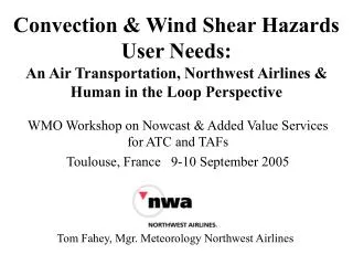
Convection & Wind Shear Hazards User Needs: An Air Transportation, Northwest Airlines & Human in the Loop Perspective. WMO Workshop on Nowcast & Added Value Services for ATC and TAFs Toulouse, France 9-10 September 2005. Tom Fahey, Mgr. Meteorology Northwest Airlines.

E N D
Convection & Wind Shear Hazards User Needs:An Air Transportation, Northwest Airlines & Human in the Loop Perspective WMO Workshop on Nowcast & Added Value Services for ATC and TAFs Toulouse, France 9-10 September 2005 Tom Fahey, Mgr. Meteorology Northwest Airlines
Presentation Scope___________________________ • Industry: Air Transportation • Geographic: United States • Users: Air Traffic Managers • Air Traffic Organizations • Airline Operation Centers (AOC’s) • Information: Weather Hazards
Convection___________________________ • Collaborative Convective Forecast Product (CCFP) • History • Began in 1998 as a ZMP CWSU, NWS & NWA Demo • Description of the Current CCFP Product • Format • Minimum CCFP criteria • 22 June 2005 CCFP Case Study • Future Opportunities / Recommendations
CCFP - Mock Up Example(Collaborative Convective Forecast Product) Actual Real-Time Forecasts: website http://aviationweather.gov/products/ccfp/
CCFP Minimum Threshold CCFP Convection Area is Defined as • Polygon of at Least 3000 sq. miles that contains: Coverage • Composite reflectivity of at least 40dbZ is expected to cover at least 25% of the forecast area, and • Echo top of 25,000 feet Mean Sea Level (MSL), or greater, are expected to cover at least 25% of the forecast area, and Confidence • A confidence of at least 25% that the above 2 minimum criteria will be met.
CCFP - Coverage & Confidence SOLID Sparce Fill = Coverage Color = Confidence
CCFP 22 June 2005 Subjective & Quantitative Verification Tom Fahey, Mgr. Meteorology, Northwest Airlines & Jennifer Mahoney, Chief, Forecast Verification Branch, FSL, NOAA Research Prepared for Meeting: S2K+5 Location: Washington DC Date: 13 July 2005
22 June 2005 - Case Study Motivation & Questions • Air Traffic Mgrs & Air Space Users:22nd CCFP did not meet Needs. • Area of Concern: NE US (ZBW-ZNY-ZDC ARTCC’s) • Time Period of Concern: 15Z - 21Z • Would the CCFP Producer Come to the Same Conclusion? • To Answer ? : Produce a Subjective, User Perspective, Verification • Then: Compare with Current Quantified CCFP Verification Method in Use. • Are AT Mgrs & Airspace User Needs Understood by CCFP producers? • Are the User Specifications Accurately describing the needs? • CCFP not required until Convection covers 3000 sq. miles. • Is This The right threshold?
Summary - 22 June 2005Subjective Verification-Shape Matching • 2 Areas Fcsted in ZBW-ZNY-ZDC Airspace • North Area (Southwest ZBW - ZNY - North ZDC) • Convective Activity developed in North Area by 17Z • No CCFP issued for this area at 15Z nor at 17Z Issue Time • Did Convection Cover > 3000sq mi @ 17Z? @19Z? • North Area 1st identified by CCFP @ 19Z Issue time • 2hr Fcst(valid 21z): • CCFP Convection Location Inaccurate (CCFP too Far North) • North Area accurate @21Z Issue Time-2hr Fcst (valid 23z) • South Area (ZDC [VA & NC Coastal area] ) • South Area 1st identified @ 15Z Issue time • South Area inaccurate @ 15, 17, 19 & 21Z Issue times
North Area Convection @17Z > or < 3000 sq.mi.?Green = 4km squares of Level 3 & Higher Wx Radar
North AreaConvection @ 17Z > or < 3000 sq.mi.? Green=40nm diameter circles w/ Solid, Bkn or Sct coverage North Area
North Area w/ No CCFP Convection @19Z > or < 3000 sq.mi.?Green = 4km squares of Level 3 & Higher Wx Radar North Area South Area
North Area w/ No CCFP Convection @19Z > or < 3000 sq.mi.?Green=40nm diameter circles w/ Solid, Bkn or Sct coverage
North Area Convection @ 21ZCCFP too far NorthGreen = 4km squares of Level 3 & Higher Wx Radar
North Area Convection @ 21Z CCFP too far NorthGreen=40nm diameter circles w/ Solid, Bkn or Sct coverage
North Area Convection @ 23ZAccurate CCFPGreen = 4km squares of Level 3 & Higher Wx Radar
North Area Convection @ 23ZAccurate CCFPGreen=40nm diameter circles w/ Solid, Bkn or Sct coverage
Grid-based approach Binary comparison Compare forecasts with observations Overlay forecasts and observations Test inclusion in forecast Methods consider the entire domain and sub-domains Compute coverage separately Quantitative Verification Approach YN NY YY NN
Quantitative Verification • 15Z Issue Time: Coverage < 3000 Sq. Miles 1,976 Square Miles
Quantitative Verification • 15Z Issue Time: Coverage > 3000 Sq. Miles 19,139 Square Miles
Conclusions & Recommendations_____________________________ • Opportunity for Future User Need Definitions • Yes: Threshold of 3000 sq. miles needs User Input • 3000 sq miles of what? • Level 3 or higher Reflectivity? - 4km squares or • Traffic Impacted Areas? - 40nm diameter circles • Is 3000 sq. miles the correct threshold? • In the Aerodrome/ Airport Terminal Environment? • In the En Route Environment? • • Specific Opportunities • Further Define En Route Threshold • Develop a Terminal Environment Product
Conclusions & Recommendations_____________________________ • Are There Future Verification Opportunities? • Yes: Both VALUE & ACCURACY Value Measurements of CCFP Value for Decisions by Airspace Users Accuracy Measurements of CCFP Accuracy for Producers (Meteorologists) • •Specific Opportunities • Importance of Coverage Definition • Maximum Tops Verification • Value of the CCFP for Users
Wind Shear __________________________ • The Phenomenon - Meteorological Causes • Measurement Capabilities • Distribution • Terminology • Verification • NWA Perspective
Wind Shear - The Phenomenon • Sources/Causes of Low Altitude Wind Shear • Convection Induced • Terrain Induced • Abrupt Temperature Change • Fronts • Inversions • Land/Sea Breeze • Gusty Winds • Convection Induced & Terrain Induced are strongest & most transitory = Most Insidious Wind Shears
Wind ShearCurrent Observation Capability • Current: Human-in-the-Loop • Pilot Reports to ATC after Encountered (PIREP) • Current: Automated • U. S. Ground Based Detection • 43 Airports: Terminal Doppler Weather Radar (TDWR) • 34 of 43 Upgrading to Integrated Terminal Weather System (ITWS) • 40 Airports: Low Level Windshear Advisory System (LLWAS) • 34 Airports: Weather System Processor (WSP) • Aircraft Based • Doppler Radar (Predictive) • Detect Change in Aircraft Performance (Reactive)
ITWS Display with Wind Shear Identified
Same ITWS Display Close Up Image (5nm Range)
Wind Shear Hazard Info - Distribution 2 Text Messages Displayed on ITWS for the Next 7 Minutes Avail. to Pilots & AOC’s Via TWIP Runway Specific Info Relayed By ATC to A/C Human-In-Loop Distribution Automated Distribution
Wind Shear - Terminology • Aircraft Performance Definition • Air Speed Loss • Air Speed Gain • .Observed Flow by Ground Radar=Term Used Divergence = LOSS Convergence = GAIN • Hazard Timeliness Wording US ATC / ICAO Automated, Observed last 1 min: Alert / Alert ? Automated or Pirep last 20 min: Advisory / Warning ? • Hazard Intensity Wording Microburst = Divergence & 30kts or More LOSS Windshear = Divergence & less than 30kts OR any Convergence
Wind ShearDetection Verification • Estimated Detection Reliability Values • ITWS, WSP, TDWR, LLWAS • Wind Shear Accuracy Values • No Storms Within 15 Nautical Miles • Opportunity: Real Time Values
Final Conclusions &Future Opportunities • Convection • Air Space User Needs • Opportunity: Additional Definition of Forecasted Hazard • Geography • CCFP is a Beneficial En Route Phase of Flight Product • Cruise Altitude product (FL250 & Above) • Future Opportunity: Climb & Descent Phase Product • Departure & Arrival Product (Below FL250, vcnty airport) • Broader Coverage Than TAF: Approx. 100nm aerodrome radius • Verification • Opportunities • Additional Focus: Measurements of Meteorological Accuracy • New Effort: Measurement of CCFP Value to Air Space Users
Final Conclusions &Future Opportunities • Wind Shear • Hazard Information Detection & Dissemination • Both Ground & A/C Based Detection Needed • Opportunity: Automated Distribution to Pilots & AOC’s • Terminology • Education Opportunity: LOSS & GAIN • Clarification Opportunity: Hazard Timeliness Wording ALERT & ADVISORY vs. ALERT & WARNING • Verification • Opportunities • Real Time Estimation of Measurement Accuracy for Users • Focus of Wind Shear Conditions with Little or No Convection