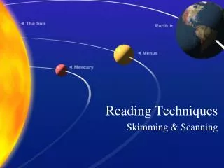
MAP READING AND BASIC TECHNIQUES
MAP READING AND BASIC TECHNIQUES. JHSA GEOGRAPHY SECONDARY 3. MAP READING. Interpreting symbols Specifying locations Determining direction Measuring distances Representing height s Interpreting human activities from topographical map. INTERPRETING SYMBOLS. What is symbols?

MAP READING AND BASIC TECHNIQUES
E N D
Presentation Transcript
MAP READING AND BASIC TECHNIQUES JHSA GEOGRAPHY SECONDARY 3
MAP READING • Interpreting symbols • Specifying locations • Determining direction • Measuring distances • Representing heights • Interpreting human activities from topographical map
INTERPRETING SYMBOLS • What is symbols? • Symbols in a map represent the actual features found on the earth’s surface. • Types of symbols • Abbreviation • Area • Height • Line • Point
5 10 65 336 N 300 250 200 Gring Forest Reserve 150 100 Gring New Township 64 50 R1 Hosp. 63 R Pekan Gring 62 Sch. R2 Lake Tanarata Laketown Resort 61 Tanarata Town Sch. Gring River 60 59 14 15 16 17 18 19 20 21 Ring road LEGEND 1 centimetre represents 5 kilometres R2 Forest Settlement Bridge School Rubber plantation Contour Road Mosque Hospital Sch. Hosp. Symbols
SPECIFYING LOCATIONS • Grid references describe the location of the feature on topographical map. • The vertical and horizontal lines divide the map into grid square. • Four figure – describe the location of a large features; lake. • Six figure – describe the exact location of the features.
5 10 65 336 N 300 250 200 Gring Forest Reserve 150 100 Gring New Township 64 50 R1 Hosp. 63 R Pekan Gring 62 Sch. R2 Lake Tanarata Laketown Resort 61 Tanarata Town Sch. Gring River 60 59 14 15 16 17 18 19 20 21 Ring road LEGEND 1 centimetre represents 5 kilometres R2 Forest Settlement Bridge School Rubber plantation Contour Road Mosque Hospital Sch. Hosp. NORTHINGS EASTINGS
QUIZ #1 What is four figure grid reference for: • Tanarata Laketown Resort • Mosque in Tanarata town • Hospital What is six figure grid reference for: • School in Tanarata Town • Mosque in Tanarata Town • School in Pekan Gring
ANSWERS What is four figure grid reference for: • Tanarata Laketown Resort – 17 61 • Tanarata town – 15 60 • Hospital – 14 63 What is six figure grid reference for: • School in Tanarata Town – 152608 • Mosque in Tanarata Town – 158 602 • School in Pekan Gring – 158 618
DETERMINING DIRECTION Compass points North Points Bearings
COMPASS POINTS NNW NNE NORTH WEST NORTH EAST WNW ENE WEST EAST ESE WSW SOUTH EAST SOUTH WEST SSE SSW SOUTH
NORTH POINTS • TRUE NORTH • MAGNETIC NORTH • GRID NORTH GN MN TN
Using compass directions Give directions to the boatman to steer his way out of the jetty to reach the island. west southwest northwest north west east northeast northeast east N north E W S
What problem do you think can happen if we use this method of giving directions? Lacks accuracy
COMPASS BEARINGS 0° 360 ° NNW NNE 45 ° 315 ° NORTH EAST NORTH WEST WNW ENE 90 ° 270 ° EAST WEST ESE WSW SOUTH EAST SOUTH WEST 135 ° 225 ° SSE SSW SOUTH 180 °
What is the direction of the dam from Upper Mandai II? Northeast North
North Southeast What is the direction of the school from the pier?
To find the bearings of (Y) from (X) For bearings from less than 180 ° Draw the North line that is parallel to the eastings on the map From X Y Read bearings in the clockwise direction 0° Draw a line to join X and Y X 90° Align protractor along the North Line with 0° corresponding to North 180°
To find the bearings of (Y) from (X) For bearings more than 180 ° Draw the North line that is parallel to the eastings on the map From X Read bearings in the anti-clockwise direction, then subtract from 360° 0° Y Draw a line to join X and Y X 90° Align protractor along the North Line with 0° corresponding to North 180°
MEASURING DISTANCES • Scale is used to calculate distances between features on a map • Three ways of showing a scale on a map: • Statement in words • Representative fraction (R.F) • Linear Scale
5 10 65 336 N 300 250 200 Gring Forest Reserve 150 100 Gring New Township 64 50 R1 Hosp. 63 R Pekan Gring 62 Sch. R2 Lake Tanarata Laketown Resort 61 Tanarata Town Sch. Gring River 60 59 14 15 16 17 18 19 20 21 Ring road LEGEND 1 centimetre represents 5 kilometres R2 Forest Settlement Bridge School Rubber plantation Contour Road Mosque Hospital Sch. Hosp.
REPRESENTING HEIGHT SPOT HEIGHT ( ) • Indicates the specific height of a point on a map. BENCH MARK ( 100M) • Indicates height of the place above sea level. TRIGONOMETRICAL STATION ( 50) • Usually found on the hilltops or mountain peaks.
5 10 65 336 N 300 250 200 Gring Forest Reserve 150 100 Gring New Township 64 50 R1 Hosp. 63 R Pekan Gring 62 Sch. R2 Lake Tanarata Laketown Resort 61 Tanarata Town Sch. Gring River 60 59 14 15 16 17 18 19 20 21 Ring road LEGEND 1 centimetre represents 5 kilometres R2 Forest Settlement Bridge School Rubber plantation Contour Road Mosque Hospital Sch. Hosp. TRIGONOMETRICAL STATION SPOT HIGHT
CONTOURS • Imaginary lines joining places of the same height above sea level. • The height of each contours usually marked on the line. • Vertical interval help us to find the value of the line of the contours.
CALCULATING GRADIENT GRADIENT = VERTICAL DISTANCE HORIZONTAL DISTANCE FIND VERTICAL DISTANCE FROM A TO B. FIND HORIZONTAL DISTANCE FROM A TO B. B ANSWER:- ___40m___ 20000m _1_ 500 This means that the slope AB rises 1 m for every 500 m of horizontal distance. 100 80 A 60
INTERPRETING HUMAN ACTIVITIES FROM TOPOGRAPHICAL MAP • Settlement patterns • Transport patterns
BASIC TECHNIQUES • INTERPRETING PHOTOGRAPH • TYPES OF PHOTOGRAPH • STEPS TO INTERPRET • SKETCHING A PHOTOGRAPH
TYPES OF PHOTOGRAPH • LANDSCAPE • AERIAL • SETELLITE IMAGES 2 1
QUIZ #3 • Each group will discuss on the steps to interpret a photograph. • Choose any types of photograph and explain the photography using the steps that you have discussed.