Map reading
Map reading. Objectives. List the types and uses of different types of maps Indentify main OS map symbols Use the OS Grid referencing system Use OS maps to define land features Use contour lines to plan routes Discuss the importance of scales and symbols on maps


Map reading
E N D
Presentation Transcript
Objectives • List the types and uses of different types of maps • Indentify main OS map symbols • Use the OS Grid referencing system • Use OS maps to define land features • Use contour lines to plan routes • Discuss the importance of scales and symbols on maps • Why are maps important in route planning • Assess the slope gradient using mapping info
Grid Reference (OS) • Great Britain has been laid out on a grid system by the Ordnance Survey, and these squares measure 100 km by 100 km. To make it easy to identify the squares, they have each been assigned a two letter code. • This forms the prefix of the National Grid Reference.
Grid Reference • These grid squares can then be broken down into more squares, of 10 km by 10 km. This is shown for grid square SP below.
Grid Reference • The basic premise for this is that the square is broken down into 10 segments by 10 segments (or 100 squares), numbered from 09 from the southwest corner horizontally and vertically. • The reading from the bottom left hand corner of the square to the bottom-right forms the EASTING. • The reading from the bottom-left hand corner of the square to the top left-hand corner forms the NORTHING. • Thus National Grid Reference SP85 is the square labelled SP85 below:
Grid Reference • Each of these smaller squares is numbered from 0 to 9 from the south-west corner, both horizontally (eastwards) and vertically (northwards). The easting (left to right) is stated first, then the northing (up and down). • To remember this, think about going through your front door: along the corridor and up the stairs.
Grid Reference • In a real life situation, we need a greater degree of precision. • So we introduce a 6 figure grid ref for example:
Grid Reference • So for a six figure grid reference we following the same methodology as above: • The prefix for the NGR is: SP • The easting for the NGR is: 875 • The northing for the NGR is: 585 • Thus the NGR in full is: SP875585
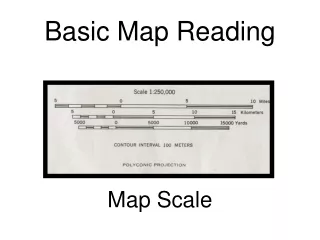
Scale • What is scale? • The scale of a map is defined as the ratio of a distance on the map to the corresponding distance on the ground • Map scales may be expressed in words, as a ratio, or as a fraction. Examples are: 'one centimetre to one hundred metres‘ or 1:10,000 or 1/10,000 'one inch to one mile' or 1:63,360 or 1/63,360 'one centimetre to one thousand kilometres‘ 1:100,000,000 or 1/100,000,000. (The ratio would usually be abbreviated to 1:100M).
Scale • What does it mean? • The two main maps you will use are the 1:25000 and the 1:50000 • Scale bar; 1:25000 This shows that 4cm= 1Kilometer 4 Cm = 1K
Scale • What does it mean? • It tells us the true distance in relation to the mapped distance so when route planning its very important to get it right!
Contour Lines • What are they?
Contour Lines • What they show.....
Contour lines • How we use them to show relief.....