Water Resources
Water Resources. Will We have Enough Usable Water?. We live on a water planet, with a precious layer of water-most of it saltwater-covering about 71% of the earth’s surface

Water Resources
E N D
Presentation Transcript
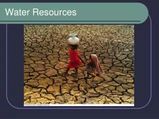
Will We have Enough Usable Water? We live on a water planet, with a precious layer of water-most of it saltwater-covering about 71% of the earth’s surface It takes huge amounts of water to supply you with food, provide you with shelter, and meet your other daily needs and wants Water also plays a key role in sculpting the earth’s surface, moderating climate, and removing and diluting wastes and pollution Only a tiny fraction of the planet’s abundant water supply – 0.024%-is readily available to us as liquid freshwater in accessible groundwater deposits and in lakes, rivers, and streams
Definitions You Need to KNOW Groundwater – precipitation infiltrates the ground and percolates downward through spaces in soil, gravel, and rock until an impenetrable layer of rock stops it The spaces in soil and rock close to the earth’s surface hold little moisture. Below a certain depth, in the Zone of Saturation, these spaces are completely filled with water. The top of this groundwater zone is the water table. It falls in dry weather, or when we remove groundwater faster than nature can replenish it, and it rises in wet weather Deeper down are geological layers called aquifers which are underground caverns and porous layers of sand, gravel, or bedrock through which groundwater flows. Most aquifers are replenished naturally by precipitation that percolates downward through soil and rock, called natural recharge
Definitions Continue Surface water, the freshwater from precipitation and snowmelt that flows across the earth’s land surface and into rivers, streams, lakes, wetlands, estuaries, and ultimately oceans Precipitation that does not infiltrate the ground or return to the atmosphere by evaporation is called surface runoff Surface water replenished by runoff is classified as a renewable but finite resource The land from which surface water drains into a particular river, lake, wetland, or other body of water is called its watershed or drainage basin
Hydrological connection There is a hydrological connection between surface water and groundwater because eventually most groundwater flows into rivers, lakes, estuaries, and wetlands If we disrupt the hydrological cycle by removing groundwater faster than it is replenished, nearby streams, lakes and wetlands could dry up, resulting in degradation of aquatic biodiversity and various ecological services
Surface Runoff Two-thirds of the annual surface runoff in rivers and streams is lost by seasonal floods and is not available for human use The remaining one-third is reliable surface runoff: the amount of surface runoff that we can generally count on as a source of freshwater from year to year
How much Reliable Runoff Do We Use? We withdraw about 34% of the world’s reliable runoff Increased population growth alone, global withdrawal rates of surface water could reach more than 70% of reliable runoff by 2025, and 90% if per capita withdrawal of water continues increasing at the current rate
Uses of Water Worldwide, we use 70% of the water we withdraw each year from rivers, lakes, and aquifers to irrigate cropland. Industry uses another 20% of the water withdrawn each year Cities and residences use the remaining 10%
United States Freshwater Resources The United States has more than enough renewable freshwater; but it is unevenly distributed, and much of it is contaminated by agricultural and industrial practices Three rainiest cities in the U.S.: Mobile, Alabama; Pensacola, Florida; New Orleans, Louisiana In the East, most water is used for energy production, power plant cooling, and manufacturing In various parts of the eastern U.S., the most serious water problems are flooding and occasional urban shortages as a result of pollution
U.S. Freshwater Almost half the water used in the United States come from groundwater sources, and the rest comes from rivers, lakes, and reservoirs 36 states are likely to face water shortages by 2013 because of a combination of drought, rising temperatures, population growth, urban sprawl, and excessive use and waste of water
17 States are Water Hotspots Houston, TX Competition for scarce water to support growing urban areas, irrigation, recreation, and wildlife could trigger intense political and legal conflicts between states and between rural and urban areas within states during the next 20 years.
Will Water Shortages Grow? Poor people bear the brunt of water shortages. In 2005, the United Nations reported that 1.1 billion people – one of every six- lacked regular access to enough clean water for drinking, cooking, and washing 2.6 billion people did not have access to even basic sanitation By 2025, at least 3 billion of the world’s projected 7.9 billion people will lack access to safe water
Natural capital degradation: stress on the world’s major river basins, based on a comparison of the amount of water available with the amount used by humans. Fig. 13-6, p. 319
Drought Forecasted Drought:a prolonged period in which precipitation is at least 70% lower and evaporation is higher than normal in an area that is normally not dry Drought is usually caused by extended periods of below normal rainfall But it can also result from diminished groundwater due to falling water tables or other factors, such as climate change, that reduce the normally available water supply Severe drought : dries out soil, reduces stream flows, decreases tree growth and biomass, lowers net primary productivity, reduces crop yields, and causes a shift in some biomes toward relatively dry conditions such as those found in savannas and deserts Between 1979 and 2008, the total area of the earth experiencing severe or extreme drought more than tripled in what some observers call “The Big Dry.” Currently, about 30% of the earth’s land area – roughly equal to the size of Asia- experiences severe drought
Who Should Own and Manage Freshwater Resources? Most people believe that everyone should have access to clean water. Most water resources are owned by governments and managed as publically owned resources for their citizens An increasing number of governments, while retaining ownership of these public resources, are hiring private companies to manage them; but some are selling their water resources to private companies Two large French companies – Veolia and Suez – realize that water scarcity is rapidly becoming one of world’s most urgent environmental problems and that is a lot of money to be made in owning and managing water resources Currently 85% of Americans get their water from publicly owned utilities Within 10 years, these two European based water companies aim to control 70% of the water supply in the U.S. by buying American water companies and entering into agreements with most cities to manage their water supplies
Who Should Own and Manage Freshwater Resources? (cont.) Many people oppose full privatization of water resources because they believe that water is a public resource too important to be left solely in private hands Some analysts point to two other potential problems in a fully privatized water system First, because private companies make money by delivering water, they have a incentive to sell as much water as they can rather than to conserve it Second, because they have too little money to pay water bills, the poor will continue to be left out
Groundwater: Should We Extract It? Most aquifers are renewable sources unless their water becomes contaminated or is removed faster than it is replenished by rainfall, as is occurring in many parts of the world Aquifers provide drinking water for nearly half of the world’s people United States, aquifers supply almost all of the drinking water in rural areas, one-fifth of that in urban areas, and 37% of irrigation water
Aquifers Shrinking In the U.S., groundwater is being withdrawn, on average, four times faster than it is replenished One of the most serious overdrafts is in the lower half of the Ogallala, the world’s largest known aquifer, which lies under eight Midwestern states from South Dakota to Texas The gigantic Ogallala aquifer supplies about one-third of all the groundwater used in the United States and has helped to turn the Great Plains into one of the world’s most productive irrigated agricultural regions The problem is that the Ogallala is essentially a one time deposit of liquid natural capital with a very slow rate of recharge Depletion of the Ogallala threatens biodiversity; it flows onto the land and creates wetlands, which are vital habitats for many species, especially birds
Dams and Reservoirs A dam is a structure built across a river to control the river’s water flow After a river is dammed, the river’s flow creates an artificial lake, or reservoir, behind the dam and reservoir system are to capture and store runoff and release it as needed to control floods, generate electricity, and supply water for irrigation and for towns and cities Dams and reservoirs have helped to reduce flooding and grow crops in arid areas; one-fourth of the world’s dams produce about 20% of the world’s electricity Dams and reservoirs have displaced 40-80 million people from their homes, flooded a productive area the size of California, impaired some of the important ecological services rivers provide About one-fifth of the world’s freshwater fish and plant species are either endangered or extinct primarily because dams and water withdrawals have destroyed many free-flowing rivers
Colorado River Basin Four major problems associated with the use of this river water: First, the Colorado River basin includes some of the driest land in the U.S. and Mexico Second, for its size, the river has only a modest flow of water Third, legal pacts signed in 1922 and 1944 allocated more water for human use in the U.S. and Mexico than the river can supply – even in rare years without a drought The pacts allocated no water for environmental purposes Fourth, since 1905, the amount of water flowing to the mouth of the Colorado River has dropped dramatically. Since 1960, the river has rarely made it to the Gulf of California because of the many dams, the increased water withdrawals, and a prolonged drought in the American Southwest, which is projected to last throughout this century This threatens the survival of species that spawn in the river and species that live in its estuary near the coast
China’s Three Gorges Dam China’s Three Gorges Dam, built across the Yangtze River, is the world’s largest hydroelectric dam and reservoir. Two kilometers long, the dam was built at a cost of at least $25 billion The reservoir fills, the dam will be able to produce an amount of electricity equal to that of 22 large coal-burning or nuclear power plants, enough electricity to provide power for a city 10 times the size of Los Angeles California Hold back the Yangtze River’s floodwaters, which have killed more than 500,000 people during the last 100 years The dam will enable large cargo-carrying ships to travel deep into China’s Interior, greatly reducing transportation cost Scientists contend that the slower flow of water in the reservoir will continually release huge amounts of sediment that will shorten the projected life of the reservoir and limit the flood-prevention capacity of the dam Farming regions below the dam will no longer receive annual deposits of nutrient-rich sediment Dam is built over a seismic fault, geologists fear it will collapse and kill millions Plant and animal matter rotting underwater in the gigantic reservoir will release methane gas into the atmosphere Costs much more when completed than first thought - $75 billion
California’s Water Transfer One of the world’s largest transfer projects is the California Water Project It uses a maze of giant dams, pumps, and aqueducts to transport water from water-rich northern California to water-poor southern California’s heavily populated agricultural regions and cities Agriculture consumes three-fourths of the water withdrawn in California, much of it used inefficiently for water-thirsty crops such as rice and alfalfa growing in desert-like conditions Northern Californians counter that sending more water south degrades the Sacramento River, threatens fisheries, and reduces the river’s power to flush pollutants out of the San Francisco Bay Its projected that within this century, many people living in arid southern California cities, as well as farmers in this area, may have to move elsewhere because of a shortage of water It would be quicker and cheaper to reduce water waste by improving irrigation efficiency, not growing water-thirsty crops in arid areas, and raising the historically low price of water to encourage water conservation
Aral Sea Disaster The shrinking of the Aral Sea is the result of a large-scale water transfer project in an area of the former Soviet Union with the driest climate in central Asia Since 1960, enormous amounts of irrigation water have been diverted from the inland Aral Sea and its two feeder rivers to create one of the world’s largest irrigated areas, mostly for raising cotton and rice The irrigation canal, the world’s longest, stretches more than 800 miles This large-scale water diversion project, coupled with droughts and high evaporation rates due to the area’s hot and dry climate has caused a regional ecological and economic disaster About 85% of the area’s wetlands have been eliminated and roughly half the local bird and mammal species have disappeared Shrinkage of the Aral Sea has also altered the area’s climate; there is less rain, summers are hotter and drier, winters are colder, and the growing season is shorter To raise yields, farmers use more pesticides, which are getting in to the water tables and making people sick
1976 2006 Natural capital degradation:the Aral Sea was once the world’s fourth largest freshwater lake. Since 1960, it has been shrinking and getting saltier because most of the water from the rivers that replenish it has been diverted to grow cotton and food crops (Concept 13-4). These satellite photos show the sea in 1976 and in 2006. It has split into two major parts, little Aral on the left and big Aral on the right. As the lake shrank, it left behind a salty desert, economic ruin, increasing health problems, and severe ecological disruption.
China’s Water Transfer The Chinese government has begun a massive engineering project to transfer water from three of its southern river basins to its populous and parched northern provinces Critics of the are worried that high levels of pollution in the three rivers from which water will be extracted and transported will contaminate northern water supplies Large scale removal of water could damage southern ecosystems, especially the fragile watersheds in Tibet Increasing desertification in northern China is eroding biodiversity and reducing supplies of drinking water for at least 96 million Chinese, because pollutants are becoming concentrated in small bodies of water Northern China needs much more water to support its large population, intensive agriculture, and rapid industrialization
Removing Salt Desalination involves removing dissolved salts from ocean water or from brackish (slightly salty) water in aquifers or lakes for domestic use One method of desalinating water is distillation- heating saltwater until it evaporates (leaving behind salts in solid form) and condenses as freshwater Reverse osmosis uses high pressure to force saltwater through a membrane filter with pores small enough to remove the salt There are three major problems with the worldwide use of desalination: the high cost and energy footprint; pumping large volumes of seawater through pipes and using chemicals to sterilize the water and keep down algal growth kills many marine organisms; produces large quantities of briny wastewater that contains lots of salt and other minerals – dumping it into the ocean threatens marine life and depositing it on land contaminates groundwater and surface water
Wasting Water 65-70% of the water people use throughout the world is wasted through evaporation, leaks, and other losses The main cause of water waste is its low cost to users Underpricing is mostly the result of government subsides that provide irrigation water, electricity, and diesel fuel used by farmers to pump water from rivers and aquifers at below-market prices Second cause for water waste is a lack of government subsides for improving the efficiency of water use Take away subsidies for wasting and provide subsides for conserving water would reduce waste water and shortages
Irrigation Methods Flood irrigation water flows by gravity through unlined ditches in crop fields so the crops can absorb it; delivers far more water than is needed for crop growth and typically loses 40% of the water through evaporation, seepage, and runoff Center-pivot, low pressure sprinkler uses pumps to spray water on crops; allows 80% of water to reach crops Drip or trickle irrigation, also called micro-irrigation, is the most efficient way to deliver small amounts of water precisely to crops; 90-95% of water reaches crops
Floodplains A flood happens when water in a stream overflows its normal channel and spills into the adjacent area, called a floodplain Floodplains, which usually include high productive wetlands, help to provide natural flood and erosion control, maintain high water quality and recharge groundwater People settle on floodplains because of their many advantages, including fertile soil, ample water for irrigation, availability of nearby rivers for transportation and recreation, and flat land suitable for crops, buildings, highways, and railroads Floods provide several benefits: create the world’s most productive farmland by depositing nutrient-rich silt of floodplains, recharge and refill wetlands, supporting biodiversity and ecological services Floods kill thousands of people each year and cause tens of billions of dollars in property damage
Increasing Flood Risks Removal of water-absorbing vegetation, especially on hillsides Removing protective mangrove forests in coastal areas can increase flooding from storms and tsunamis Draining and building on wetlands which help buffer hurricanes effects Global warming caused by humans burning fossil fuels and clear cutting forests
Natural capital degradation:hillside before and after deforestation. Once a hillside has been deforested for timber, fuelwood, livestock grazing, or unsustainable farming, water from precipitation rushes down the denuded slopes, erodes precious topsoil, and can increase flooding and pollution in local streams. Such deforestation can also increase landslides and mudflows. A 3,000-year-old Chinese proverb says, “To protect your rivers, protect your mountains.”