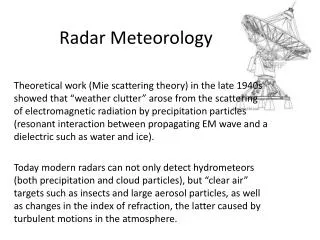
Radar Meteorology
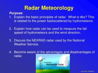
Purpose : Explain the basic principles of radar. What is dbz? This is related to the power backscattered by hydrometeors. Explain how radar can be used to measure the fall speed of hydrometeors and the wind direction. Discuss the NEXRAD radar used by the National Weather Service.

Radar Meteorology
E N D
Presentation Transcript
Purpose: Explain the basic principles of radar. What is dbz? This is related to the power backscattered by hydrometeors. Explain how radar can be used to measure the fall speed of hydrometeors and the wind direction. Discuss the NEXRAD radar used by the National Weather Service. Become aware of the advantages and disadvantages of radar. Radar Meteorology
Definitions RADAR is an acronym. RAdio Detection And Ranging. Advanced Research Project Agency (ARPA) Long-range Tracking and Identification Radar (ALTAIR). Ballistic Missiles and Space Surveillance (military). NEXRAD Weather Radar
NEXRAD RADAR NEXRAD (background) and weather balloon launch facility.
Named WSR-88D S-band radar radiation wavelength is λ = 10.7 cm Power is 750,000 kW Tallahassee (right) NEXRAD RADAR
More Definitions: NEXRAD and WSR-88D NEXRAD or Nexrad (Next-Generation Radar) is a network of 159 high-resolution Doppler weather radars operated by the National Weather Service, an agency of the National Oceanic and Atmospheric Administration (NOAA) within the United States Department of Commerce. Its technical name is WSR-88D, which stands for Weather Surveillance Radar, 1988, Doppler. NEXRAD detects precipitation and atmospheric movement or wind. It returns data which when processed can be displayed in a mosaic map which shows patterns of precipitation and its movement. The radar system operates in two basic modes, selectable by the operator: a slow-scanning clear-air mode for analyzing air movements when there is little or no activity in the area, and a precipitation mode with a faster scan time for tracking active weather. NEXRAD has an increased emphasis on automation, including the use of algorithms and automated volume scans. (wikipedia).
Precipitation Estimation using theZ-R Relationship The equation used for the Z-R relationship can be changed to produce different outputs. Private companies or researchers may use a different Z-R relationship for different geographical regions or climatic zones R = aZb where R = Rain Estimation a = 300 Z = Radar Reflectivity b = 1.5
Radar Bright Band: Strong Scattering from Melting Hydrometeors http://www.radar.mcgill.ca/bright_band.html
WIND PROFILER The wind profiler is a ground based array of multiple beam Doppler radar units which measures and displays wind information up to an altitude of 16 km. This instrument is generally used to detect low level wind shear.
The frequency of the em wave used depends on the application. Some frequencies travel through clouds with virtually no attenuation. ALL em waves move at the speed of light
Radar Frequency Bands f = c, c=3x10⁸ m/s, =wavelength, f= frequency
Pulse Lengths for WSR-88D Radar[Weather Surveillance Radar, 1988, Doppler] Total radiated power in a radar pulse Range Resolution: Long Pulse: Short Pulse:
94 GHz 35 GHz Maximum Propagation Distance Energy Absorbed by Atmosphere 10-15 km 20-30 km 3.2 mm 8 mm Radar Wavelength
Zenith Microwave Transmittance: Cloud Free Atmospheres Water Vapor Rotational Lines Choose microwave frequencies for cloud emissivity measurement wheretransmittance is high!!! Water vapor is variable; choose low frequency.
Scattering and Absorption by Particles Summary of Scattering Regimes: Note Particle Sizes and wavelengths of radiation!!
Mie Radar Backscatter Efficiency for Water and Ice Spheres Non Rayleigh strong backscatter by water drops compared to that of ice!! Rayleigh WSR-88D NWS Doppler Radar
Rayleigh Scattering Phase Function: Angular Distribution of Light Scattered by a Dipole vertical polarization state 3D rendering horizontal polarization state The Peanut! Average of both polarization states.
Example: June 27, 2008, Omaha Nebraska. Check out those monster spikes near 5 pm!! More than 0.5” rain in less than 15 minutes.
Gravity Waves Pre-frontal squall line formation is not fully understood. One theory suggests that a surging cold front may initiate "gravity waves" aloft, where the rising motion of the wave causes cumulus cloud development.
Trailing Stratified Clouds An extensive region of stratified clouds may follow behind a squall line. This figure shows a loop of rising and falling air that supplies the moisture to the stratiform clouds and associated light precipitation.
Acoustic Echo-location hello
Acoustic Echo-location hello distance
Hi !! time Hi !! t = 2 x range / speed of sound Example:range= 150 m Speed of sound≈340 meters/second t= 2 X 150 / 340 ≈ 1 second
RADAR Echolocation(RADAR ~ RAdio Detection And Ranging)“Microwave Echo-Location” Tx Rx Microwave Transmitter Receiver
Radars work by… • Transmitting microwave pulses…. • and measuring the … • Time delay (range) • Amplitude • Frequency • Polarization • … of the microwave echo in each range gate
Target Spatial Orientation Closer look at Large drop Large Drops Polarization Pt Small Drops Polarization Ps
Example: Weather Echoes Microwave Transmitter Receiver
Echo versus Range(range profile) Transmitted Pulse #1 Cloud Echo time
Why Radar Can't (Usually) See Tornadoes • The network of WSR-88D Doppler radars across the US has certainly proven itself for the ability to detect severe weather. Tornado warnings, in particular, are much better now that National Weather Service forecasters have this fantastic new (new as of the early 1990s) tool. • But did you know that Doppler radar (usually) can't see an actual tornado? When Doppler radar is cited in a tornado warning it is generally because meteorologists see evidence the storm itself is rotating. It is a supercell thunderstorm or at least contains an area of rotation called a mesocyclone. • When can and when can't Doppler radar see a tornado? It's math! Let's figure it out. We'll be looking into two factors: • 1) the first is something you learned in school a loooong time ago - the earth is curved, and • 2) the radar "beam" is 1 degree wide.
Antennas • Antenna is a transition passive device between the air and a transmission line that is used to transmit or receiveelectromagnetic waves.
Antenna Beamwidth radians D is the antenna diameter λ is the wavelength of signal in air Tradeoff: Small wavelengths (high frequencies) = small antennas But small wavelengths attenuate more
How wide and tall are various things we want to see? Object Size Width of Meteorological Objects (i.e. Storms, Tornadoes)
Understanding and Interpreting NWS WSR-88D Doppler Radar From the National Weather Service Greenville-Spartanburg, SC
Antenna emits series of radio waves Listens for amount of energy reflected back The better the target is reflecting (i.e. more raindrops) the stronger the signal or echo will be Quick Overview Interesting Tidbit: The WSR-88D takes about 0.0000016sec to emit a pulse or radio wave. This means for every hour, the Radar is “on” for 7 seconds and “listens” for the remaining 59min and 53sec From the National Weather Service Greenville-Spartanburg, SC
How Doppler Works The Doppler effect: change in frequency depending upon movement toward or away from observer When a train passes, what sound does it make? Velocity data useful during severe weather and detecting rotation such as tornadoes From the National Weather Service Greenville-Spartanburg, SC
From the National Weather Service Greenville-Spartanburg, SC Scan Patterns Clear Air Mode Used when no precipitation is present Can detect smoke plumes, clouds, fog, birds and insect swarms One full scan every 10 minutes Precipitation Mode Switches over from Clear Air Mode automatically when considerable precipitation is detected One full scan every 5-6 minutes
Ground Clutter • Most prevalent on 0.5° reflectivity and velocity images • Radar beam is striking stationary ground targets • Usually appears as an area of uniform returns surrounding radar site • Velocities usually near zero on velocity images • Some is filtered but it is impossible to remove it all • Especially bad during inversions or after frontal passages From the National Weather Service Greenville-Spartanburg, SC
The beam widens as it moves away from the radar. If a small storm is a considerable distance from the radar...it may not be big enough to completely fill the beam. Since the radar cannot discern things thinner than the beam, it assumes the storm is filling it entirely. This can make a storm look bigger than reality. Beam Spreading Actual Depicted From the National Weather Service Greenville-Spartanburg, SC
Beam Height vs. Distance • Lowest elevation slice is 0.5° so it is not totally horizontal. • Earth’s curvature also plays a role. • Radar beam gets higher off the ground farther from the radar. • Makes low level precipitation invisible to radar at considerable distances. From the National Weather Service Greenville-Spartanburg, SC
Reflectivity Images Velocity Images (Doppler) Precipitation Estimates Vertically Integrated Liquid Echo Tops Animated Loops of Most Products Many Other Products Products Available From the National Weather Service Greenville-Spartanburg, SC
Reflectivity Images Base Reflectivity and Composite Reflectivity Base Reflectivity Composite Reflectivity • Displays the maximum returned signal from all of the elevation scans • Better summary of precipitation intensity • Much less deceiving than Base Reflectivity • Subtle 3-D storm structure hidden • 0.5° elevation slice • Shows only the precipitation at the lowest tilt level • May underestimate intensity of elevated convection or storm cores From the National Weather Service Greenville-Spartanburg, SC
Reflectivity Images Composite Reflectivity • Displays the maximum returned signal from all of the elevation scans to form a single image • Can often mask some Base Reflectivity signatures such as a hook echo From the National Weather Service Greenville-Spartanburg, SC
Base vs Composite Reflectivity Which is which? Base Reflectivity Image Composite Reflectivity Image • Notice the heavier returns and more coverage • Notice the lighter returns From the National Weather Service Greenville-Spartanburg, SC