Download
1 / 13
150 likes | 427 Vues
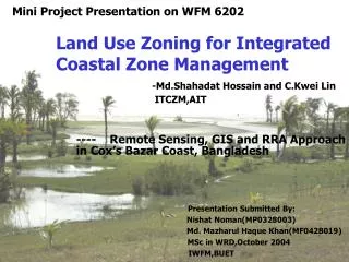
Mini Project Presentation on WFM 6202. -Md.Shahadat Hossain and C.Kwei Lin ITCZM,AIT. Land Use Zoning for Integrated Coastal Zone Management. ---- Remote Sensing, GIS and RRA Approach in Cox’s Bazar Coast, Bangladesh.

E N D
Mini Project Presentation on WFM 6202 -Md.Shahadat Hossain and C.Kwei Lin ITCZM,AIT Land Use Zoning for Integrated Coastal Zone Management ---- Remote Sensing, GIS and RRA Approach in Cox’s Bazar Coast, Bangladesh Presentation Submitted By: Nishat Noman(MP0328003) Md. Mazharul Haque Khan(MF0428019) MSc in WRD,October 2004 IWFM,BUET
Introduction • Natural resources • Over-utilization/Under-utilization • Lack of guidelines for natural Resource utilization • Major Conflicts • Evaluation of resources • Land/Resourse use zoning-Suitability Criteria Presentation on WFM 6202
Objective • Basis for the communication and exchange of ideas • To encourage development in the most suitable areas • To define areas to promote the development • To provide a focus for research or monitoring • To define environmental capacity • To develop area-based certification • Basis for sectoral EIA or Cost Benefit analysis Presentation on WFM 6202
Methodology • The required criteria for the objectives have been considered during the Remote Sensing and GIS analysis. • The diagnostic factors considered for suitability assessment for different vital activities depending on their respective parameters • The land suitability map was prepared to identify the suitable area for each activity Presentation on WFM 6202
Location of Cox’s Bazar Hydrology • These rivers swell rapidly and flow in spate for a few days at the time after heavy pre-monsoon or monsoon rainfalls in the Chittagong Hill Tracks Presentation on WFM 6202
Mangrove • Responsible factors: Removal of forest product for fuel, shrimp farming, human settlement, salt production…………… • The swamp consisted of innumerable low-lying islands, which were mostly submerged at high tide Table:Historical changes of Chokoria Sunderban mangrove forest in Cox’s Bazar coast for 100 years time scale Presentation on WFM 6202
Land Use Map • Most of the suitable areas for mangrove afforestation are currently being used for shrimp and salt production Presentation on WFM 6202
Present Result • Most of the salt beds are used for extensive shrimp culture during monsoon month Table:Present result and the existing land use pattern in the Cox’s Bazar coast Presentation on WFM 6202
Mangrove & Shrimp • Soil type • Tidal area • soil pH • soil salinity • Land use pattern • Slope • elevation • soil texture • soil pH • organic matter • tidal area • disease problems Presentation on WFM 6202
Salt Production & Tourism • soil texture • tidal area • land use pattern • beach type • tourist accommodation • transportation facilities Presentation on WFM 6202
Management Process Presentation on WFM 6202
Conclusion • Public awareness • participation of local people, government and others……… • coastal community must be involved in the decision, planning and management processes • appropriate feedback Presentation on WFM 6202
THANK YOU Presentation on WFM 6202