Download
1 / 8
80 likes | 187 Vues
This report examines the critical role of place names in disaster management in Australia and New Zealand, focusing on recent catastrophic events such as the 2009 Victorian Bushfires, Queensland Floods, and the Christchurch earthquake. It highlights how effective location identification and resource deployment improved community support and recovery efforts. The report also emphasizes the need for database integrity, integration of place name data, and the establishment of community-based geographic naming systems. Lessons learned from these experiences can guide future disaster management strategies to better protect communities.

E N D
Place names and Disaster Management Recent experiences in Australia and New Zealand
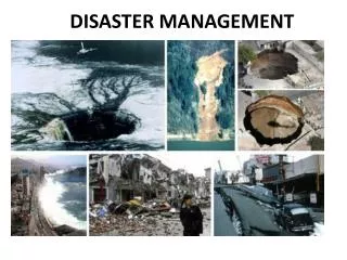
Scope Of Events • 2009 Victorian Bushfires – 9th worst in the world – 183 deaths • 2010 – 2011 – Queensland Floods & Cyclone – over 45 deaths, 200 000 people affected – 75% of State affected – extensive damage to infrastructure, homes and businesses • 2011 – Victorian Floods – 2 deaths – 3000 people evacuated – 33% of State flooded – extensive damage to homes and farms • 2011 – Western Australian bushfires and floods • 2011 – Tasmanian Floods • 2011 – New South Wales Floods • 2011 – Christchurch earthquake – over 130 deaths - extensive damage to buildings and infrastructure
Use of Place Names Used in the following context • Disaster management • Location identification • Forecasting impacts • Resource deployment • Initial relief grants • Recovery • Community support
Use of Place Names • Positive Outcomes • Data availability and contents • The New Zealand gazetteer and each jurisdictional data in Australia is available to and widely used by emergency services. • For major toponyms, this data was more than suitable • Community Geographic Domain Names • Established for many communities immediately after the disaster, or were in existence. • 19 sites used in the Queensland floods • 4 established specifically for the Victorian floods, other previously established after 2009 Victorian bushfires • Rural Addresses • Distance based addressing system provided accurate coordinates of properties as well as an address for other purposes
Marysville.vic.au – set up immediately after the 2009 bushfires to provide a community focus to assist in the recovery efforts
Use of Place Names • Improvements needed • Database Integrity and Integration • Official Gazetteers vs. mapping datasets • Western Australia – fully integrated into spatial data systems compared with other States where this has not occurred to the same level • Micro toponyms not well represented • Not enough of the locally used names were in the databases. • A recent study for a linguistic thesis in very small portion of South Australia found of the 230 place names studies, only 12 were listed in the State Gazetteer • Address creation / education • Christchurch does not have defined suburb boundaries – address confusion • Lack of use of the official addresses by residents in Victorian and Queensland delayed the grants program – need to establish education processes