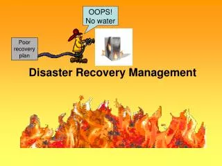
DISASTER MANAGEMENT
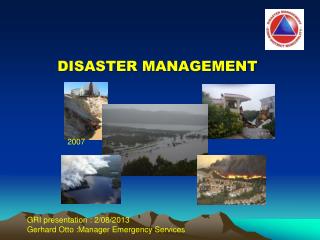
DISASTER MANAGEMENT. 2007. GRI presentation : 2/08/2013 Gerhard Otto :Manager Emergency Services. Contents. Risk overview- Eden district; Major incidents 2012- 2013; Eden update of disaster risk assessment;

DISASTER MANAGEMENT
E N D
Presentation Transcript
DISASTER MANAGEMENT 2007 GRI presentation : 2/08/2013 Gerhard Otto :Manager Emergency Services
Contents • Risk overview- Eden district; • Major incidents 2012- 2013; • Eden update of disaster risk assessment; • The collection and consolidation of all available flood related data for Eden District Municipality ; • Early warning and early warning display;
NEW ERA CIVIL PROTECTION LEGISLATION DISASTER MANAGEMENT LEGISLATION (ACT 57 OF 2002) : Promulgated 31/03/2004 (ACT 67 OF 1977) DISASTER RISK REDUCTION PHASE DISASTER RESPONSE PREPAREDNESS Civil Protection Civil Protection RELIEF D i s a s t e r C o n t i n u u m Disaster Management Disaster Management REHABILITATION MITIGATION/PREVENTION RECONSTRUCTION DISASTER RECOVERY PHASE
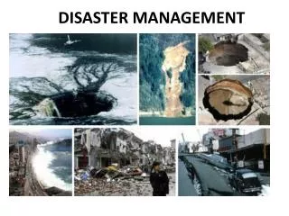
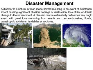
RISK OVERVIEW: EDEN DISTRICT Disasters / Major incidents : Last 7 years Most Frequent Disasters Underlying/ Predisposing Factors Disaster Risk Profile • • 14 Jan 2005: Flooding in Mossel Bay (R2.5 million) • Feb 2005: Avian Flu (Ostriches) • • March 2005: Drought • • Apr 2005: Porcine reproductive & respiratory syndrome (Pigs) approx. 8 000 affected • • July 2005: Swine Fever (Pigs) 1 542 culled • July/August 2006 Floods Eden (R275 million ) • November 2006 Haarlem hailstorm R9.3 million • November 2007 Floods Eden (R1.1 billion) • September 2008 High seas- coastal erosion • 2009/2010 Drought Eden District (R 300 million) • April 2009 --Swine Flue outbreak • March 2010 –-GRJ Air link accident • March 2010- Rift Valley fever • 2010 Avian Influenza –Klein Karoo (? R 1 Billion) • 2011 Eden DM Floods (R 485 million) • February 2011 – Aircraft incident :Robberg • July 2011- Rock falls N 12 and Outeniqua mountains • December 2011 – Oil spill Diaz beach • Kouga mountain fires (R 1 million) • 2012 Eden DM Floods (Bitou R13 ,8mil) • 2012 Albertinia Fires (R 2 million) • 2012/2013 Civil unrest farm workers • 2013 Hail storm – Langkloof ? • 2013 Onion seed -no pollination ? • • Extreme weather • • Meteorological drought • • Riverine flooding • • Estuarine flooding • • Coastal flooding/storm surges • • Urban flooding • • Hydrological drought • • Agricultural drought • • Seismic risks and earthquakes • • Rock falls and landslides • • Urban fringe fires • • Veldt fires • • Human epidemics • • Livestock epidemics • • Air pollution • • Water pollution • Soil erosion/land degradation • • Power plants • • Bridges • • Dams • • Petrochemical installations • • Transport: Roads, air, sea and rail • • Marine oil spills • • Toxic cargo spills • • Radioactivity emissions • • Urban formal fire • • Urban informal fire • • Drought • • Flooding • • Fires (Veldt) • • Fires (Informal • settlements) • Animal diseases • Environmental degradation • Human immigration to area • Extreme weather events • Unplanned human settlements • Frequency of fires in informal settlements and veldfires
Disaster Planning: Ongoing, Dynamic Process CANNOT occur In Isolation Nature
General comments- Flood related data • Detailed flood mapping focussed on coastal areas; • Rural areas poorly covered; • Constrained by lack of topographical data eg. Lidardata; • Large amount of local knowledge un-captured (To be included); • Flood data not well managed – lack of metadata, reports etc. • Focus on flood extent and frequency- very little on consequences; • Flood data not translated into practical actions (Risk reduction projects); • Data not integrated with other decision making processes – development; • No flood data management protocol – information flow (One database); • No standard guidelines for flood mapping; • Access missing data and reports – Gorra, flood severity data;
EARLY WARNING= THE KEY TO SAVING LIVES AND LIMIT THE IMPACT ON COMMUNITIES
Standardization of Alert Categories:Reflecting Increasing Urgency of Hazard Risk FCAST-PRE-20110323.001.1
PROCESS FLOW DIAGRAM FOR ALERTS IN SOUTHERN AFRICA INPUTS WEATHER ALERTS disseminated to: • Remote Sensing • Satellite (geostationary, meteorological) • Scatterometer data from Polar orbiters (Jason, ASCAT etc) • Shore-based marine radar PRIMARY ROLE PLAYERS • South African Weather Service website • Media(National TV, printed media, internet news, radio (regional and national) INPUTS FEEDBACK • Realtime data • Moored buoys (CSIR, waverider etc) • Metocean drifting buoys • Tide gauges • Ship-based Met Obs (VOS) • National disaster Management Centre (NDMC MHEWS website) • Provincial Disaster Management centres (PDMC) • District and Local Municipal Disaster Management Centres • Other Primary users as listed but not limited to 7.2.2 INPUTS • Numeric weather Prediction (NWP)Models: • Atmosphere • Ocean waves (open water) PROCESSING (Ref Chapter 6) Preliminary risk assessment by partner groups/agencies ALERT LEVEL ASSESSMENT (Ref Chapter 8.3) Predicted astronomical tide data (SA Navy) SECONDARY ROLE PLAYERS OUTPUT Severe weather alert issued Bathymetry of near-shore environment. • Local Disaster Management • Ward councilors • Traditional leaders • Other role players as listed, but not limited to 7.2.3 CSIR: Modelling of nearshore/ Inshore transition of waves from open ocean to inshore
Disaster management- Way Forward • Completion of the Eden severe weather early warning system; • (Partial funding from SANTAM – Business adopt a municipality (BaaM); • Unpack the 2013 risk assessment at local authority level- Disaster advisory forums; • Update disaster management plans for the Eden District and the local • municipalities – review ,assess and update; • Update provincial and other response plans : i.e. oils spill contingency plans / • dam safety plans and ACSA safety plan; • Capacity building, awareness campaigns etc.
Disaster management is everybody's business Let’s plan together to ensure an safer future for everybody in the Eden area
QUESTIONS? THANK YOU DANKIE ENKOSI GERHARD OTTO HEAD OF DISASTER MANAGEMENT Eden District Municipality Tel:(044) 803 1300 Sel:083 6302602 gerhardo@edendm.co.za