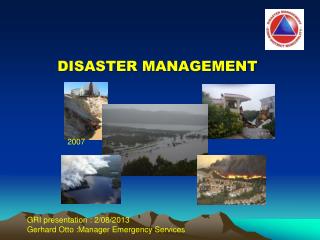
DISASTER MANAGEMENT
DISASTER MANAGEMENT. Prof. Kishor B SHIKAHRE Civil Engineering Department Aurangabad college of Engineering, Aurangabad. What is a Disaster ?. Disaster is a sudden, calamitous event bringing great damage, loss, and destruction and devastation to life and property.

DISASTER MANAGEMENT
E N D
Presentation Transcript
DISASTER MANAGEMENT Prof. Kishor B SHIKAHRE Civil Engineering Department Aurangabad college of Engineering, Aurangabad.
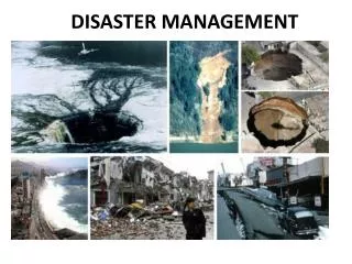
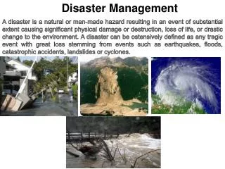
What is a Disaster ? • Disaster is a sudden, calamitous event bringing great damage, loss, and destruction and devastation to life and property. • Losses exceed the ability of affected to cope with it using its own resources. AS Per D M ACT-2005: Disaster is defined as “a catastrophe, mishap, calamity or grave occurrence in any area, arising from natural or man made causes, or by accident or negligence which results in substantial loss of life or human suffering or damage to, and destruction of property, or damage to, or degradation of, environment, and is of such a nature or magnitude as to be beyond the coping capacity of the community of the affected area”.
A disaster happens when a hazard impacts on the vulnerable population and causes damage, casualties and disruption.
Is Dependent on : Lead Time Available. Intensity of Hazard. Duration. Spatial Extent. Density of Population & Assets. Time of Occurrence. Vulnerabilities existing in the Elements at Risk. Scale of Disaster Hazard X Vulnerability = Risk (Mostly Natural) (Man and Built Env.) (Consequence) Geological Physical Death/Injury Hydrological Social/ Cultural Financial Loss Meteorological Economic Social Loss
What is a Hazard ? Hazard may be defined as “a dangerous condition or event, that threat or have the potential for causing injury to life or damage to property or the environment.” The word ‘hazard’ owes its origin to the word ‘hasard’ in old French and ‘az-zahr’ in Arabic meaning ‘chance’ or ‘luck’
What is vulnerability ? • Vulnerability may be defined as “The extent to which a community, structure, services or geographic area is likely to be damaged or disrupted by the impact of particular hazard, on account of their nature, construction and proximity to hazardous terrains or a disaster prone area.”
Vulnerabilities can be categorized as follows: • Physical vulnerability: It includes notions of who and what may be damaged or destroyed by natural hazard such as earthquakes or floods It is based on the physical condition of people and elements at risk, such as buildings, infrastructure etc. and their proximity, location and nature of the hazard • Socio-economic vulnerability: The degree to which a population is affected by a hazard will not merely lie in the physical components of vulnerability but also on the socio-economic conditions. For example, people who are poor and living in the sea coast don’t have the money to construct strong concrete houses
People Livestock Rural Housing Stock Houses Vulnerable Crops, Trees, Telephone, Electric poles Boats, Looms, Working Implements Personal Property Electricity, Water and Food Supplies Infrastructure Support ELEMENTS AT RISK
What is capacity ? Capacity can be defined as “resources, means and strengths which exist in households and communities and which enable them to cope with, withstand, prepare for, prevent, mitigate or quickly recover from a disaster. Physical Capacity: People whose houses have been destroyed by the cyclone or crop have been destroyed by the flood can salvage things from their homes and from their farms. Some family members have skills, which enable them to find employment if they migrate, either temporarily or permanently.
What is capacity ? Socio-economic Capacity: In most of the disasters, people suffer their greatest losses in the physical and material realm. Rich people have the capacity to recover soon because of their wealth. In fact, they are seldom hit by disasters because they live in safe areas and their houses are built with stronger materials. However, even when everything is destroyed they have the capacity to cope up with it. Hazards are always prevalent, but the hazard becomes a disaster only when there is greater vulnerability and less of capacity to cope with it. In other words the frequency or likelihood of a hazard and the vulnerability of the community increases the risk of being severely affected.
What is risk ? Risk is a “measure of the expected losses due to a hazard event occurring in a given area over a specific time period. Risk is a function of the probability of particular hazardous event and the losses each would cause.” The level of risk depends upon: • Nature of the hazard • Vulnerability of the elements which are affected • Economic value of those elements
Earthquake • Earthquake is one of the most destructive natural hazard. They may occur at any time of the year, day or night, with sudden impact and little warning. They can destroy buildings and infrastructure in seconds, killing or injuring the inhabitants. Earthquakes not only destroy the entire habitation but may de-stabilize the government, economy and social structure of the country. It is the sudden shaking of the earth crust. The impact of an earthquake is sudden and there is hardly any warning, making it impossible to predict.
Cause of Earthquake : Plate Tectonic:
FOCUS & EPICENTER • The point of rupture is called the 'focus' and may be located near the surface or deep below it. • The point on the surface directly above the focus is termed as the 'epicenter‘ of the earthquake
General characteristics • Earthquake vibrations occur in a variety of frequencies and velocities. The actual rupture process may last for a few seconds to as long as one minute for a major earthquake. The ground shaking is caused by ‘body waves’ and ‘surface wave’. • Body waves (P and S waves): • Penetrate the body of the earth, • vibrating fast. • ‘P’ waves travel about 6 kilometers per hour and • ‘S’ waves travel with a speed of 4 kilometers per hour. • Surface waves vibrate the ground horizontally and vertically. • These long period waves cause swaying of tall buildings and slight waves motion in bodies of water even at great distances from the epicenter.
Types of Earthquake based on focal depth: • Deep:- 300 to 700 kms from the earth surface • Medium:- 60 to 300 kms • Shallow:- less than 60 kms
Measuring Earthquakes • Earthquakes can be described by two different scales of measurement • Magnitude • Intensity MAGNITUDE: Earthquake magnitude or amount of energy released is determined by the use of a seismograph’ which is an instrument that continuously records ground vibration. The scale was developed by a seismologist named Charles Richter. Earthquake with a magnitude 7.5 on the Richter scale releases 30 times the energy than one with 6.5 magnitudes. An earthquake of magnitude 3 is the smallest normally felt by humans. The largest earthquake that has been recorded with this system is 9.25 (Alaska, 1969 and Chile, 1960).
Measuring Earthquakes INTENSITY: • The second type of scale, the earthquake intensity scale measures the effects of an earthquake where it occurs. The most widely used scale of this type was developed in 1902 by Mercalli an Italian seismologist. • The scale was extended and modified to suit the modern times. • It is called the Modified Mercalli Scale, which expresses the intensity of earthquake effect on people, structure and the earth’s surface in values from I to XII. • With an intensity of VI and below most of the people can feel the shake and there are cracks on the walls, but with an intensity of XII there is general panic with buildings collapsing totally and there is a total disruption in normal life.
TYPICAL ADVERSE EFFECTS OF EARTHQUAKE • Physical damage: • Human Settlements • Building Damages • Infrastructural Damages Bridges, Elevated roads, Railways, Water towers, Pipelines, Electrical generating facilities.
Distribution pattern of Earthquakesin India • India falls quite prominently on the 'Alpine -Himalayan Belt'. • This belt is the line along which the Indian plate meets the Eurasian plate. This being a convergent plate, the Indian plate is thrusting underneath the Eurasian plate at a speed of 5 cm per year. • The movement gives rise to tremendous stress which keeps accumulating in the rocks and is released from time to time in the form of earthquakes.
Much of India lies in zone III. • New Delhi the capital city of India lie in zone IV • Where as big cities like Mumbai and Chennai are in zone III.
RISK REDUCTION MEASURES • Community preparedness: Community preparedness is vital for mitigating earthquake impact. The most effective way to save you even in a slightest shaking is 'DROP, COVER and HOLD'. • Planning: building plans have to be checked by the Municipality, according to the bylaws. As per the IS building code building should be constructed. • Public education:
Tsunami The term Tsunami has been derived from a Japanese term Tsu meaning 'harbor' and nami meaning 'waves'. Causes of a Tsunami: Geological movements The most common of these are fault movements on the sea floor, accompanied by an earth-quake. They release huge amount of energy and have the capacity to cross oceans. The degree of movement depends on how fast the earthquake occurs and how much water is displaced. Fig shows how an earthquake causes tsunami.
The second most common cause of the tsunami is a landslide either occurring under water or originating above the sea and then plunging into the water. The largest tsunami ever produced by a landslide was in Lituya Bay, Alaska 1958. The massive rock slide produced a wave that reached a high water mark of 50 - 150 meters above the shoreline.
General Characteristics • Tsunami differs from ordinary ocean waves, which are produced by wind blowing over water. • The tsunamis travel much faster than ordinary waves. • Compared to normal wave speed of 100 kilometers per hour, tsunami in the deep water of the ocean may travel the speed of a jet airplane - 800 kilometers per hour! • The tsunami is not a single giant wave. • It is possible for a tsunami to consist of ten or more waves which is then termed as 'tsunami wave train'. • The waves follow each other 5 to 90 minutes apart. • Tsunami normally causes flooding as a huge wall of water enters the main land.
Predictability There are two distinct types of tsunami warning: a) International tsunami warning systems b) Regional warning systems. • International Tsunami Warning Systems: Shortly after the Hilo Tsunami (1946), the Pacific Tsunami Warning System (PTWS) was developed with its operational center at the Pacific Tsunami Warning Center (PTWC) near Honolulu, Hawaii. The PTWC is able to alert countries several hours before the tsunami strikes. The warning includes predicted arrival time at selected coastal communities where the tsunami could travel in few hours. A tsunami watch is issued with subsequent arrival time to other geographic areas.
Predictability b) Regional Warning Systems: Usually use seismic data about nearby earthquakes to determine if there is a possible local threat of a tsunami. Such systems are capable enough to provide warnings to the general public in less than 15 minutes. In India, the Survey of India maintains a tide gauge network along the coast of India. The gauges are located in major ports.
In India, the Survey of India maintains a tide gauge network along the coast of India. The gauges are located in major ports.
PREDICTABILITY Apart from the tide gauge, tsunami can be detected with the help of radars. The 2004 Indian Ocean tsunami, recorded data from four radars and recorded the height of tsunami waves two hours after the earthquake. It should be noted that the satellites observations of the Indian Ocean tsunami would not have been of any use in delivering warnings, as the data took five hours to process and it was pure chance that the satellites were overhead at that time. However, in future it is possible that the space-based observation might play a direct role in tsunami warning.
TYPICAL ADVERSE EFFECTS • Flooding affect of the Tsunami that causes major destruction to the human settlements, roads and infrastructure thereby disrupting the normal functioning of the society. • As the waves withdraw towards the ocean they sweep out the foundations of the buildings, the beaches get destroyed and the houses carried out to sea. • Apart from the physical damage, there is a huge impact on the Public health system. • Tsunami flooding has caused large scale health problem. • Availability of drinking water has always been a major problem in areas affected by a disaster. • Sewage pipes may be damaged causing major sewage disposal problems. • Open wells and other ground water may be contaminated by salt water and debris and sewage.
DISTRIBUTION PATTERN OF TSUNAMI IN INDIA • Even though India has not faced frequent Tsunamis but there is a need to identify the areas that are generally affected by Tsunamis
RISK REDUCTION MEASURESof course not possible to preventa tsunami, in certain tsunami pronecountries some measures have been taken to reduce the damage caused on shore.
RISK REDUCTION MEASURES Site Planning and Land Management- • Comprehensive plan, • Site planning determines the location, configuration, • Density of development on particular sites • The designation and zoning of Tsunami hazard areas: • open-space • Uses as agriculture, • Parks and recreation, Damaged houses constructed on the sea coast in Chennai
RISK REDUCTION MEASURES • Site selection – Avoid building or living in buildings within several hundred feet of the coastline as these areas are more likely to experience damage from tsunamis. • Construct the structure on a higher ground level with respect to mean sea level. • Elevate coastal homes: Most tsunami waves are less than 3 meters in height. Elevating house will help reduce damage to property from most tsunamis. • Construction of water breakers to reduce the velocity of waves. • Use of water and corrosion resistant materials for construction. • Construction of community halls at higher locations, which can act as shelters at the time of a disaster.
RISK REDUCTION MEASURES Design solution to tsunami effect
RISK REDUCTION MEASURES • Flood management – Flooding will result from a tsunami. Tsunami waves will flood the coastal areas. Flood mitigation measures could be incorporated.
FLOOD • Flood is a state of high water level along a river channel or on the coast that leads to inundation of land, which is not usually submerged. • Floods may happen gradually and also may take hours or even happen suddenly without any warning due to breach in the embankment, spill over, heavy rains etc. • Types of floods : • Flash flood, • Riverine flood • Urban flood
CAUSES OF FLOOD a. Heavy rainfall b. Heavy siltation of the river bed reduces the water carrying capacity of the rivers/stream. c. Blockage in the drains lead to flooding of the area. d. Landslides blocking the flow of the stream.
TYPICAL ADVERSE EFFECTS OF FLOOD • loss of life and property • Structures like houses, bridges; roads etc. get damaged by the gushing water. • Lack of proper drinking water facilities. • contamination of water (well, ground water, piped water supply) leads to outbreak of epidemics, diarrhoea, viral infection, malaria and many other infectious diseases. • Agricultural land getting inundated as a result there is a huge crop loss. • affect the soil characteristics. • may be rendered infertile due to erosion of top layer or may turn saline.
Distributional Pattern of floods in India • The Vulnerability Atlas of India shows pictorially the areas liable to floods. • Around 12 per cent (40 million hectare) of land in India is prone to floods. Most of the flood affected areas: Ganga basin Brahmaputra basin North-western river basin (comprising Jhelum, Chenab, Ravi, Sutlej, Beas) Andhra Pradesh, Tamil nadu, orissa and Kerela. Assam, Uttar Pradesh, Bihar and Orissa Map showing Flood Zones in India