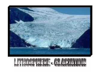
LITHOSPHERE - GLACIATION
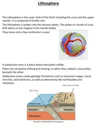
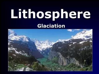
LITHOSPHERE - GLACIATION. Severn Thames line. the Ice Age. The ‘Ice Age’ was a series of advances and retreats of the icecaps. It lasted from 1.7 million years to 10,000 years BP. Most of Britain was glaciated as far south as the Severn-Thames line. the last Ice Age.

LITHOSPHERE - GLACIATION
E N D
Presentation Transcript
Severn Thames line the Ice Age The ‘Ice Age’ was a series of advances and retreats of the icecaps. It lasted from 1.7 million years to 10,000 years BP. Most of Britain was glaciated as far south as the Severn-Thames line. the last Ice Age
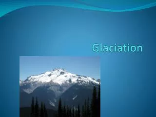
These occur at high altitudes, latitudes nearer the poles and often on the colder, north-facing slopes. Glaciers form in areas of permanent snow called snowfields. formation of a glacier
formation of a glacier • As more snow falls the pressure makes the earlier snowflakes melt. • Repeated melting and re-freezing forms granules called firn or névé. • Further compression forms larger crystals of glacial ice. • It can take 30 to 40 years for snow to form dense glacial ice. • It now moves downslope under its own weight.
glacier flow • Despite being hard and solid, glacier ice flows because of: • internal deformation - individual ice crystals within a glacier deform and slide across one another. • basal sliding - meltwater at the base of the glacier lubricates the ice causing it to slide.
Copy! valley glacier Zone of accumulation This is where the snow collects, turns into ice and forms features like cirques, arêtes and pyramidal peaks. The rocks above the glacier undergo frost shattering. Zone of flow The ice moves under gravity. It erodes through abrasion and plucking. Glacial troughs, hanging valleys, waterfalls and lakes are formed in this zone. Zone of wasting (melting and evaporation)This zone contains the terminal moraine ridge and outwash plain. It occurs at the snout of the glacier.
Copy Extra info on next 3 slides.... Ice erodes by: 1. Freeze Thaw (Frost Shattering) Water in cracks in the rock freezes and expands. After many cycles of freezing and thawing lumps of rock are broken off. 2. Plucking Glacier ice freezes into cracks in rocks and when the glacier moves it pulls out chunks to leave a jagged surface. 3. Abrasion Rocks stuck in the ice grind away the bedrock under the glacier.
Water expands when it freezes Scree - rock fragments broken off by freeze thaw (frost shattering) freeze thaw • Water from melted snow collects in cracks and crevices in rocks above glaciers. • At night temperatures drop below freezing and the water changes into ice. • Water expands when frozen and so exerts pressure on the sides of the crack. • Eventually the rock shatters. • Sharp, angular pieces of rock are formed called scree.
plucking • Glacial ice melts due to friction as it goes over an obstacle like a rock mass. • This water will almost instantly refreeze because of the overlying pressure of the ice. • It re-freezes into the cracks and crevices and as the glacier moves loose pieces of rock are pulled or torn out.
abrasion This erosion process occurs when pieces of rock debris embedded in the ice wear away the rocks on the valley floor and sides.
abrasion The rock is scratched, polished, smoothed and eventually worn away by the scouring action. The pieces of rock also become smaller through this rubbing action.
Striations abrasion Striations are scratches made on the existing surface by rocks that are embedded in the bottom of the glacier as it moves forward.
formation of a corrie Snow collects in nivation hollows, especially on the less sunny north and east facing slopes, turns to glacial ice and moves downwards under the force of gravity Rocks are plucked out and the hollow is widened to become a cirque or corrie. A corrie is a deep, rounded hollow with a steep head or back wall.
formation of a corrie
formation of a corrie a) snow collects in hollows b) snow compacts to ice c) ice moves under gravity, lubricated by meltwater d) ice rotates to lip e) abrasion deepens corrie f) plucking steepens back and sides g) corrie lochan (tarn) may fill hollow.
corrie and tarn Once the glacier retreats, the cirque may be filled with water. A small, generally circular loch is formed. This is known as a tarn or corrie lochan.
Glacial Features – Corries- model answer • Snow gathers in a nivation hollow usually on the north facing side of a mountain. This gets deepened by repeated freeze-thaw action; • Fresh snow is buried and compacted by further snowfall into firn or névé; • After 30 – 50 years deeper layers become glacial ice; • Under the enormous pressure from above, this becomes plastic and will flow under gravity; • As the glacier moves, plucking erodes and steepens the backwall and abrasion deepens the corrie base; • This is helped by meltwater which lubricates the sole of the glacier and scree which gets frozen into the ice and acts as an abrasive; • Rotational sliding helps create the concave base of the corrie and the corrie lip; • A mountain lake (aka corrie lochan, tarn, llyn) may form in the bottom of the corrie.
Aiguille du Midi formation of an arete An arete is a narrow, sharp-edged ridge which forms the side walls of cirques and separates different glacial valleys.
arete Arete = knife-edged ridge
formation of a horn (pyramidal peak) a) three or more corries form around a peak b) where corrie sidewalls meet they form an arête (knife edge). c) arêtes meet to form a horn (pyramidal peak).
horn horn = pyramidal peak
Matterhorn horn When three or more corries erode backwards a sharp pointed pyramid shape is created. This is called a Pyramidal Peak or Horn.
revision a) b) c) d) 1. Write a definition of each of the following terms:- corrie arête horn tarn 2. Which feature goes with which letter on the diagram?
Eleven National Parks have been designated in England and Wales. • National Parks have two purposes:- • to conserve the natural beauty of the countryside • to promote public access to the countryside.
Helvellyn Lake District
Red Tarn Helvellyn Lake District corrie and tarn Red Tarn
Red Tarn Helvellyn Lake District corrie and tarn Red Tarn
Striding Edge Helvellyn Lake District arete Striding Edge When a corrie is formed, its back and side walls are steep. When two corries form next to each other a narrow rock ridge is formed. This is often likened to a knife edge, with near vertical sides and a sharp top edge. This feature is called an arête or knife-edged ridge.
Striding Edge Helvellyn Lake District arete Striding Edge
Swirral Edge Helvellyn Lake District Catstye Cam Helvellyn Lake District Catstye Cam Swirral Edge arete
revision scree cirque tarn arête Identify examples of glacial features on the map.
formation of a 'U' shaped valley a) glacier flows in an earlier 'V' shaped valley, b) glacier abrades the sides and floor of the river valley, c) valley is greatly deepened, widened and straightened, d) when the ice melts the valley is 'U' shaped, e) it has very steep sides and a fairly flat floor, f) any later rivers are called 'misfit streams’ because they are far too small to have cut the valley.
Describe the main features of a glaciated U-shaped valley and its ‘misfit’ river. 'U' shaped valley
'U' shaped valley Glaciers are very powerful agents of erosion: they reshape former V-shaped river valleys into wide, deep, steep-sided troughs by the processes of abrasion and plucking.
'U' shaped valley Former river spurs are truncated: their ends are cut off by the ice action to form steep, sheer cliffs.
Sognefjord Norway fiord When a glaciated valley is submerged or drowned by a rise in sea level a fiord is formed. The sea lochs of western Scotland are the best examples of fiords in the British Isles.