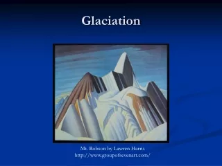
Glaciation
Glaciation. ?. What do we know? What do we want to know? Why should we care? How does it affect us?. Glaciers- The basics. A glacier carries assorted rock debris (boulders, pebbles, or finer materials) on or beneath its solid surface.
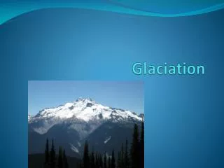

Glaciation
E N D
Presentation Transcript
? • What do we know? • What do we want to know? • Why should we care? • How does it affect us?
Glaciers- The basics • A glacier carries assorted rock debris (boulders, pebbles, or finer materials) on or beneath its solid surface. • As mountain glaciers reach lower, warmer level…they? • Melt and drop their debris which form moraines. • The meltwater spreads development of rich soil
Review of vocabulary • What is a zone of accumulation? • What is an ice sheet? • What is an ice age?
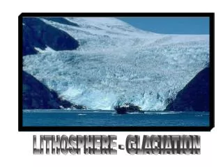
Glaciation of Canada • Glaciers, are the most responsible force for the topography of Canada. • 1) extremely powerful force • 2) in geologic time, glaciation happened recently= not enough time for glacial features to be worn away.
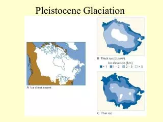
What happened? • 20 000 years ago, Ice sheets spread outward from 3 locations and changed the face of the land. • See overhead! • Pressure of the ice lowered land • Melting ice rebounding of land upward (1 to 2 cm per year)
Erosional features • Creation of troughs
Erosional Features • Creation of U-Shaped valley
Erosional features • Bulldozer effect ice gouged out basis of existing lakes making them deeper and wider. • Ex) Great lakes
Erosional features • As ice sheets moved, they eroded tons of soil, sand, gravel and rock. • Sandpaper effect this material acted like sandpaper, scraping and gouging away at the surface.
Erosional features • This caused Striations: grooves gouged out in bed rock by rocks frozen in the ice. • Which landforms have visible striations? • Canadian Shield!
Depositional features • As glaciers move and melt, they deposit certain materials. • Till: clay, sand, gravel, that is deposited directly from ice sheet. • Both large and small particles • Pointy rocks (have yet to be smoothed out by water)
Depositional Features • Till plain: a gently rolling landscape formed by till deposited under ice • agriculture is ideal because of deep, well-drained soil • Moraines: Ridges of tills • Not ideal for agriculture because of thin-soil, hills and swamps • Ideal for grazing, forestry • Drumlin: An egg-shaped hill with a steep side at the wide end, and the gently slope on the other. • Ideal for agriculture because of deep, well-drained soil
Depositional Features • Erratic: random rocks that are picked up by glaciers • Ex) Eroded rock from Canadian shield deposited in surrounding areas
Meltwater What is it? Why would it play a role in depositing glacial material? Explanation: Rivers flowing within or under melting ice carried sand and gravel along them and laid it down in river bed. Once the ice melted, the material created a steep-sided ridge.
Depositional Features • Esker: long ridge of material deposited by meltwater stream flowing beneath glacier. • Source produced: sand and gravel for construction As the glaciers melted, subglacial river beds left behind natural embankments called eskers.
Water flow • Water, rounds off rock and materials • Action of moving water deposited larger rock particles in 1 layer, and smaller ones in another
The end? • 14 000 years ago, climate grew warmer, glaciers began to melt. • Meltwater flowed into lakes along the margins of the ice • Creation of glacial ponds and massive lakes (now much smaller due to drainage) • Lake plains: areas that were once the botom of the ancient glacial lakes • Ideal for agriculture? Why? • Fertile soil, minerals
Glaciers melted, the sea rolled in and covered large areas of depressed land (not the sad kind ) of St Lawrence River valley • About 6000 years ago, the Ice Age came to an end and we had Canadian landscape, as we know it today!