Download
1 / 38
400 likes | 479 Vues
Explore the origins, hearths, and diffusion of urbanization from ancient civilizations to the Second Urban Revolution and industrialization. Discover the factors influencing city locations and growth patterns worldwide.

E N D
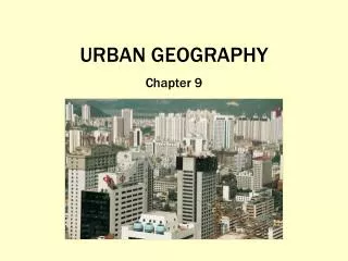
URBAN GEOGRAPHY Chapter 9
When and Why Did People Start Living in Cities? • City: A conglomeration of people and buildings clustered together to serve as a center of politics, culture, and economics • Urban: The buildup of the city and surrounding environs connected to the city (central city and suburbs) • Urbanization: Movement of people from rural to urban areas—can happen very quickly in the modern world
Origins of Urbanization • Agricultural villages • Began about 10,000 years ago • Relatively small, egalitarian villages, where most of the population was involved in agriculture • The first urban revolution: Enabling components • An agricultural surplus • Social stratification (leadership class)
Hearths of Urbanization • Mesopotamia, 3500 BCE • Nile River Valley, 3200 BCE • Indus River Valley, 2200 BCE • Huang He and Wei River Valleys, 1500 BCE • Mesoamerica, 200 BCE
Indus River Valley Harappa and Mohenjo-Daro • Intricately planned • Houses equal in size • No palaces • No monuments
Huang He and Wei River Valleys Purposefully planned cities • Centered on a north-south axis • Inner wall built around center • Temples and palaces for the leadership class Terracotta warriors guarding the tomb of the Chinese Emperor Qin Xi Huang
Mesoamerica Mayan and Aztec cities: Theocratic centers where rulers were deemed to have divine authority and were god-kings
Diffusion of Urbanization • Greek cities (by 500 BCE) • Greeks highly urbanized • Network of more than 500 cities and towns on the mainland and on islands • Acropolis (buildings on a height of land) and an agora (open public space) in each city • Roman cities • A system of cities and small towns, linked together by hundreds of miles of roads and sea routes • Sites of Roman cities typically for trade • Forum a combination of the acropolis and agora into one space • Extreme wealth and extreme poverty
Urban Growth after Greece and Rome • Europe • Middle Ages (500–1300) • Little urban growth, even decline • Asia • Centers along the Silk Road • Urban growth in Korea, Japan • West Africa • The Americas
Cities in the Age of Exploration • Early Eurasian centers • Crescent-shaped zone from England to Japan • Most cities sited in continental interiors • Maritime exploration • Change in situation to favor coastal locations • the location of a place relative to its surroundings and other places. Factors included in an area's situation include the accessibility of the location, the extent of a place's connections with another, and how close an area may be to raw materials if they are not located specifically on the site. • Continued importance under colonialism • Wealth for mercantile cities of Europe • European model for cities in colonies
The Second Urban Revolution • A large-scale movement of people to cities to work in manufacturing, made possible by 1. Second agricultural revolution that improved food production and created a larger surplus - coincided with indust. rev. - food surpluses fed factory workers - New methods and technologies (crop rotation, steel plow) 2.Industrialization, which encouraged growth of cities near industrial resources • Favored places • Had undergone the second agricultural revolution • Possessed industrial resources • Possessed capital from mercantilism and colonialism
Where Are Cities Located, and Why? Site • Absolute location • Static location, often chosen for trade, defense, orreligion • Site factors include things like landforms (i.e. is the area protected by mountains or is there a natural harbor present?) • climate, vegetation types, availability of water, • soil quality, • minerals, and even wildlife. • Historically, these factors led to the development of major cities worldwide. NYC Situation • Relative location • A city’s place in the region and the world around it • Trade area: An adjacent region within which a city’s influence is dominant • situation can also cause problems. • example Canada's Eastern Provinces of New Brunswick, Newfoundland and Labrador, Nova Scotia, and Prince Edward Island are some of that country's most economically downtrodden areas due in large part to their situations. These areas are isolated from the rest of Canada making manufacturing and the little agriculture possible too expensive.
Rank-Size Rule • Characteristic of a model urban hierarchy • The population of the city or town is inversely proportional to its rank in the hierarchy For example: largest city = 12 million 2nd largest = 6 million 3rd largest = 4 million 4th largest = 3 million • Primate city: The leading city of a country, disproportionately larger than the rest of the cities (not always the largest)
Central Place Theory • Developed by Walter Christaller • Predicts how and where central places in the urban hierarchy (hamlets, villages, towns, and cities) are functionally and spatially distributed • Assumes that • Surface is flat with no physical barriers • Soil fertility is the same everywhere • Population and purchasing power are evenly distributed • Region has uniform transportation network • From any given place, a good or service could be sold in all directions out to a certain distance -each central place has a surrounding complementary region, an exclusive trade area
Practical insights from the model - there is a hierarchy of urban places that are spatially balanced • Established larger cities will be spaced further from each other than smaller towns and villages • Studies have confirmed that the distribution of cities, towns, and villages in a region is no accident…. Rather it is tied to trade areas, population size, and distance • Cities are not simply random collections of buildings and people • They have a functional structure: spatially organized to perform their functions – commerce, production, education, and more Central Place Theory continued.
How Are Cities Organized, and How Do They Function? • Urban morphology: The layout of a city, its physical form and structure • Functional zonation: The division of the city into certain regions (zones) for certain functions (purposes) • Zones = areas with uniform land use patterns • Zoning laws designate the types of development that can exist in a particular zone
Zones of the City • Zones • Central business district (CBD) • Central City (the CBD + older housing zones) • Suburb (outlying, functionally uniform zone outside of the central city) • Suburbanization: process by which land that wasn’t part of the city becomes urbanized when people and business from the city move into these spaces • Transformation of rural land to urban • Aesthetic of the suburbs reveals the occupants’ idealized living patterns • Much of “suburbia” is no longer an appendage to the central city – self sufficient hub of economic and cultural activities • Suburbs have become the essence of the modern American city • Urban regions or zones that lie near or adjacent to one another make up a metropolis
Zones of the City • Modeling the North American city • Concentric zone model (Ernest Burgess) • Based on Chicago in 1920s • CBD, zone of transition, zone of indep. workers homes, zone of better homes, commuter zone • Sector model (Homer Hoyt) • 1930s model focused on residential patterns, where the wealthy in a city chose to live • Argued that as city expands so to do the pie shaped sectors extending outward from the CBD • Multiple-nuclei model (Chauncy Harris and Edward Ullman)1940s • Felt nether sector nor concentric ring adequately described cities. CBD losing its dominant position • Most urban geographers feel these models are too simplistic • Automobiles, construction of ring roads has contributed to the explosion of suburbanization • As outer regions grew rapidly many became edge cities with their own workplaces, shopping, leisure activates…. Self sufficient urban environment • Urban realm: describes contemporary special components of the modern metropolis, where each realm is a separate economic, social, and political entity that is linked together to form the larger metropolitan framework. • Urban Models
Classical Models of Urban StructureUrban Models Burgess & Hoyt
Edge Cities Suburban downtowns, often located near key freeway intersections, including • Office complexes • Shopping centers • Hotels • Restaurants • Entertainment facilities • Sports complexes
Urban Realms Model Each realm a separate economic, social, and political entity that is linked together to form a larger metropolitan framework
Cities of the Periphery and Semi-Periphery: Latin America • Griffin-Ford model • Blend of Latin American traditions with globalization • Combines radial sectors and concentric zones • CBD divided between traditional market sector and modern high-rises • Adequate public transp. and nearby affluent residences assure the dominance of the CBD • The “mall” area reflects the emergence of suburban nodes • Disamenity sectors • Not connected to city services • May be controlled by gangs and drug lords • Little law enforcement presence • Industrial park: where industrial activity is found in the city • Gentrification area – historic buildings preserved (gent. is less common in L. Amer. cities but is an emerging phenomena)
Cities of the Periphery and Semi-Periphery: Sub-Saharan Africa • De Blij model • Outside of tropical Africa 57% of population lives in urban areas • Tropical Africa = 40% urban • Has the worlds fastest growing cites • Low levels of urbanization but rapid growth rates • European colonial imprint • Typically have 3 CBDs • Many African cities are ringed by satellite townships that are squatter settlements • b/c of the diverse nature of African cities it is difficult to formulate a model
Cities of the Periphery and Semi-Periphery: Southeast Asia • McGee model • Colonial port and surrounding commercial zone as focal point • Found that the elements of the CBD are typically separate clusters near the old colonial port • One of the main differences between the McGee model and Griffin Ford model is the presence of middle income housing • Reflects a larger middle class in these cities of the semi-periphery when compared to the small middle class in Latin Amer. cities
How Do People Make Cities? • Role of powerful social and cultural forces • Periphery and semi-periphery • Sharp contrast between rich and poor • Often lack zoning laws or enforcement of zoning laws • - if these cities weren’t labeled could you tell which one is from the wealthy country and which is in a poor country? How do you know? • Telephone and elect. wires, building materials, aesthetics, transportation, spacing Luanda, Angola Tokyo, Japan
Making Cities in the Global Periphery • Many of the most populous cities are located in the least prosperous countries • Pull factors play a major role often more imaginary than real • Housing can’t keep up with the massive inflow -shantytowns= unplanned developments of crude dwellings • Many cities in the periphery and semi-periphery have no zoning laws (drawn up to ensure use of space in way that the society deems culturally and environmentally acceptable) • w/o zoning laws cities in the periphery will have mixed land use throughout the city
Making Cities in the Global Core • Not all cities in the core have zoning laws • Few European countries do, they tend to the have looser land-use plans • Segregation had an influence on zoning laws in the US • Realtors, finical lenders, and city governments defined and segregated space in urban enjoinments • Redlining: Financial institutions refusing to lend money in certain neighborhoods • Identify “risky” neighborhoods (Black residential areas) and refuse to offer loans to those in • Now an illegal practice • Led to a downward spiral in the quality of the neighborhoods b/c funds weren’t available for upkeep • Blockbusting : Realtors purposefully selling a home at a low price to an African American and then soliciting white residents to sell their homes at low prices (the neighborhood is going downhill), to generate “white flight” • Led to a significant turnover in housing that benefited real estate agents • Prompted landowners to sell their prosperities at low prices, developers subdivided properties and built tenements lowering the property values further
Making Cities in the Global Core • Gentrification: Individuals buying and rehabilitating houses, raising the housing value in the neighborhood • Commercialization: City government transforming a central city to attract residents and tourists, often in stark contrast to the rest of the central city • Tear-downs: Houses that new owners buy with the intention of tearing them down to build much larger homes • McMansions: Large homes, often built to the outer limits of the lot
Urban Sprawl - Unrestricted growth of housing, commercial developments, and roads over large expanses of land, with little concern for urban planning
New Urbanism • Development, urban revitalization, and suburban reforms that create walkable neighborhoods with a diversity of housing and jobs • Concerns • Privatization of public spaces • Failure to address conditions that create social ills of cities • Countering urban sprawl • New Urbanism
Gated Communities • Neighborhoods with controlled gate (access) for people and vehicles • Private security • Rapid diffusion to Europe, Asia, Africa, Latin America • Security for wealthy in poor countries • Use for low-income communities in core countries
Ethnic Neighborhoods • European cities: Neighborhoods of migrants • Cities of the periphery and semi-periphery
What Role Do Cities Play in Globalization? • Function of world cities beyond state boundaries • World cities as nodes in globalization • Primate cities with concentration of development, interconnectedness • Primate cities in former colonies