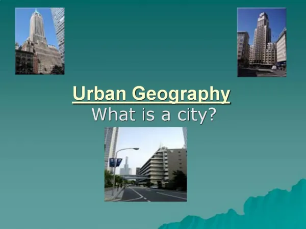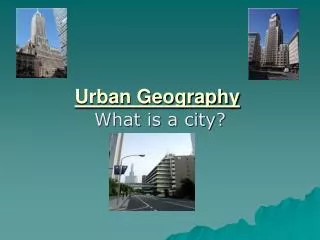
Urban Geography
Urban Geography. Urban Zones. You should be able to:. Describe and account for the location of a particular zone within a town or city Describe and contrast the features of urban zones Identify zones on an Ordnance Survey Map and give evidence to support your choice.

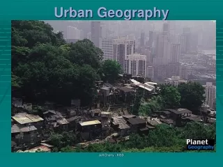
Urban Geography
E N D
Presentation Transcript
Urban Geography Urban Zones
You should be able to: • Describe and account for the location of a particular zone within a town or city • Describe and contrast the features of urban zones • Identify zones on an Ordnance Survey Map and give evidence to support your choice
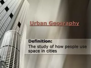
Central Business District Usually a place where there is: • Major transport routes converge, making it very accessible • Department stores, high order services and entertainment venues • Offices, banks, administration services • Main railway and bus stations
High rise buildings Chicago’s CBD Shops, entertainment etc. Offices, banks etc.
CBD cont. • Land is expensive so lots of high-rise buildings to maximise space • Few houses/industry due to high rent • Very large daytime population but often quiet at night • Often the historic centre of the city: old buildings, churches etc. • Often serves many functions e.g. shopping, tourism, administration, education etc.
CBD – OS Map Shopping centre University Tourist information Cathedral Train stations City Hall Densely packed buildings Main A-class roads
Problems of a CBD • Traffic congestion and air pollution • Pedestrian congestion • Crime • Competition from out-of-town development • Conflict between historical and modern
Transition Zone • Older industry close to CBD • Often railways and canals pass through • Large block buildings • Housing is older, densely packed, little open space • Traditionally low-cost housing for workers in industry • Grid iron street patterns
OS Map Old industry Grid iron street pattern railways Closely packed houses River for transport Little open space Large buildings
Suburbs • Better housing as you move away from CBD (reduced pollution etc) • Bungalows, semi and detached housing • More garages, gardens and green areas • Lower density housing • Often middle and low order services • Curvilinear or cul-de-sac street patterns
OS Map Houses have gardens and garages Curvilinear street pattern Green space Away from CBD Lower density housing
Task Time • Read New Higher Textbook p.332 on ‘Edinburgh’s Functions’ • Answer Q. (a) – (h).
Past Paper Model Answer Question: Describe the urban landscape of the Central Business District. (4 marks)
Model answer The Central Business District (CBD) is usually situated at the centre of an urban area, at the meeting point of major transport links, making it the most accessible part of the city (1). Land is usually is high demand and therefore is expensive and buildings are often high-rise (2). There are few residential properties and factories as they cannot afford the rental prices (3). There can often be many older buildings in the CBD as it is often the historic centre of the settlement e.g. churches, cathedrals, town halls etc. (4) for this reason there is often a strong tourism function in the CBD and therefore can be many hotels, restaurants and entertainment zones (5). Due to it’s easy accessibility the CBD usually has many shops and offices also (6).
Land Values and Urban Zones CBD High order shops Main roads Offices/ entertainment Traffic congestion Transition Zone Tall brick factories, chimneys, canals, railways Terraced housing Grid iron street pattern Suburbs Detached and semi-detached Curvilinear street pattern Well spaced Gardens, garages Outskirts New industrial estates One/two storey Near main roads Open space Room for expansion
Add the transect of Urban land use to your notes The diagram shows that land values are highest at the CBD due to it being the most accessible. It contains the functions that can compete for the highest priced land. • Land values decrease as you move away from the CBD although industry can afford to pay higher rents at the edge of the CBD. • Prices rapidly decrease in the twilight zone • Prices rise again as you move away from the inner city due to the better quality of housing in the suburbs • Value decreases again at the edge of the city and is used for new industry, out-of-town shopping centres, private housing etc.
Answer the following questions in your jotter • Why are land values highest in the CBD? • Why does the value of the land decrease rapidly at the edge of the CBD? • Describe the housing associated with the Twilight/transition zone. • In recent years, what has the land at the edge of the city been used for?
Urban Change Towns and cities are constantly changing: • Decentralisation (retail and offices moving out of town) • Deindustrialisation (closing old industry and movement of others out of town) • Gentrification (renovating old inner city property) • Suburbanisation (people moving from inner city to outer suburbs)
Conflicts of Urban Change • Deindustrialisation can create unemployment, poverty and urban decay. • Inner city redevelopment can displace people that do not want to move • Demand for new housing can result in conflict between developers and conservationists
Task • Read New Higher Textbook p.61 on ‘Urban Change’ • Answer Activity 4 Q. (a) – (c)
Changes in the CBD of Glasgow • As shop trade declines in the CBD many are unable to remain in business. Closures have become common place for many years • Many independent department stores have been taken over by a franchise and now rent space to other brands like ‘Principles’ which offsets costs. • Buildings of shopping centres e.g. Buchanan Galleries where shoppers have greater comfort. Also provide essential parking facilities • Pedestrianised zones where traffic is not aloud during the day e.g. Buchanan Street
Reasons for changes • Changes have helped these high streets compete with the out-of-town shopping centres, which threaten high street trade as they are very attractive to shoppers which features such as free parking, entertainment facilities and catering. E.g. Braehead or Glasgow Fort • New road schemes make the CBD more accessible • Redesigned or developed building maximise space and attract more custom • Renovation of old buildings
Inner city redevelopment • Major changes in many cities • Old buildings in poor conditions and tightly packed • Old buildings are demolished or refurbished • Derelict land is reclaimed or re-landscaped • Industry has relocated
Case Study: Urban Redevelopment in Glasgow • Glasgow Eastern Area Renewal scheme (GEAR) • Attempt to improve living conditions in East End Glasgow (poor and run down) • Aims included: creating better housing, reducing unemployment, improving local environment etc. Read and highlight the two handouts on the GEAR Case Study
Redevelopment in Leith, Edinburgh You may be more familiar with redevelopment in Leith: • Traditionally a port, lots of factories and warehouses, and run down tenement housing • Renovation over the last decade • Tourism (Royal Yacht Britannia etc) • Entertainment (cinema, bars, clubs) • New modern housing developments • Can you think of examples? Ocean Terminal, The Shore, Platinum Point, Next Generation
The Greenbelt • Greenbelts have been created around major cities to prevent urban expansion into the rural fringe • Development is limited by strict planning regulations • Main land uses are farming, recreation and open space • However due to lack of space in urban areas there is continually more pressure to build in Greenbelt areas Read and highlight your handouts on Edinburgh’s Greenbelt
Task • Use your notes on Urban Expansion and the Green belt to help you answer the questions from the worksheet on Urban redevelopment.
OS Mapwork • You should be able to identify and describe the key features of urban zones within a city • Also be able to compare and contrast particular zones and say why they are so different • Be able to give map evidence to suggest the likely function of a settlement
Collect an OS Map of Glasgow and answer the following questions: • Glasgow’s original site is in 6065. Why do you think this site was chosen? • Give the grid reference of Glasgow’s CBD. Give map evidence to support your answer. • Look at 5763. What urban zone is this? Give reasons for your answer. • Describe the urban environment in grid square 5470. • Describe the likely functions of Glasgow. Give map evidence to support your answer. (4) (6) (5) (5) (6)
Additional map skills • Look at New Higher textbook p. 65 • Complete Activity 8 (a) – (i) on Glasgow
Traffic in Urban Areas • As the population of urban areas increase so does the amount of traffic, especially to and from the CBD • The result is congestion, air and visual pollution, noise, and accidents • Often congestion is made worse by rush hour traffic on old, narrow, grid-iron street layouts. Common in the older parts of the CBD
Traffic Solutions Task • Make a spider diagram outlines measures that could be taken to ease traffic congestion and pollution in urban areas. Traffic solutions Building ring-roads and by-passes
GMTs • You should be able to describe and analyse land-use maps and transects • Know how to determine the size and shape of a settlements sphere of influence • Annotate field sketches and photographs of urban areas Task: Complete the worksheet by annotating the two Urban photographs. Labels should be detailed and point out significant features