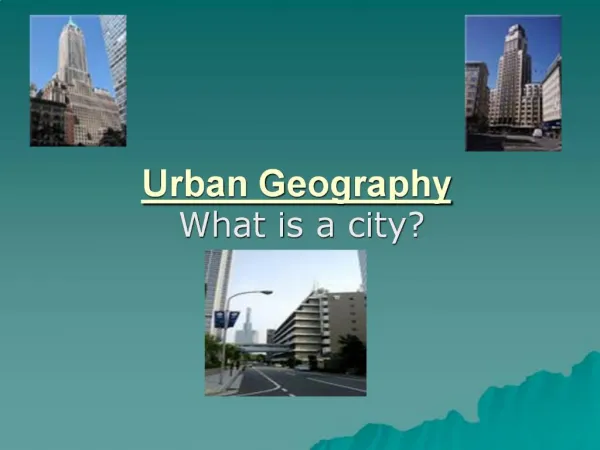
Urban Geography
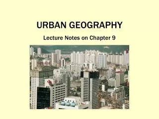
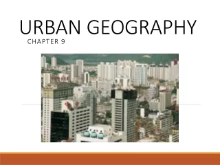
Urban Geography . Shenzhen changed from a fishing village to a major metropolitan area in just 25 years. 25 years ago, all of this land was duck ponds and rice paddies. When and why did people start living in cities?. Urban morphology : the layout of a city, its physical form and structure

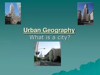
Urban Geography
E N D
Presentation Transcript
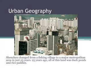
Urban Geography Shenzhen changed from a fishing village to a major metropolitan area in just 25 years. 25 years ago, all of this land was duck ponds and rice paddies.
Urban morphology: the layout of a city, its physical form and structure • Ex: Areas of low development in divided Berlin
Formation of Cities • Agricultural Surplus • Less Farmers needed • Social stratification • Creation of leadership class
First Urban Revolution • An independent invention • Occurred independently in Mesoamerica, Nile Valley, Mesopotamia, Indus Valley, and Huang He River Valley • It is debated as to whether the Nile Valley is actually a hearth
First Urban Revolution • Mesopotamia 3500 BCE • Social Inequality in housing • Priest-king class controlled the harvests through taxes. • City surrounded by a mud wall. • Temples were the most noticeable buildings.
First Urban Revolution • Nile River Valley 3200 BCE • There were no walls around cities in the Nile River Valley. • The people who controlled the irrigation systems had the power. • The whole region was controlled by one power. • It was debated as to whether the Nile River valley was actually a hearth.
First Urban Revolution • Indus River Valley 2200 BCE • The cities seem very well planned. • All of the houses are the same size. • All the houses had access to the same infrastructure.
First Urban Revolution • Huang He River Valley 1500 BCE • Infrastructure for the elite and leadership classes were inside an inner wall. • This inner wall was built around a vertical structure in the center of the city.
First Urban Revolution • Mesoamerica 200 BCE • Cities were centers of religion. • The urban elite built religious buildings. • Rulers were god-kings.
Greek vs. Roman Cities Greek cities • Every Greek city has an acropolis, where the largest building was; it was usually religious • Greek cities had large squares for social centers. • Housing in Greek cities was poor, along with sanitation and health conditions. • Cities were built with slave labor.
Greek vs. Roman Cities Roman cities • Romans has an extensive transportation network. • Adopted the Greeks’ grid pattern for planning cities • Expanded on the Greek idea of the acropolis, and created the Forum. • In both Greek and Roman cities, infrastructure was built with slave labor.
Second Urban Revolution • Only happened after the second agricultural revolution. • Agricultural practices improved • Seed drill • Hybrid Seeds • Improved livestock breeding practices • Industrialization caused an increase in the number of people moving to cities. • These sudden change in population necessitated changes in infrastructure. • The Second Urban Revolution started in Great Britain.
Where are cities located and why? • Site and situation help explain why certain cities were planned and why cities thrive or fail • A trade area or hinterland is an adjacent region within which a city’s influence is dominant (customers from smaller towns and villages come to shop, conduct business) • Three key components arose in the studies in urban geography: population, trade area, and distance • Trade areas and population combine to form a hierarchy of urban places, following a pattern commonly called the rank size rule
The rank-size rule holds that in a model of urban hierarchy the population of a city or town will be inversely proportional to its rank in the hierarchy • For example: - largest city = 12 million -2nd largest = 6 million -3rd largest = 4 million -4th largest = 3 million • Does not apply in all countries, especially ones with supremely dominant cities (primate city) such as Paris (France) and Mexico City (Mexico)
Central Place Theory • 1933 Walter Christaller’sCentral Place Theory is a model to predict how and where central places in the urban hierarchy (hamlets, villages, towns, cities) should be functionally and spatial distributed with respect to one another • Assumed: -surface is flat with no physical barriers -soil fertility is the same everywhere -population and purchasing power are evenly distributed -region has uniform transportation network -from any given place, a good or service could be sold in all directions out to a certain distance
Central place: any point or place in the urban hierarchy, such as a town or city, having a certain economic reach or hinterland • the largest central place provides the greatest number of functions to most of the region • Range: is the maximum distance that people are willing to travel to purchase a product or partake in a service • Threshold: the minimum number of customers needed to keep a business in existence • Hinterland: the market area surrounding an urban center, which the urban center serves
hexagonal regions as the shape of each trade area Hexagonal Hinterlands • Urban Hierarchy: • City: large, densely populated areas • Towns: may consist of 50 to a few thousand people • Villages: larger than hamlets and offer more services. May have grocery store • Hamlets: may include only a few dozen people and offer very limited services, may have a gas station
Central Places Today • When Christaller made his spatial model, the world was much simpler and much less populated, many factors make it less relevant today • In the Sunbelt phenomenon- the movement of millions of Americans from northern and northeastern States to the South and Southwest • existing cities would respond by increasing production of technological goods and services, increasing economic reach • Atlanta, Dallas and Phoenix became increasing more important economically
How are cities organized, and how do they function? • Each model of the city is a study of functional zonation: the division of the city into certain regions or zones (e.g. residential or industrial) for certain purposes or functions (e.g. housing or manufacturing) • zone: area of a city with a relatively uniform land use (e.g. an industrial zone, residential zone) is typically proceeded by a descriptor that conveys purpose
Zones of the City • the central business district (CBD): the downtown heart of a central city, the CBD is marked by high land values, a concentration of business and commerce, and the clustering of the tallest buildings • central city: the urban area that is not suburban, generally the older or original city that is surrounded by newer suburbs • suburb: an outlying, functionally uniform part of an urban area, and is often (but not always) adjacent to the central city • Suburbanization: movement of upper and middle class people from the urban core areas to the surrounding outskirts to escape pollution as well as deteriorating social conditions( perceived and actual) In north America, the process began in the early 19th century and became a mass phenomenon by the second half of the 20th cent
Concentric zone model (Burgess) : a structural model of the American central city that suggest the existence of five concentric land-use rings arranged around a common center • (Zone 1) At the center CBD • (zone 2) zone of transition is characterized by residential deterioration and encroachment by business and light manufacturing • (Zone 3) is a ring of closely spaced but adequate homes occupied by blue collar labor force • (Zone 4) consists of middle class residences • (Zone 5) is the suburban ring, commuters zone
late 1930s Homer Hoyt published his… • sector model: places the CBD in the middle with wedge shaped sectors radiating outwards from the center along transportation corridors • focused on residential patterns explaining where the wealthy in a city chose to live • argued that the city grows outward from the center, so a low rent area could extend all the way from the CBD to the city’s outer edge
the 1940s Chuancy Harris and Edward Ullman proposed multiple-nuclei model: it recognizes that the CBD is losing its dominant position as the single nucleus of the urban area • Cities have numerous centers of business and cultural activity
Edge Cities • Suburban downtowns, often located near key freeway intersections, often with: -office complexes -shopping centers -hotels -restaurants -entertainment facilities -sports complexes Urban realm: a spatial generalization of the large, late 20th century city in the U.S. It is shown to be widely dispersed, multicentered metropolis consisting of increasingly independent zones or realms, each focused on it own suburban downtown; the only exception is the shrunken central realm, which is focused on the CBD
Each realm is a separate economic, social and political entity that is linked together to form a larger metro framework.
Modeling the Cities of the Global Periphery and Semiperiphery • “colonial” cities as urban areas where European transplants dominated the form of the city, laying it out with Western styles • “indigenous” cities remained remote from globalizing influences and various forms of Western society • These cities have been swept into the process of globalization today and have been transformed
Griffin-Ford model: a model of the Latin American city showing a blend of traditional elements of Latin American culture with the forces of globalization that are reshaping the urban scene, combining radial sectors and concentric zones • The CBD is divided into the traditional market and the more modern high rise sector • Emanating outward from the urban core along the city’s most prestigious axis is the commercial spine, surrounded by the elite residential sector • Disamenity sector: the very poorest part of the cities that in extreme cases are not even connected to regular city services and are controlled by gangs and drug lords
Industrial park, reflecting ongoing concentration of economic activity
The African City (de Blij) • The central city often consists of three CBDs: • a remnant of the colonial CBD • an informal and sometimes periodic market zone • a traditional business center with single-story buildings • Manufacturing and mining operations are found near ethnic neighborhoods • Ringed by satellite townships that are squatter settlements
Southeast Asian City • In 1967, urban geographer T.G. McGee developed the McGee model: shows similar land use patterns among the medium sized cities of Southeast Asia • The focal point of the city is its old colonial port zone combined with the largely commercial district that surrounds it • No formal CBD, rather McGee found the elements of the CBD present as separate clusters • Elite residential sector, an inner city zone of middle income housing, and peripheral low-income squatter settlements
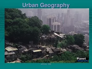
Transportation and Infrastructure • Cities reflect social and cultural preferences. • In poorer cities, there is usually no evidence of a middle class. • Shantytowns: unplanned developments of crude dwellings and shelters made mostly of scrap. • Zoning laws ensure that space is used in culturally and environmentally acceptable ways.
Segregating Space • Redlining: A process where business refused to offer loans to neighborhoods or areas of cities that they considered to be risky. • Blockbusting: A process where realtors would convince white residents to sell houses by telling them that the neighborhood was declining because African-American residents were moving in.
Revival of Cities • Commercialization: Changing the city area to make it more attractive to tourists and residents. • Gentrification: When individuals buy and revamp old houses, raising the value of the neighborhood as well as changing it. • McMansions: Large houses in suburbs that often will up the entire lot.
Urban Sprawl • The unrestricted growth of housing, commercial developments, and roads over large expanses of land. • Cities are growing “out” rather than “up”. • Leads to the destruction of farmland and old industrial sites. Henderson, Nevada
Gated Communities • Fenced-in neighborhoods with controlled access gates. • Came about to create spaces of safety in the urban landscape. • In poorer countries, gated communities provide extra comfort for the wealthy.
What role do cities play in Globalization? • World Cities: function at the global scale, beyond the reach of the state borders, functioning as the service centers of the world economy.
World Cities • Alpha: cities in the first order • Beta: next order of cities, San Francisco, Sydney, Toronto, Brussels, Madrid, Sao Paulo • Gamma: third order, Amsterdam, Boston, Jakarta, Prague
Primate City • A country’s largest – ranking atop the urban hierarchy- most expressive of the national culture and usually (but not always) that capital city • London, UK • Spaces of consumption: areas of a city, the main purpose of which is to encourage people to consume goods and service; driven primarily by global media industry • Times Square, New York City