Download
1 / 33
400 likes | 852 Vues
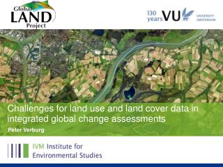
International Symposium on Land Cover Mapping for the African Continent June 25-27, 2013 UNEP HQ & RCMRD, Nairobi, Kenya. FAO Land Cover Mapping methodology, tools and standards & GLC–SHARE database Renato Cumani & John Latham Land and Water Division (NRL ).

E N D
International Symposium on Land Cover Mapping for the African Continent June 25-27, 2013 UNEP HQ & RCMRD, Nairobi, Kenya FAO Land Cover Mapping methodology, tools and standards & GLC–SHARE database RenatoCumani & John Latham Land and Water Division (NRL)
FAO Global Land Cover Network • Standards for Land Cover mapping • FAO Land Cover Mapping Toolbox • African land cover databases • Global Land Cover SHARE database • Conclusions Content
Main activities of the organization • Putting information within reach • Sharing policy expertise • Providing a meeting place for nations • Bringing knowledge to the field
FAO Global Land Cover Network (GLCN) Main Objectives: • To improve linkages between global, regional and national studies on land cover and the environment • To improve standardization, homogenization, compatibility and efficiency of information provided by different applications • To provide information that improves design and efficiency of sampling for validation of land cover products at global, regional and national levels. • To increase use and sharing of remote sensing data and its derived datasets • To provide comparable products at global, regional, and national and lower levels • To undertake capacity development and institution strengthening to maximize benefits for developing countries • To support operational development and use by national stakeholders of products emanating from the programme multi-date landsat imagery
Sudan • Nepal FAO GLCN Core activities • Establish global network • Develop Land cover mapping methodology • Standards development (LCCS/LCML) • Land Cover Mapping Toolbox (LCCS/MadCat/ADG) • Technical assistance to national experts for land cover mapping activities • Preparation of guidelines, manuals, templates, workshops, technical papers, metadata • Capacity building • Awareness raising workshops, training resources and sessions • Dissemination and outreach (FAO GeoNetwork and FAO GLCN website) • Enable use of the land cover information multi-date landsat imagery
LCCS: Comprehensive methodology for description, characterization, classification and comparison of most land cover features identified anywhere in the world, at any scale or level of detail: basis for comparative classification. (6 UN official languages) Created in response to a need for a harmonized and standardized collection and reporting on the status and trends of land cover Standards and Tools Standards and Classification SystemLCCS / LCML / ISO 19144-2:2012
Standards and Tools LCCS databases Global Land Cover (GLC) 2000 1 km resolution The dataset was sponsored by members of the VEGETATION programme, including JRC. Each partner used the Land Cover Classification System (LCCS) produced by FAO and UNEP, which ensured that a standard legend was used across the globe
Standards and Tools LCCS databases GlobCover ~2006 300 m resolution The GlobCover Land Cover product is based on ENVISAT MERIS data at full resolution from January 2005 to June 2006. The GlobCover Land Cover product is labelled according to the UN Land Cover Classification System
Standards and Tools THEMATIC & CART. ASPECT INTERPRETATION EFFICIENCY MULTI USER DATA BASE BROWSER ACCURACY ANALISYS Advanc. Map Land cover class. Syst. DATA BASE Database Acc. GATEW. Prog. DATA PRODUCERS DATA USERS FAO Land Cover Mapping Toolbox
Standards and Tools LCCS 2: 2001 (use LCCS) LCCS 3: 2013 (use LCML/UML) ADG 2: 2003 ADG 3: 2013 ADG 3 for ArcGIS 10.x: 2013
Standards and Tools Mapping Device – Change Analysis Tools (MADCAT) • Application designed by FAO • Uses object-base classification • Current version – Release June 2013 • Wizard driven installation • Implemented using .Net Framework • Coding with LCCS2 and LCCS3 • Requires Windows XP / Vista / 7 /8 (32 and 64 bit) • Free to use for FAO programmes • One time activation needed: • Institution, User Name, Address, PC CODE • send request by email
Africa Land Cover products FAO’s Land Cover Mapping in Africa • Country scale (30m or better resolution) • on going ECONET • Ethiopia • 2012 Fouta Djallon Highlands • Malawi • 2011 Sudan • 2010 South Sudan • Tunisia • Kenya Update • 2007 Somalia • 2006 Kenya LCC • 2005 Senegal • 2004 Libya • 1998- 2002 AFRICOVER
Africa Land Cover products GLCN/AFRICOVER: East Africa Module Development of a regional database and regional aggregation • Project facts: • Mapped area: 8.5 million Km2 • Countries covered: 10 • Landsat Scenes used: more than 400 • Period of activity: 1998-2004 • Result: Multipurpose Africover Database for the Environmental Resources produced at a 1:200,000 scale (1:100,000 for small countries and specific areas) Burundi, DR Congo, Egypt, Eritrea, Kenya, Rwanda, Somalia, Sudan, Tanzania and Uganda.
Africa Land Cover products Fouta Djallon Highlands land cover change • Fouta Djallon AOI: ca. 400,000 Km2 • 5 Countries within the AOI: Guinea, Guinea-Bissau, Mali, Senegal, Sierra Leone LANDSAT coverage (30m res) 1990-2005 ASTER coverage (17 m res) 2008-2011 RapidEyecoverage (5 m res) ~2005
Africa Land Cover products Malawi Land Cover change database (1990’s-2010’s) From other to cropland (square blue) and vice versa (circle orange)
Africa Land Cover products Sudan Land Cover Primary datasets: • Landsat30m (~2000, ~2005-2007 ) • Spot4 imagery • 2009-2010, 2.5-5m, 10-20 m res • IRS 2007, 15-22m res • Aster 2005-2010,15 m res. • Ancillary: • GoogeEarth high resolution imagery • Africover dataset (dated 1999-2000) • ATLAS of Sudan • Digital ATLAS (DVD) • Posters • Skin • Implemented in Sudan • Capacity to undertake land cover assessments
Africa Land Cover products Land Cover Map of South Sudan Primary: • Landsat ETM imagery (GLS), 30m res., false color. • 2000 circa • 2005-2007 • Spot4 imagery • 2006-2008, 10-20 m res., true color. Ancillary • Google Earth high resolution imagery • Africover datasets
Africa Land Cover products Senegal Land Cover Change: 2005 • 55 land cover classes • Landsat 1990’s and 2005’s • Completed in Senegal with involvement of national exerts
Africa Land Cover products Libya Land Cover database • Landsat ETM+ imagery 2001’s and 2002’s • 88 landsat scenes in total
BASIC OBJECTS PROPRERTIES CHARACTERISTICS Herbaceous Cover 30 – 50 % Cultivated Rainfed Field size 1 ha Tree Cover 1 -3 % Natural Eight 5 -8 m. Disposition: irregular Leaf type: Broadleaf Leaf type % 100 Scrub Cover 2 – 4 % Natural Eight 1 – 3 m. Disposition: irregular Leaf type: Broadleaf Leaf type % 100 Africa Land Cover products ECO–NET Africa • Earth Cover Network Africa • Sample tiles at 10 by 10 Km at half degree • Very high resolution imagery (targeted 5m or better) • Detailed land cover mapping using LCML enriched with vegetation index(es) from remote sensing • About 9,000 sampling sites • Coordinated and supervised by FAO GLCN with engagement of national experts
Africa Land Cover products ECONET Outcomes • Create a database with extremely detailed information, global or regional, comparable and continually updated in support of a wide range of activities. • Serve as multi-statistical source of information at any level of detail or complexity. Using specific software on the Web, any end users worldwide will be able to define a geographical area and the categories for which area statistics will be generated. • Provide the most consistent, detailed and dynamic test site for calibration and/or accuracy assessment of any future wall-to-wall global, regional or national Land Cover mapping programmes
GLC-SHARE database GLC-SHARE approach • FAO System of Environmental Economic Accounts (SEEA) London Group process • Global Consultations, interviews, comments, questions, recommendation • A significant step in improving the information accuracy of global land cover database • It integrates the best land cover data available (at sub-national, national, regional and global level) into one single harmonized database • It uses international standards: ISO TC 211 – 19144-2:2013 LMCL • Recommendation 19b.1: That the Land Cover Classification System (LCCS 3) developed by FAO should be adopted as the land cover classification system in the revised SEEA and that the LCML (ISO 19144-2) should be adopted at the methodology for linking to external sources of land cover data described in other land cover systems.
GLC-SHARE database GLC-SHARE design principles • Use existing available land cover databases at national, regional and global level; • Use the best available spatio-temporal land cover databases; • Use the land cover legend prepared by SEEA and FAO based on the Land Cover Meta-Language; • Make use of the harmonization of the land cover elements addressing semantic requirements; • Use data fusion technology; • Progressively update the database getting input from the community of users and include additional datasets as they become available.
GLC-SHARE database GLC-SHARE: fact-sheet • Uses the FAO SEEA LCML(*) legend • 30 arc-second pixel resolution • 11+1 layers indicating the % share of each class • Dominant land cover layer and quality score • Overall class accuracy ~80% • Designed as a platform to facilitate crowd-sourcing • Compatible with FAOSTAT classification • Designed to be used for GAEZ 2010 update Methodology and datasets will be published in 2013
GLC-SHARE database GLC-SHARE SEEA Legend
GLC-SHARE database GLC-SHARE SEEA LCML Legend
GLC-SHARE database Coverage of land cover databases
GLC-SHARE database Processing Chain • Multi-source and multi-resolution data fusion through use of the land cover class elements and the LCML • Class confidence levels used in the processing chain to use the optimal spatio-temporal information at pixel level • Per product and per class rating assigned by technical experts (experts opinion) • Outputs include 11 rasters at 30 arc-second, 1 dominant land cover dataset, 1 quality indicator dataset including source date, resolution, sensor and confidence level per pixel, metadata, and technical paper
GLC-SHARE database GLC-Share Database
GLC-SHARE database Quality Assessment Distribution of the validation points Used ~1,000 points (ArcGIS and Google Earth validation) Overall dominant class accuracy ~80%
GLC-SHARE database GLC-SHARE Summary • GCL-SHARE is the first global database created using the ISO standard for land cover classification ISO TC 211 – 19144-2 LMCL (Land Cover Meta Language) and is designed to be improved over time • GLC-SHARE will be used for GAEZ 2010 update • GLC-SHARE will be used to update Land Use Systems 2010 (FAO) • Planned to be made publicly available for comments and feedback by end of 2013 • Fully documented, including metadata, LCML/LCCS3 legend • Update of the beta release with new available datasets including the global coverage of Landsat 30 meter and new national land cover datasets • Maintained by FAO and community of practice partners such as GEO, CGIAR, JRC, IIASA
Contacts: renato.cumani@fao.org john.latham@fao.org FAO Links: www.fao.org www.fao.org/nr/gaez www.fao.org/geonetwork www.glcn.org Thank you