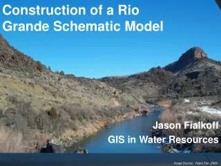
Rio Grande Rectification Reach FLO-2D Model Development
Rio Grande Rectification Reach FLO-2D Model Development. Presentation to: New Mexico – Texas Water Commission and Paso del Norte Watershed Council Project Completed for: U.S. Army Corps of Engineers and International Boundary and Water Commission March 9, 2006. Jim O’Brien

Rio Grande Rectification Reach FLO-2D Model Development
E N D
Presentation Transcript
Rio Grande Rectification Reach FLO-2D Model Development Presentation to: New Mexico – Texas Water Commission and Paso del Norte Watershed Council Project Completed for: U.S. Army Corps of Engineers and International Boundary and Water Commission March 9, 2006 Jim O’Brien FLO-2D Software, Inc.
What are we doing? Basically the same thing as the RGCP reach…
Project Components • Hydrology Review • Sediment Supply Review • Field Data Collection Program • FLO-2D Model Development • Model Calibration and Application
Hydrologic Review • This was a start from scratch effort. • Draft Report has been completed and submitted by Wolf Engineering, LLC., Albuquerque, New Mexico. • The various return period flood hydrographs from the arroyo tributaries have been generated.
Field Data Collection • Channel cross sections (channel only) • Survey control • Levee crest profiles • Local topography details • Photographs • Channel bed material samples
Field Data Collection Channel cross section surveys have been completed by the Wolf Engineering, LLC. and Mussetter Engineering, Inc. Data is being reduced. A levee profile survey on the Mexico side was performed by Professor Eduardo Recio at the University of Juarez. Doug Wolf is obtaining this data.
Field Data Collection At the end of March, a field trip to the Mexico arroyos is being arranged to view the potential sediment delivery from the Mexican side. Mussetter Engineering, Inc. is performing the sediment review.
FLO-2D Model Development Getting Started • Compile mapping, DTM points, aerial images • Flood hydrology will provide inflow flood hydrographs • Select grid element size to discretize the system.
FLO-2D Model Development Getting Started – Add Modeling Details Add channel component: • Channel location • Channel element length and roughness • Cross sections • Thalweg profile
FLO-2D Model Development Getting Started – Add Modeling Details • Add levees • Add infiltration and evaporation • Input hydraulic structures • Berms and roadway embankments • Diversions and drains (return flows)
Calibration Difficulties • No water surface calibration data available for the cross section survey • Calibration will be limited to gage flood hydrograph shape, timing and peak discharge magnitude • Gage data can be assumed to have an accuracy of only ± 20% (some missing data) • Arroyo tributary inflows are ungaged
Modeling Issues • Probable that 100-year flood will not be outside the levees.
Modeling Issues If the levees are overtopped, some of the minor flooding will be conveyed in the drainage canals along the floodway.
Modeling Issues • Floodplain conditions (roughness) change overtime with maintenance.
The End March 9, 2006