Bulgaria
Bulgaria. One of the oldest states on the European continent. Geography position.

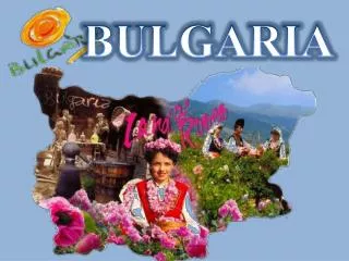
Bulgaria
E N D
Presentation Transcript
Bulgaria One of the oldest states on the European continent.
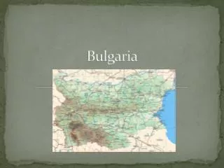
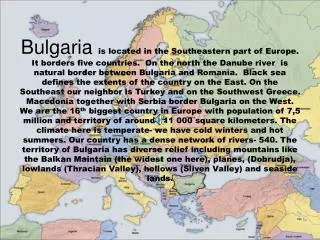
Geography position Bulgaria is situated in the eastern part of the Balkan Peninsula.- The most northern point is the mouth of the river Timok.-The most southern part of Bulgaria is the peak Veikata.-The western peak is Kitka.-The most easterly point is Cape Shabla.
Physiographic zones There are 5 physiographic zones: Danube Valley, Balkan Mountain area, KraishtenskoTundjanska zone, Osogovo-Rodopska Zone and Black Sea area.
Danube Valley-includes a big part of northern Bulgaria. The relief is lowland passing in hilly-plateau. The average altitude is 178 m. The climate is temperate continental, with hot summers and cold winters. • Balkan area-separates North and South Bulgaria. StaraPlanina mountain range has a length of 550 km and a height of 2376 m (peak Botev).
Borders • The total length of border is 2245 km. The northern border of Bulgaria with Romania is divided into two parts - the river and land. The eastern boundary includes the Black Sea from the Cape Kartal to the mouth of river Rezovska. On south Bulgaria borders Greece and Turkey. The border between Bulgaria and Macedonia extends from peak Tumba to peak Golesh.
Relief • The relief of Bulgaria is mainly mountainous, with lowlands in north and southeast, and relatively low altitude. The modern landscape is mainly a result of processes in the lithosphere during younger geologic periods.
Climate • In Bulgaria prevails temperate climate with four seasons. Decisive factors for the formation of the climatic characteristics of the country are its topography and location of the Black Sea. With a strong continental influence seems to be mainly in Northern Bulgaria.
Soils • The territory of Bulgaria is divided into three soil zones. Within the scope of the North forest-steppe zone soil are common zonal soil types - chernozems and gray forest soils.
Water • As water resources among the Balkan countries, Bulgaria ranks last. The waters are divided into two types - surface and underground. Iskar is the longest Bulgarian river, 368 km. In Bulgaria there are over 400 lakes with total area of 95sq.km. Depending on the type, they are divided into: tectonic, karst, landslides, mountain, river and sea.
Natural resources • Bauxite, copper ore, lead and zinc ores, coal, timber, arable land, uranium .. and others. Crossroads geographic location of Bulgaria is determined by five trans-European corridor. They are the most valuable capital of the country in international relations today. • arable land: 43%permanent crops: 2%permanent pastures: 14%forests: 38%other 3% (data from 1999)
Protecting the environment • In the country, several hundred protected areas in different degrees of limited access and business people. Among them are three national parks.
Tertiary sector • Tourism-has grown markedly since the 1960s; about 5 million annual foreign arrivals visit Bulgaria. • Transportation and telecommunications-the European International Highway links Sofia with Istanbul, and the main railway lines connect Sofia with the Black Sea coast.