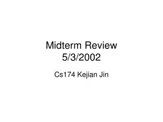
Telesupervised Adaptive Ocean Sensor Fleet Year 3 Midterm Review
530 likes | 703 Vues
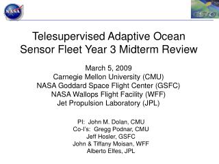
Telesupervised Adaptive Ocean Sensor Fleet Year 3 Midterm Review. March 5, 2009 Carnegie Mellon University (CMU) NASA Goddard Space Flight Center (GSFC) NASA Wallops Flight Facility (WFF) Jet Propulsion Laboratory (JPL). PI: John M. Dolan, CMU Co-I’s: Gregg Podnar, CMU Jeff Hosler, GSFC

Telesupervised Adaptive Ocean Sensor Fleet Year 3 Midterm Review
E N D
Presentation Transcript
Telesupervised Adaptive Ocean Sensor Fleet Year 3 Midterm Review March 5, 2009 Carnegie Mellon University (CMU) NASA Goddard Space Flight Center (GSFC) NASA Wallops Flight Facility (WFF) Jet Propulsion Laboratory (JPL) PI: John M. Dolan, CMU Co-I’s: Gregg Podnar, CMU Jeff Hosler, GSFC John & Tiffany Moisan, WFF Alberto Elfes, JPL
Outline • Project and system overview (slides 2-6) • Response to Year 2 External Review (slide 7) • Technical status (slides 8-34) • Schedule, milestones, and work planned (slides 35-40) • Critical issues (slide 41) • Financial status (slides 42-47) • Educational outreach and presentations (slides 48-51) • Acronyms/glossary (slide 52)
Team Members and Roles • John M. Dolan (CMU), PI • Gregg Podnar (CMU), Co-I and Program Manager • Jeff Hosler (GSFC), Co-I and ASF Software • John Moisan (WFF), Co-I and OASIS Platform Lead • Tiffany Moisan (WFF), Co-I and HAB Science Lead • Alberto Elfes (CMU), Co-I and HAB Data Analysis and Prediction • John Higinbotham (EST), OASIS Platform Software and Operations • Alan Guisewite (CMU), Field Observation System and Infrastructure • Steve Stancliff (CMU), Software Architecture and MSB Platform Development • Christopher Baker (CMU), Software Architecture and Testing • Bryan Low (CMU), Adaptive Sampling Techniques • David Schlesinger (CMU), Data Storage and Visualization • David Asikin (CMU), MSB/RSB Platform Control and Navigation • Vinay Gunasekaran (CMU), MSB/RSB Platform Control and Navigation • Yunchan Paik (CMU), Path Planning and Software Architecture • Rob Waaser (CMU), RSB Platform Development
Telesupervised Adaptive Ocean Sensor Fleet (TAOSF) PI: John Dolan, CMU Objective • Improved in-situ study of Harmful Algal Blooms (HAB), coastal pollutants, oil spills, and hurricane factors • Expanded data-gathering effectiveness and science return of existing NOAA OASIS (Ocean Atmosphere Sensor Integration System) surface vehicles • Establishment of sensor web capability combining ocean-deployed and space sensors • Manageable demands on scientists for tasking, control, and monitoring Telesupervised Adaptive Ocean Sensor Fleet investigating a Harmful Algal Bloom (simulated with water-tracing dye). Approach Key Milestones • Telesupervision of a networked fleet of NOAA surface autonomous vehicles (OASIS) • Adaptive repositioning of sensor assets based on environmental sensor inputs (e.g., concentration gradients) • Integration of complementary established and emergent technologies (System Supervision Architecture (SSA), Inference Grids, Adaptive Sensor Fleet (ASF), Instrument Remote Control (IRC), and OASIS) • Thorough, realistic, step-by-step testing in relevant environments • Interface Definition Document Feb 2007 • Test components on one platform in water May 2007 • Autonomous multi-platform mapping of dye Jul 2007 • Science requirements for Inference Grid Feb 2008 • Multi-platform concentration search simulation May 2008 • HAB search in estuary for high concentration Jul 2008 • Moving-water test plan & identify location Feb 2009 • Simulate test using in-situ and MODIS data May 2009 • Use MODIS data to target and reassign fleet Jul 2009 Co-I’s/Partners • Gregg Podnar / CMU • Jeffrey Hosler, John Moisan, Tiffany Moisan / GSFC • Alberto Elfes / JPL TRLin = 4 TRLEndY1 = 5 TRLEndY2 = 6
TAOSF Program Synergy AIST Value Added Outputs Inputs Tools and Technology Users ESTO Office ESTO Office Telesupervised Adaptive Ocean Sensor Fleet Project OASIS Platforms Planetary Exploration HAB Detection 14 PhD, MS, BS, and HS students Sensor Web Infrastructure Adaptive Sensor Fleet Inference Grids GSFC Multi-Robot Telesupervision Architecture Collaborative Partner
System Components • System Supervision Arch. (SSA) • Adaptive Sensor Fleet (ASF) • Instrument Remote Control (IRC) • Inference Grids (IG) • Marine platforms (OASIS) High-level planning and monitoring High-bandwidth, single-platform telepresence Low-bandwidth, multi-platform telemetry TAOSF System Overview
System Supervision Architecture (CMU/JPL) Adaptive Sensor Fleet (GSFC) SSA Platform Interface (CMU) Underwater Platform (UCSD) Multi-Platform Simulation Environment (GSFC) OASIS ASV System (EST/WFF) Platform Simulator (CMU) River Platforms (CMU) Buoys, Aerostat (CMU/JPL) CMU: Carnegie Mellon University GSFC: Goddard Space Flight Center WFF: Wallops Flight Facility EST: Emergent Space Technologies JPL: Jet Propulsion Laboratory UCSD: University of California at San Diego TAOSF System Overview
Response to Year 2 External Review • Limited OASIS platform availability • Legitimate concern; our solution is to develop additional platforms at CMU • These platforms are not HAB-chasers, but will allow us to demonstrate the multi-platform telesupervision capability which is the project’s principal goal • Loss of aerostat, possible alternative kite system • The aerostat system was valuable in Year 1 and 2 tests; however, in Year 3 we are concentrating on chlorophyll-a mapping in the absence of HAB, and it is not visible from the air except possibly with highly expensive instruments • OASIS power system limitations • Severity of the problem depends on the extent to which: 1) dye/HAB float with the current; 2) OASIS floats with the current vs. a combination of current and wind • Our tests to date, including our July 2008 test, have not shown a strong wind effect, and OASIS was able to use water-coordinates-based navigation to remain with the dye. We will soon test the same with chlorophyll-a. • Dye gap measurement inexact • Main factor is probably target-drift-compensation error; can be improved with real-time current measurement • Knowledge of HAB occurrence predictors • Many data gathered, but no scientific consensus among ocean biologists • OASIS boats’ data will aid analysis of this problem
Technical Status (progress since last review) • Operational platforms (slides 9-13) • 2 OASIS platforms with chl-a sensor packages • Created Miniature Sensor Boat (MSB) and Robot Sensor Boat (RSB) • Software (slides 15-18) • TAOSF architecture design and software extensions • System Tests (slides 20-26) • ASF – SSA data throughput tests • MSB and RSB pool tests • Data analysis (slides 28-34) • Analysis of in-water dye-mapping tests
OASIS Platforms (NOAA Platform Team) OASIS-2 about to launch OASIS-3 platform • Year 1 • Brought OASIS-1 to the level of OASIS-2; third platform (OASIS-3) near completion • Year 2 • Completion of OASIS-3 (a.k.a. ASV3) • OASIS-2 and OASIS-3 operational; upgraded OASIS-1 still in testing • Year 3 to date • OASIS-1 decommissioned
OASIS Platform Status The ASV1 platform hascompleted its lifecycle as an early prototype system and has been decommissioned to maximize use of diminishing funding resources. Functional components are being used to support maintenance or serve as spares for the operational ASV2 and ASV3 platforms.
OASIS Platform Sensors & Telemetry Chlorophyll sensor added to ASV3 since Y2 end-of-year review.
Miniature Sensor Boat • Miniature Sensor Boat (MSB) • Boat model retrofitted for autonomy • Prototype control/sensing system transferable to other platforms MSB side view Control and sensing hardware (Nomad GPS, compass, USB hub, cellular modem comms, air temp sensor, …) Autonomy hardware mounted in MSB
Robot Sensor Boat • Robot Sensor Boat (RSB) • Ported MSB control system to RSB • Plan to build two more for year-end system test Kayak base platform Diver propulsion system (2) Water sonde
Technical Status • Operational platforms • Software • System Tests • Data analysis
Software Progress Overview • Year 1 (Sep 2006 – Aug 2007) • Integration of CMU (SSA – System Supervision Architecture), U.S. Navy OCU (MOCU1), Goddard (ASF - Adaptive Sensor Fleet), and Wallops (OASIS) software into single system for OASIS platform control, monitoring, and data collection • Year 2 (Sep 2007 – Aug 2008) • Improved interface (OCU support for heterogeneous fleet; interactive data access and display) • Improved simulation capability (turning, wind, current) • Initial cooperative and adaptive search algorithms • Year 3 to date • Improved ASF-SSA data throughput • Control and telemetry software for new MSB/RSB platforms • Multiple improvements to existing software 1MOCU ( Multi-Robot Operator Control Unit) is developed by SPAWAR Systems Center San Diego (SSC-SD)
Software Subsystems System Supervision Architecture (CMU) Task Planning Data Storage And Retrieval Adaptive Sampling / Inference Grids Operator Control Interfaces Web-based Data Displays JPL Adaptive Sensor Fleet (GSFC) CMU Remote Sensor Platforms Platform Interface Platform Simulator OASIS ASV System Platform Communicator Multi-Platform Simulation Environment EST, WFF CMU: Carnegie Mellon University GSFC: Goddard Space Flight Center WFF: Wallops Flight Facility EST: Emergent Space Technologies JPL: Jet Propulsion Laboratory
Software Progress • New software components • “Platform" module (based on the simulator module) to run MSB / RSB and other entities (drift buoys, etc.) • Low-level interfaces to sensors and actuators • High-level interfaces to SSA telemetry and command data, waypoint planner, etc. • Simple GUI interface (simple = no maps, etc.) which runs on a ruggedized Linux PDA for controlling platforms in the field Ruggedized PDA & GUI PDA GUI close-up showing engineering telemetry
Software Progress • Improvements to existing software • Improved data throughput in ASF-SSA interface • New control modes added to SSA system to control for MSB / RSB • Modularity in engineering data similar to previous modularity in science data (deal easily with platforms having different engineering data) • Incremental improvements in many modules in order to improve reliability and throughput • Improved software logging capabilities / granularity • Archiving of command files in database (not fully integrated)
Technical Status • Operational platforms • Software • System Tests • Data analysis
System Tests Year 1 • Multiple dry system software tests • Three in-water single-platform tests, the final one (21 Aug 07) with dye-mapping and sensor validation system Year 2 • Multiple system component tests (communications, navigation, drift compensation, telemetry) • Two in-water multi-platform tests, the second (2 July 08) with drift-compensated dye-mapping Year 3 to date • UCSD UUV telemetry dry test with upload to SSA database • ASF – SSA data throughput tests • February 2009 pool tests of MSB and RSB
ASF – SSA Interface Tests • Component purpose: translate commands and telemetry between SSA software components and the OASIS platforms • Goals of recent work • Increase telemetry throughput by porting telemetry output to new sockets-based SSA interfaces • Insufficient throughput causes data to back up on the ASF side of the interface, causing large delays • Previous work had already substantially enhanced throughput, but was still only marginally sufficient (0.8-1.1Hz) relative to expected platform data rates (~1Hz) • Incorporate updated ASF capabilities • Allow capture radius and speed to be specified per commanded waypoint • Report current commanded path and tracking status back to operator - e.g. "Working on waypoint 3 out of 5“ • Results • Telemetry output now possible at roughly 2Hz per platform (leaves acceptable overhead to recover from transient problems) • Current command and tracking status correctly reported from ASF into SSA (allows more effective command verification and monitoring) • Long-term stability • Successfully ran 3 simulated boats for roughly one hour • Negligible steady-state delay, no appreciable accumulating delay • Ready for dry test with real OASIS platforms
System Tests • Miniature Sensor Boat (MSB) dry tests (October 2008 through January 2009) • Determine bandwidth overhead for various transport methods in order to reduce bandwidth usage over cellular modems • Cellular and 802.11 antenna performance tests • Testing of sensor/actuator integration with SSA platform code (GPS, compass, air temperature sensor) • Testing of transmission of engineering and science telemetry over cellular modems to dataserver
System Tests • Miniature Sensor Boat (MSB) in-water tests (Feb 2009) • Test platform stability, performance, and remote control capability Platform balancing 20 Feb pool test http://water.tsar.ri.cmu.edu/~gwp/RSB/MSB_initial_testing.mp4
System Tests • 27 Feb Robot Sensor Boat (RSB) test • Port MSB control methodology to RSB • Test platform stability, performance, and remote control capability http://water.tsar.ri.cmu.edu/~gwp/RSB/RSB_initial_testing.mp4
System Test Issues • WFF was unable to establish an operations contract with EST until early February 2009 • As a result, OASIS testing has been on hold • Awaiting warmer weather for use of manually driven skiff to gather chlorophyll-a data for analysis prior to OASIS chl-a mapping tests • MSB/RSB platforms handle well and are ready for field and autonomy testing in warmer weather
System Test Plans Test 0 (System shakeout – dry test) • March 2009 • Communications and telemetry throughput Test 1 (Chlorophyll-a mapping – April 2009) • 2 OASIS platforms • Raster scanning of Chesapeake Bay area to map chlorophyll-a variations • Not algae, but a real-world biological process Test 2 (Adaptive chlorophyll-a mapping – April/May 2009) • 2 OASIS platforms • Adaptive “front” mapping or concentration gradient search of Chesapeake Bay area • Show chlorophyll-a in recent MODIS image Test 3 (Multi-platform system proving test – June/July 2009) • 2 OASIS platforms, 1 MSB (Miniature Sensor Boat), 3 RSB (Robot Sensor Boats), multiple simulated platforms • All systems under telesupervisory control
Technical Status • Operational platforms • Software • System Tests • Data analysis • JPL activities • 2 Jul 08 test recap • IG and Log-Gaussian process inference
Summary of Activities • Definition of comprehensive data format • A standard format has been defined in joint work with CMU to store data from all sensor sources • JPL is working on the definition of an Engineering Data Record (EDR) for the TAOSF data 2. Development of visualization/science interface (in progress) • Easy visualization of MODIS, EO-1 imagery overlaid on ocean test area 3. Implementation of stand-alone Inference Grid software for easy interface to TAOSF architecture (in progress) • Implementation of Random Field updating models using sensor data • Implementation of multi-property Random Field data structure • Interpolation/extrapolation Random Field methods to provide overall structure of the field from sparse data • Bloom edge finding and bloom motion estimation methods
Example: Multi-Property Inference Grid Dye presence probability Humidity Wind speed Air pressure
2 July 2008 Multi-Platform Dye-Mapping Test • Part A: Map dye patch with multiple platforms during slack tide (high, slow-moving) using multi-platform raster / rectangle scan patterns • Details • Perpendicular current • Two distinct dye stripes are laid down • Boat A progresses along the dye stripes using a raster scan • Boat B performs a box pattern as the dye stripes pass through • Drift buoys serve as end markers for the dye stripes
2 July 2008 Multi-Platform Dye-Mapping Test OASIS 2 raster OASIS 3 box Inter-dye-stripe gap? meters • Combined plot of fluorometer “hits” (above threshold) of OASIS 2 and 3 • An inter-dye-stripe gap is intuitively noticeable, with errors probably due to a combination of drift divergence and fluorometer thresholding Duration: 15 min 40 sec
Multi-Boat Inference Grid Dye presence Inference Grids computed from fluorometer data obtained during the July 2, 2008 Transit 2 test: OASIS 2 OASIS 3 OASIS 2+3
Multi-Boat Inference Grid: Dye presence Inference Grids computed from fluorometer data obtained during the July 2, 2008 Transit 2 test: OASIS 2+3
Data Analysis (2 Jul 08 wet test) • Log-Gaussian estimation of dye stripes Inferred stripe pattern using thresholding OASIS-2 drift-corrected path 3D rendering of fluorometer readings Fl. rdng. Row
Year 3 Schedule Yr. 3 end date: Sept. 4, 2009 Yr. 3 start date: Sept. 5, 2008
Three-Year Schedule Yr. 1 start date: Sept. 5, 2006 Yr. 3 end date: Sept. 4, 2009
Year 2 Milestones (Modified) • Establish requirements for Inference Grids Dec 2007 • Autonomous multi-platform mapping of dye Mar 2008 • Performed 2 July 2008 • Validate target-drift compensation methods Apr 2008 • Performed 12 June 2008 • Inference-Grid mapping and bloom localization May 2008 • Performed July-October 2008 • Multi-platform HAB search in estuary Jul 2008 • No HABs reported during the 2008 season Note: blue milestones are new or modified
Year 3 Milestones (Modified) • Moving-water test plan & identify location Feb 2009 • Performed during Year 2 • Adaptive chlorophyll-a mapping Apr 2009 • Simulate test using in-situ and MODIS data May 2009 • MODIS data are too low-resolution; simulation will be based on chlorophyll-a • Use MODIS data to target and reassign fleet Jul 2009 Note: blue milestones are new or modified
Key Project Milestones • Interface Definition Document Feb 2007 • Autonomous multi-platform mapping of dye Jul 2007 • Performed Jul 2008 • Multi-platform HAB search in estuary Jul 2008 • No HABs have occurred, so we will sense chlorophyll-a instead • Use MODIS data to target and reassign fleet Jul 2009
Work Planned • Refine drift compensation • Include wind adjustments • Acquire drift from speed-in-water sensor, compare to drift buoy • Perform three graduated system tests • Raster chlorophyll-a mapping • Adaptive chlorophyll-a mapping • Multi-platform, multi-location telesupervised science sensing • UCSD UUV wet test, showing incorporation of “foreign” platform into SSA • Data collection and analysis and system telesupervision performing pursuit and observation of a naturally occurring HAB, if possible
Critical Issues • Unavailability of EST partner for first half of Year 3 owing to inability to establish operations contract • Unavailability of OASIS platforms for testing Mitigation • Development of additional (MSB and RSB) platforms at CMU
Project Financial Status Notes: 1. Underspent by $94K (1 Mar 09): $2K CMU, $30K GSFC, $8K WFF, $54K JPL
Project Financial Status Notes: 1. As in Year 1, in Years 2 & 3, GSFC again subtracted overhead up front, but only reports spending on the remainder. The above is based on multiplying reported Year 2 & 3 spending by 1.414 = (original budget/(budget-overhead) from Year 1.
Educational Outreach Bryan Low • Ph.D. student, ECE • Carnegie Mellon University Chris Baker • Ph.D. student, Robotics • Carnegie Mellon University Steve Stancliff • Ph.D. student, Robotics • Carnegie Mellon University Ellie Lin Ratliff • M.S. student, Robotics • Carnegie Mellon University • Graduated May 2008 • Univ. of Pittsburgh Secondary Science Education Master’s Program Sandra Mau • M.S. student, Robotics • Carnegie Mellon University • Graduated May 2007 • Physical Sciences Commercialization Analyst, Univ. of Queensland, Brisbane, Australia
Educational Outreach Vinay Gunasekaran • M.S. student, ECE • Carnegie Mellon University David Asikin • M.S. student, Robotics • Carnegie Mellon University No picture available Cristian Guajardo • M.S. student, ECE • Carnegie Mellon University • Graduated May 2008 • Boeing Corporation, Dallas, TX Yunchan Paik • B.S. student, ECE • Carnegie Mellon University