Download
1 / 12
120 likes | 258 Vues
Hydrological impacts of climate change over the contiguous United States : Project overview. Objectives. Improve depiction of impacts of climate change on water resources Improve downscaling methods (better statistical downscaling, high-resolution dynamical downscaling, simple weather model)

E N D
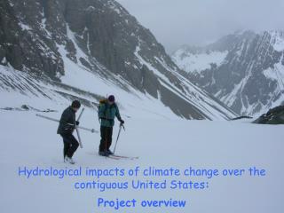
Hydrological impacts of climate change over the contiguous United States: Project overview
Objectives • Improve depiction of impacts of climate change on water resources • Improve downscaling methods (better statistical downscaling, high-resolution dynamical downscaling, simple weather model) • Improve hydrologic scenarios of climate change (shift from single-model to multi-model approaches; implement state-of-the-art hydrologic modeling approaches and parameter estimation methods • Develop a routing tool to transform gridded hydrologic projections into daily time series of streamflow at any point in the river network within any river basin within the contiguous U.S. • Document the relative impact of different sources of uncertainty in hydrologic projections in different hydroclimatic regions throughout the contiguous U.S.
Runoff Aggregation • 100 VIC-modeled runoff time-series from CMIP5 simulations • Monthly runoff at 1/8th degree in mm • CMIP5 BCSD Forcing • USACE Requirement • Runoff & Routed runoff for HUC4 basins in CFS • Forcing data aggregated to HUC4 basins • Surface air temperature • Precipitation
Runoff Aggregation • GIS Methods applied • Derive HUC4 basin-to-grid correspondence • Aggregation (zonal statistics) and unit conversion • Output time-series to custom NC format
Runoff Aggregation Routed runoff for non-headwater basins. Routed runoff time-series for HUC 0809 – Lower Mississippi
Hydrologic modeling: USGS Geospatial Fabric • Infrastructure for Nat’l Hydro Modeling (NHM) • GIS dataset of hydrologic modeling features • Sets of parameter tables • Simplify simulation of streamflow at (almost) any point in US • Pre-process feature delineation & parameterization • Support PRMS, NWBM, SPARROW, WaterSmart Census, ??? • Method for indexing & sharing of results • Use hydrography to organize information resources related to hydrologic modeling
Geospatial Fabric Methodology Aggregate NHDPlus catchments based on Points of Interest (POIs) to make Hydrologic Response Units (HRUs)
Geospatial Fabric feature dataset: Points of Interest (POI) • Aggregate NHDPlus features based on POIs to define segments & HRUs • POIs: • Gages II USGS Reference/non Ref. Gages • SPARROW • National Weather Service River Forecast Centers • Major confluences and waterbody inlets/outlets • Travel time points (< 1 day) • Elevation bands (500m)
NHDPlus Region 1a and 2b
NHDPlus Region 1a and 2b HRUs from aggregated NHDPlus
Routing (collaboration with the USGS) • Using high-resolution NED elevation data & PRMS stream segments • Establishing flow connectivity of runoff through the river network • Building routing table for entire CONUS region
Objectives • Improve depiction of impacts of climate change on water resources • Improve downscaling methods (better statistical downscaling, high-resolution dynamical downscaling, simple weather model) • Improve hydrologic scenarios of climate change (shift from single-model to multi-model approaches; implement state-of-the-art hydrologic modeling approaches and parameter estimation methods • Develop a routing tool to transform gridded hydrologic projections into daily time series of streamflow at any point in the river network within any river basin within the contiguous U.S. • Document the relative impact of different sources of uncertainty in hydrologic projections in different hydroclimatic regions throughout the contiguous U.S.