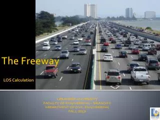
The application of the satellite remote sensing data in the land investigation along the freeway
The application of the satellite remote sensing data in the land investigation along the freeway (LIU Xianbin, LI Xiumei, ZHAO Xinggui) ( Tianjin University of Science and Technology , Tianjin TEDA , CHINA, 300457 ) TEL. 022-60600328, 13352068008 Email: lxb0688@tust.edu.cn.

The application of the satellite remote sensing data in the land investigation along the freeway
E N D
Presentation Transcript
The application of the satellite remote sensing data in the land investigation along the freeway (LIU Xianbin, LI Xiumei, ZHAO Xinggui) ( Tianjin University of Science and Technology, Tianjin TEDA,CHINA, 300457) TEL. 022-60600328, 13352068008 Email: lxb0688@tust.edu.cn
The traditional methods disadvantage : • 2 The advantages of the satellite sensing data in land survey; • Interpreting the land use along the freeway with the satellite data; • 4 Conclusion
The traditional methods disadvantage : • A large number of people; • A lot of material; • Financing • the surveying precision is lower; • Take a long time;
2 The advantages of the satellite sensing data in land survey • Provide the geographical landscape information of the earth’s surface in time; • Reduction macroscopic object; • Rich information; • Show the picture at different time.
Interpreting the land use along the freeway with the satellite data • TM satellite image • No.5 land satellite on April 13, 2005; • 116°59ˊ16.90″E -117°56ˊ59.40″E • 39°12ˊ54.54″N - 39°21ˊ10.77″N • (4) TM2、TM3 and TM4 • (5) ERDAS IMAGINE8.5
The classification has adopted the following : • Initial classification; • Identify the special subject; • Classification and merger; • Coloring; • Classification aftertreatment; • Statistics analysis
The image of the satellite remote sensing shows the land use along the freeway
The image of the satellite remote sensing shows the land use.
Table 1 The distribution of the land utilized along the freeway
4 Conclusion • There is obvious advantage to survey the land use by means of satellite remote sensing technique. • Because of the restriction of the image resolution, it is very hard to interpret the small object and vegetation. • The satellite remote sensing technique should be cooperated with other methods, we can understand the land use completely. • The satellite remote sensing technique would become an important means in land use survey.