Download

1 / 37
790 likes | 1.87k Vues
Week – 2 – March 13, 2013. Fundamentals of Satellite Remote Sensing. NASA ARSET- AQ Introduction to Remote Sensing and Air Quality Applications Winter 2014 Webinar Series. ARSET - AQ A pplied R emote S ensing E ducation and T raining – A ir Q uality A project of NASA Applied Sciences.

E N D
Week – 2 – March 13, 2013 Fundamentals of Satellite Remote Sensing NASA ARSET- AQ Introduction to Remote Sensing and Air Quality Applications Winter 2014 Webinar Series ARSET - AQ AppliedRemoteSensingEducationandTraining –Air Quality A project of NASA Applied Sciences
Outline • Remote Sensing • Active and Passive sensors • Imagers, Sounders, and Radiometers • Satellite Orbits • Spatial, spectral, radiometric and temporal resolution
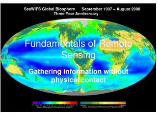
Remote Sensing … Remote sensing instrument measures reflected or emitted radiation
Remote Sensing: examples • Platform depends on application • What information do we want? • How much detail? • What type of detail? • How frequent?
Transmission, Reception, and Processing (E) (A) Energy Source or Illumination Remote Sensing Process Recording of Energy by the Sensor (D) Interpretation and Analysis (F) Radiation and the Atmosphere (B) Application (G) Interaction with the Target (C) Reference: CCRS/CCT
Transmission, Reception, and Processing (E) (A) Energy Source or Illumination Remote Sensing Process Recording of Energy by the Sensor (D) Interpretation and Analysis (F) (B) Radiation and the Atmosphere Application (G) Interaction with the Target (C) Reference: CCRS/CCT
Transmission, Reception, and Processing (E) (A) Energy Source or Illumination Remote Sensing Process Recording of Energy by the Sensor (D) Interpretation and Analysis (F) (B) Radiation and the Atmosphere (C) Interaction with the Target Application (G) Reference: CCRS/CCT
Transmission, Reception, and Processing (E) (A) Energy Source or Illumination Remote Sensing Process (D) Recording of Energy by the Sensor Interpretation and Analysis (F) (B) Radiation and the Atmosphere (C) Interaction with the Target Application (G) Reference: CCRS/CCT
(A) Energy Source or Illumination Remote Sensing Process (D) Recording of Energy by the Sensor Interpretation and Analysis (F) (B) Radiation and the Atmosphere (E) Transmission, Reception, and Processing (C) Interaction with the Target Application (G) Reference: CCRS/CCT
(A) Energy Source or Illumination Remote Sensing Process (D) Recording of Energy by the Sensor (E) Transmission, Reception, and Processing Interpretation and Analysis (F) (B) Radiation and the Atmosphere (F) Interpretation and Analysis (C) Interaction with the Target Reference: CCRS/CCT
Energy Source or Illumination (A) Remote Sensing Process Recording of Energy by the Sensor (D) Transmission, Reception, and Processing (E) Interpretation and Analysis (F) Radiation and the Atmosphere (B) (G) Application Interaction with the Target (C) Reference: CCRS/CCT
Satellite/Sensor Classifications Some of the ways satellites/sensor can be classified • Orbits • Polar vs Geostationary • Energy source • Passive vs Active … • Solar spectrum • Visible, UV, IR, Microwave … • Measurement Technique • Scanning, non-scanning, imager, sounders … • Resolution (spatial, temporal, spectral, radiometric) • Low vs high (any of the kind) • Applications • Weather, Ocean colors, Land mapping, Atmospheric Physics, Atmospheric Chemistry, Air quality, radiation budget, water cycle, coastal management …
Remote Sensing …Sensors Passive Sensors: Remote sensing systems which measure energy that is naturally available are called passive sensors. Examples: ASTER, LANDSAT, AVHRR, TOMS, MODIS, MISR, OMI, CERES Active Sensors: The sensor emits radiation which is directed toward the target to be investigated. The radiation reflected from that target is detected and measured by the sensor. Examples: LIDAR (CALIPSO, LITE), RADAR (SAR, PR, CPR), SONAR
Pause for Questions • Important Note: Passive instruments measure reflected/emitted radiance at the top-of-atmosphere. All other information is derived from this and some ancillary data.
Imagers & Sounders Imagers create images – MODIS, MISR Active and passive sounders can provide vertical profiles – Cloud Profiling Radar (CLOUDSAT) SAR (Synthetic Aperture RADAR) Atmospheric Infrared Sounder (AIRS)
Common types of orbits Geostationary Polar Polar orbiting orbit fixed circular orbit above the earth, ~600-1000km in sun synchronous orbit with orbital pass at about same local solar time each day Geostationary orbit An orbit that has the same Earth’s rotational period Appears ‘fixed’ above earth Satellite on equator at ~36,000km
Ascending vs Descending Polar Orbits
MODIS-Aqua (“ascending” orbit) Approximately1:30 PM local overpass timeAfternoon Satellite MODIS-Terra (“descending”) Approximately10:30 AM local overpass time Morning Satellite
Remote Sensing – Resolutions • Spatial resolution • The smallest spatial measurement. • Temporal resolution • Frequency of measurement. • Spectral resolution • The number of independent channels. • Radiometric resolution • The sensitivity of the detectors.
Pixel pixels - the smallest units of an image. Image pixels are normally square (but not necessary) and represent a certain area on an image/Earth.
Instantaneous Field of View (IFOV) The IFOV is the angular cone of visibility of the sensor (A) and determines the area on the Earth's surface which is "seen" from a given altitude at one particular moment in time (B). The size of the area viewed is determined by multiplying the IFOV by the distance from the ground to the sensor (C). This area on the ground is called the resolution cell and determines a sensor's maximum spatial resolution
increasing pixel size Scan direction bow-tie effect Flight direction Spatial Resolution Off-nadirpixel size IFOV FOV • Spatial Resolution : The highest magnification of the sensor at the ground surface • Satellite images are organized in rows and column called raster imagery and each pixel has a certain spatial resolution. Satellite height Nadirpixel size
Spectral Resolution • Spectral resolution describes the ability of a sensor to define fine wavelength intervals. The finer the spectral resolution, the narrower the wavelength range for a particular channel or band. • multi-spectral sensors - MODIS • hyper spectral sensors - OMI, AIRS
755 760 765 770 775 Wavelength (nm) In order to capture information contained in a narrow spectral region – hyper spectral instruments such as OMI, or AIRS are required
Radiometric Resolution • Imagery data are represented by positive digital numbers which vary from 0 to (one less than) a selected power of 2. • The maximum number of brightness levels available depends on the number of bits used in representing the energy recorded. • 12 bit sensor (MODIS, MISR) – 212 or 4096 levels • 10 bit sensor (AVHRR) – 210 or 1024 levels • 8 bit sensor (Landsat TM) – 28 or 256 levels (0-255) • 6 bit sensor (Landsat MSS) – 26 or 64 levels (0-63)
Radiometric Resolution 4 - levels 2 - levels 16 - levels 8 - levels In classifying a scene, different classes are more precisely identified if radiometric precision is high.
Temporal Resolution • How frequently a satellite can provide observation of same area on the earth • It mostly depends on swath width of the satellite – larger the swath – higher the temporal resolution • MODIS – 1-2 days – 16 day repeat cycle • OMI – 1-2 days • MISR – 6-8 days • Geostationary – 15 min to 1 hour (but limited to one specific area of the globe)
Remote Sensing – Trade offs Aster Image 15 M Resolution MODIS 500 Meter True color image
Remote Sensing – Trade offs 60 KM 2300 KM MODIS 500 Meter True color image • The different resolutions are the limiting factor for the utilization of the remote sensing data for different applications. Trade off is because of technical constraints. • Larger swath is associated with low spatial resolution and vice versa • Therefore, often satellites designs are applications oriented
Trade Offs • It is very difficult to obtain extremely high spectral, spatial, temporal and radiometric resolutions at the same time • MODIS, OMI and several other sensors can obtain global coverage every one – two days because of their wide swath width • Higher resolution polar orbiting satellites may take 8 – 16 days for global coverage or may never provide full coverage of the globe. • Geostationary satellites obtain much more frequent observations but at lower resolution due to the much greater orbital distance.
Instrument Capabilities – for Air Quality Radiometers Imagers • MODIS – Terra and Aqua • 250m-1 KM Resolution • MISR • 275m- 1.1 KM Resolution • Polder • 6 KM Resolution • OMI – • 13 x 24 KM Resolution • GOME-2 • 40 x 80 KM Resolution • SCIAMACHY • 30 x 60 KM Resolution
Three Satellites for air quality data • MODIS (Terra and Aqua) • 36 spectral channels • columnar aerosol loading – can be used to get particulate matter mass concentration • MISR (Terra) • 4 spectral bands and 9 angular bands • Columnar aerosol loading in different particle size bins • in some cases aerosol heights • OMI (Aura) • Absorbing aerosols • Trace gases
Geophysical Products Images Cloud Fraction Aerosol Optical Depth – Particulate Matter Total Column Trace Gas Amount Trace Gas Layer Concentrations Land Cover Type Vegetation Index
Factors which change with each instrument • Calibration accuracy • Quality Assurance • Data formats • Product Resolutions • Level of data products • Current release of the data and data history
Assignment Assignment #2 Due Wednesday January 15th