Exploring Oceans: From Ancient Mariners to Modern Discoveries
Discover the diverse components of oceanography - geological, physical, chemical, and biological. Travel through history from the Ancients to the Age of Discovery and beyond, exploring key figures and expeditions that shaped our understanding of the oceans. Delve into 20th-century advancements and the role of technology in ocean exploration, from bathymetric readings to submersibles. Witness James Cameron's historic dive into the Mariana Trench.

Exploring Oceans: From Ancient Mariners to Modern Discoveries
E N D
Presentation Transcript
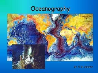
Oceanography Definition: The Science or Study of the Oceans • Geological Oceanography • Physical Oceanography • Chemical Oceanography • Biological Oceanography
Geological Oceanography • Formation processes of the seafloor • Sediments (Any particulate matter that can be transported by fluid flow and which eventually is deposited as a layer of solid particles on the bed or bottom of a body of water or other liquid) • Rocks and minerals • Geothermal vents “hot spring on ocean floor”
Physical Oceanography • How and why oceans move • Weather • Heat transfer • Water cycles • Waves, tides, currents • Temperature
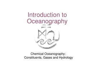
Chemical Oceanography • Composition of seawater • Seawater processes • Salinity • Dissolved gases • Nutrients
Biological Oceanography • Living organisms • Organisms relationships with each other and their environment
Contributions of the “Ancients” • Phoenicians (from what is now Lebanon) navigated and traded around Mediterranean Sea, Indian Ocean, Red Sea, and Africa; 2000BC • Greeks-create Maps of Mediter. Sea-450BC, Eratosthenes(Mathematician) predicted the circumference of the earth: 42,250 KM real distance is 40,067 KM and developed the system of longitude and latitude. 3. Romans-studied and noted the phenomenon of erosion and researched and documented the water cycle
Middle Ages 500 AD ~ 1400 AD • Fall of the Roman Empire -Europe lost most of its detailed understanding of geography • During this time, Arabic nations continued to explore and expand trade routes…. • The Vikings were ship-borne warriors/pirates and traders of northern Europe who went on expeditions to explore the Americas, Iceland, Greenland
Age of Discovery • Columbus attempts to reach East Indies by sailing west because Eastern routes were blocked. He crossed the Atlantic and “found” the Americas… 2. Balboa settles the first European Colony in Panama. He crossed the Isthmus of Panama to the Pacific Ocean in 1513. He became the first European to lead an expedition known to have seen or reached the Pacific from the New World.
Age of Discovery • Magellan was credited with being the first around the world… though while on voyage, he was killed in the Philippines in 1521. However, the 18 members left of his Crew finished the voyage in 1522. The “sea” becomes a new place for empires to interact. It was the Era of trade with, and plunder of, the Aztecs and Incas in S. Americafor their gold and silver by the Spanish.
MORE discoveries…. 1. Captain James Cook- 1700’s A British navigator who discovered the Hawaiian Islands. Is considered the best cartographer and reckless navigator of his time. Applied use of latitude and longitude. 2. Ben Franklincharted maps of the gulf stream in 1777. 3. Charles Darwin-1800’s sailed to the Galapagos Islands to study the Biology of the Sea and in the process developed his Theory of Natural Selection.
4. Edward Forbes -1800’s predicted different types of plant and animal life at different depths of the ocean. Introduced the idea of dredging. 5. Challenger Expedition- England’s Royal Society obtained the use of HMS Challenger to study sea floor characteristics, chemical composition of sea water and life at all levels!
20th Century Oceanography 1. German expedition- 1920’s ship named Meteor was used to map depths in the Pacific Ocean. 2. US National Ocean Survey- Bathymetric readings to determine how deep each ocean is. Early techniques used pre-measured heavy rope or cable lowered over a ship's side. Today data is generated from an echosounder (sonar) mounted beneath or over the side of a boat, "pinging" a beam of sound downward at the seafloor . 3. National Oceanic and Atmospheric Administration (NOAA) establishes wise use of ocean resources, minerals, oil, fish, etc, and do coastal restorations and weather forecasts.
5. Submersibles-ALVINCreated by Woods Hole Oceanographic Institution and can carry up to 3 passengers to great depths (14,764 ft.), explore the ocean, the organisms there and record data. 6. Jacques Cousteau- SCUBA; Declared the importance of the oceans, he was a champion of the life that existed there and saw pollution—and exploitation by man--as the destroyer of the marine environment.
James Cameron’s Dive into Mariana Trench • James Cameron, director of Titanic and Avatar, made a Record Breaking Dive to the deepest part of the ocean, the Mariana Trench, in March 2012.