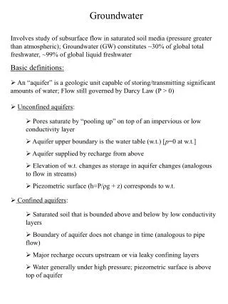
Download
1 / 23
240 likes | 472 Vues
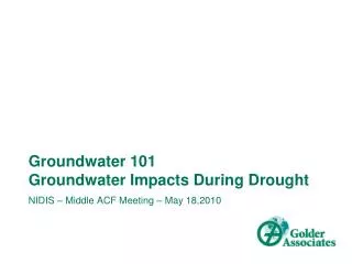
NIDIS – Middle ACF Meeting – May 18,2010 . Groundwater 101 Groundwater Impacts During Drought. Topics. Introduction – Questions about groundwater? Recharge , Surface Water, Groundwater Interactions Major Georgia Aquifers and Recharge Areas

E N D
NIDIS – Middle ACF Meeting – May 18,2010 Groundwater 101Groundwater Impacts During Drought
Topics • Introduction – Questions about groundwater? • Recharge, Surface Water, Groundwater Interactions • Major Georgia Aquifers and Recharge Areas • Surface/groundwater interactions in varying geologic conditions • Groundwater level response to drought – recent examples
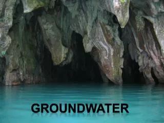
Conceptual Model of Groundwater Flow and Stream-Aquifer Interaction
Conceptual Model of Groundwater Flow and Stream-Aquifer Interaction Source: USGS Circular 1139
Piedmont Aquifer– Fracture Flow Dominated Source: USGS OFR96-483
Middle ACF – Cretaceous Aquifer Source: USGS OFR96-492
Lower ACF – Typical Floridan Source: USGS OFR95-321
Georgia Groundwater Recharge Areas Source: Georgia Geologic Survey
ACF Groundwater Recharge Areas Source: Georgia Geologic Survey
Statewide Groundwater Monitoring Network, GA 2008 • USGS Network • About 180 continuously monitored wells (29 in real time) • About 20 synoptic wells measured bimonthly • EPD is cooperator on 137 wells • Other cooperators include: • City of Brunswick and Glynn County; Albany WG&L; City of Lawrenceville; Lee County; Flint River Planning and Policy Center; and, McIntosh County
Groundwater Monitoring Network Source: USGS Groundwater Watch
Summary Statistics & Maps for Prior Yrs. Source: USGS SIR 2009-5070
Surficial Aquifer Source: USGS SIR 2009-5070
UFA: Southwestern Area Source: USGS SIR 2009-5070
UFA: Southwestern Area (Albany) Source: USGS SIR 2009-5070
Claiborne/Gordon Aquifer Source: USGS SIR 2009-5070
Clayton Aquifer Source: USGS SIR 2009-5070
Cretaceous Aquifer System Source: USGS SIR 2009-5070
Crystalline-rock Aquifers Source: USGS SIR 2009-5070
Conclusions • Almost all aquifers affected by drought during recent event • Various factors contribute to drought response time in aquifer • Aquifer type • Proximity to recharge areas • Type of recharge and flowpath - “flashiness” of aquifer • Compounding usage/issues (ag, municipal, over-usage, etc.) • Water conservation/reuse • Recent drought showed rate of decline increased as drought progressed
Thank You - Questions? For More Information Contact: Joe Volpe Golder Associates Inc. Atlanta, GA jvolpe@golder.com www.golder.com