Download

1 / 26
260 likes | 376 Vues
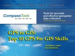
GPS to GIS: Top 10 GPS for GIS Skills. ANDREW CAREY ELI CRAWLEY. Objectives. Check List for Project Planning GPS for the Office GIS for the Field. Food for Thought. Real Examples. THE WHAT – GIS ?.

E N D
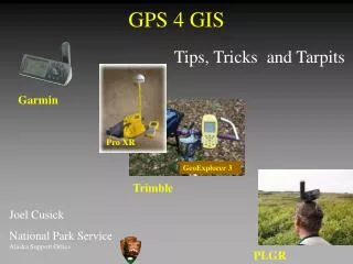
GPS to GIS:Top 10 GPS for GIS Skills ANDREW CAREY ELI CRAWLEY
Objectives • Check List for Project Planning • GPS for the Office • GIS for the Field Food for Thought Real Examples
THE WHAT – GIS ? A Geographic Information System or GIS is a computer system that allows you to map, model, query, and analyze large quantities of data within a single database according to their location. • Create maps • Integrate information • Visualize scenarios • Present powerful ideas, and • Develop effective solutions!!! http://www.epa.gov/reg3esd1/data/gis.htm
THE WHAT - GPS? GPS – Global Positioning System (US Dept of Defence) GNSS – Global Navigation Satellite System – generic term for all satellite navigation systems GLONASS – GLObalNAvigationSatellite System (Russian System)
THE WHY COMMUNICATION ! Field - Office Personnel
TOP TEN GIS GPS
2. Projections • Datum • Map Projection • World File
2. Projections Assigning a .prj to your Trimble export will allow other programs to read and know the coordinate system and datum the data is in. To attach a prj…
2. Projections Under the coordinate system tab ---Bottom next to Projection File click Browse, to ESRI “Coordinate Systems” 64 – Bit C:\Programs Files x86 \ArcGIS\Desktop\CoordinateSystem 32 – Bit C:\ProgramsFiles\ArcGIS\Desktop10.0\CoordinateSystem
3. Data Prep • Time Spent Prior to Data collection, Time Reduction in the Field • Drop Downs and Domains, Quick Data Acquisitions • How do people identify objects, Common vs Scientific
4. Data Collection • Ensuring High Quality Data Collection
5. Data Processing Differential Correction Process Data Proximity to Base Station Correcting with Multiple Base Stations
1. Data Sources Continued • Arizona: http://sco.azland.gov/imagery.htm • Utah : http://gis.utah.gov/data/ • South Dakota: http://www.sdgs.usd.edu/digitaldata/index.html • New Mexico: http://rgis.unm.edu/browsedata • National Map (Nation Wide) : http://nationalmap.gov/ • GIS Inventory: http://gisinventory.net/ • Colorado: http://ucblibraries.colorado.edu/map/links/gis.htm#co • Nation Wide Roads : http://www.census.gov/cgi-bin/geo/shapefiles2013/main
2. ArcMap Essentials Zoom Pan Full Extent Identify Add Data
3. Toolbox • Clip, Buffer, Export, Joins • Spatial Data Tools • Spatial Statistics
4. Best Management Practices • Data Control-Merging • GUIDs (Every Point and Geometry) • Personal / File GDB vsShapefiles • DATA BACK UP !!!
5.Final Product – Cartography Center for Spatially Integrated Social Sciences
5.Cartography – Continued • North Arrow • Scale Bar • Data Frame