Services Overview
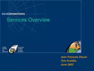
Services Overview. Jean François Doyon Tom Kralidis June 2003. Services Overview. Web Services OGC Web Services OGC Web Services Within CGDI CGDI Development Network. Services Overview. Web Services OGC Web Services OGC Web Services Within CGDI CGDI Development Network. Introduction.

Services Overview
E N D
Presentation Transcript
Services Overview Jean François Doyon Tom Kralidis June 2003
Services Overview • Web Services • OGC Web Services • OGC Web Services Within CGDI • CGDI Development Network
Services Overview • Web Services • OGC Web Services • OGC Web Services Within CGDI • CGDI Development Network
Introduction • GeoConnections • Federally coordinated program to facilitate the geospatial information highway in Canada • Canadian Geospatial Data Infrastructure (CGDI) • Network of distributed data and services • See http://geodiscover.cgdi.ca/
Web Services • What’s a Web Service?? • Service: performs functions based on request, provided by an entity through an interface • Interface: a set of operations which characterize a service • Web Service: any software which makes itself available over the Internet and uses a standard XML messaging system • Process: request / response / process • Use of the Internet as the distributed computing platform (DCP) • Enabling “Plug and Play” Interoperability ** Web Services Enable Infrastructure **
Web Services • Independent of • operating systems • programming languages • Organizations • How? • non-proprietary data / messaging standards • eXtensible Markup Language (XML)
Web Services- Benefits • Lower software integration costs • Maintaining legacy systems • Using standards lowers IT costs of collaboration with external partners, vendors, clients
Web Services • Web Service Protocol Stack • Transport • HTTP, SMTP, FTP • XML Messaging • Common XML (XML-RPC, SOAP) • Service Description • Web Services Description Language (WSDL) • Describes public interface • Service Discovery • Universal Description, Discovery, and Integration (UDDI) • Centralized registry • Provides publish / find mechanisms
Service Access Point Clients Service Provider Client Using Service via Interface Services, Interfaces, Clients
European GII U.S.NSDI GlobalSDI OtherSDI AustralianSDI CGDI Web Services Information Holdings System Web Service
Applications e.g., Transportation Planning, Climate Change Monitoring, Site Assessment Users Services e.g., Metadata Service, gazetteer service, Web Map Service Other Applications Data e.g., topographic, thematic, imagery, toponymy, metadata Service Architecture Approach For Example… A trip planning web site that calculates the best route between two cities uses Gazetteer service, Road network server, Web mapping service based on Geographical Names, Road network features Base maps
eXtensible Markup Language (XML) • Markup language describing structured information • Meta Language • Self Describing Semantics • Information Exchange / Messaging • Human Readable • Portable, non-proprietary • Interoperable
eXtensible Markup Language (XML) • Allows for application-neutral communication • Separates content from look and feel • Enables scaleable development for wide variety of applications • Many XML processing / development tools
Web Services • Mainstream Web Services Environments for Geospatial • Microsoft MapPoint.net • programmable XML Web Service for location intelligence into your applications, business processes, and Web sites • http://www.microsoft.com/mappoint/net/ • ESRI Geography Network • http://www.geographynetwork.com/webservices/index.html • OpenGIS Consortium (OGC) • http://www.opengis.org/
Services Overview • Web Services • OGC Web Services • OGC Web Services Within CGDI • CGDI Development Network
OpenGIS Consortium (OGC) • Collaborative environment • industry, government, academia • Public, open specifications for geospatial interoperability • “Geo-Enable" the Web
OGC Specifications (relative) * Supported by MapServer ** To be supported by MapServer • Visualization * • OpenGIS Web Map Service (WMS) • Data Access * • OpenGIS Web Feature Service (WFS) • Data Encoding * • OpenGIS Geography Markup Language (GML) • Viewer Client Bookmarks * • OpenGIS Web Map Context Documents • Data Presentation ** • OpenGIS Styled Layer Descriptor (SLD) • Data Query ** • OpenGIS Filter Encoding • All formally endorsed by CGDI
Web Map Service (WMS) • Provides images of map data defined by a geographic / spatial component • Provides point based query functionality • Interoperable means of map compositing
Web Map Service (WMS) • Interoperable, ‘just-in-time’ approach to map delivery • Map compositing from multi-servers
Web Mapping: Phase I • GeoGratis – http://geogratis.gc.ca/ • Toporama: http://toporama.cits.rncan.gc.ca/
Interoperability • Common Standards • Services Web Mapping: Phase I • Interoperability • Common Standards • Services
MapServer MapServer MapServer MapServer Web Browser Web Map Servers Viewer Client internet Web Mapping with WMS
Web Feature Service (WFS) • Feature level access to spatial data • Finer grained access and query • Spatial and non-spatial query capability • Attribute and / or geometry • Returns GML • Can further transform with XSLT to SVG, style with SLD, etc. • Transactional capability • INSERT, UPDATE, DELETE, LOCK, … • Security considerations
Geography Markup Language (GML) • XML encoding of geospatial information • XML dialect • Basic application framework for handling geospatial information • Enables complex features & feature associations between data • Human-readable • Can be processed by many XML tools in various development environments
Instance Document Data Instance Information Community Definition Application Schema GML Schemas Geometry Definitions Geography Markup Language (GML) As static data or through Service Instance
Geography Markup Language (GML) • New features (GML3) • Topology • Temporal • Enhanced Geometry • Coverages • Units of Measure
OpenGIS Web Map Context Documents - Need • Growth of various WMS instances • Growth of applications supporting WMS • Need for saving state of a web mapping application for reuse, to enable user-friendly web mapping applications • Any client should be able to generate a given view of data through WMS
OpenGIS Web Map Context Documents - Overview • ‘bookmarkable’ XML encoding of state of a web mapping application • Analogous to ‘project’ files in most popular GIS software packages • Enables sharing of application scenarios, demonstrative presentations, etc. • DM Solutions, GeoConnections part of OGC specification working group
Web Mapping – Same data; multiple applications (OpenGIS Web Map Context Documents)
Styled Layer Descriptors (SLD) • Symbolization to map data • Styling • Addresses lack of symbolization within current and past OGC services • Cartographic design of GeoData • Augments OpenGIS specifications • Can custom style WMS content • Can custom style WFS content
Filter Encoding • XML Definition of data query language for online services • GML used for geometry querying semantics • Used as filter grammar for OpenGIS WFS • Stand alone specification • Can be applied to any service as a query interface
Services Overview • Web Services • OGC Web Services • OGC Web Services Within CGDI • CGDI Development Network
CGDI Services Growth • Many services available within CGDI • WMS • WFS • WCS • GML • Catalog • Gazetteer • Tools
CGDI WMS Content Providers • 28 WMS instances within CGDI within last 20 months • From multiple agencies / application domains, varying content, vendor implementations • Topographic Data (CTIS NTDB 50K, 250K scales, CDED) • Atlas of Canada (1M, 7.5M scales) • Geology (Geological Survey of Canada) • Forestry (National Forest Information System [NFIS]) • Agriculture (Agriculture and Agri-Food Canada) • EO Data (Landsat 7 Ortho Imagery, Radarsat-1 [CCRS]) • (TRIM Orthos [BC Provincial Government]) • Marine • Multilingual Service metadata requirement • Currently in collaboration within CGDI, to be forward for recommendation into forthcoming OGC services
Services Overview • Web Services • OGC Web Services • OGC Web Services Within CGDI • CGDI Development Network
CGDI Development Network • Collaborating geo-technology discussion / testing environment • Initial focus to implement distributed set of Open GIS Consortium web services developed to support user communities of practice
CGDI Development Network • Website: • http://cgdi-dev.geoconnections.org/ • Mailing List: • http://cgdi-dev.geoconnections.org/mailinglist/ • Open to all • Collaborative environment • Test your components / tools • Free to join
Services Overview Thanks! http://www.geoconnections.org/ http://cgdi-dev.geoconnections.org/ http://www.opengis.org/ http://www.ogcnetwork.org/ Jean-François Doyon (jdoyon@nrcan.gc.a) Tom Kralidis (tom.kralidis@ccrs.nrcan.gc.ca) * OpenGIS is a registered trademark and OpenLS and OGCNetwork are trademarks of the Open GIS Consortium, Inc. in the U.S. and other countries