Download
1 / 33
330 likes | 348 Vues
Explore riparian windthrow impact on stream channels and develop control strategies. Ground surveys and visible effects revealed key findings, predictors, and management suggestions.

E N D
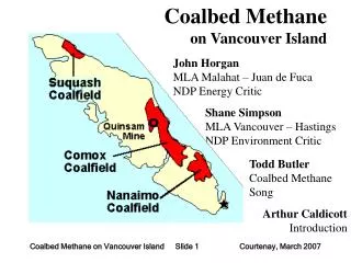
Riparian Windthrow Northern Vancouver Island Terry Rollerson Kerry McGourlick
Study objectives • Document the extent/character of riparian windthrow on Northern Vancouver Island • Evaluate the factors associated with riparian windthrow • Document the effects on stream channels • Develop windthrow control strategies • Develop a monitoring/database system
Methodology • Ground surveys of 76 km of pre and post FPC riparian edges, S1 to S6 streams • 447 variable length plots defined by homogeneous stand, soil, terrain, stream reach & boundary characteristics • Visual estimates of windthrow percentage, penetration, spatial pattern, orientation and effects on streams
Visible stream effects • ~95% of the stream reaches surveyed had no visible streambank disturbance. • ~4% had 5% streambank disturbance • ~1% of the stream reaches had 10-20% streambank disturbance • ~64% of the stream reaches were spanned by windthrown trees and ~36% were not.
Wind Exposure Index WEI = (BE 1 rank) + (BE 2 rank) BE=boundary exposure
Best Predictors • Dominant species • Wind exposure • Rooting depth • Boundary-slope geometry • Stand characteristics (age/height/density) • Leave type (1 vs 2-sided) • Strip width • Edge treatment
Summary • Average riparian windthrow ~ 21% • Average penetration distance ~ 13 m • Windthrow and penetration is greatest on windward boundaries ~ 16 m • Deeper rooting and taller trees are associated with more windthrow
Summary continued ... • 2-sided riparian strips have more windthrow than 1-sided (external) strips (15% vs 27%) • Feathering reduces windthrow (11% vs 19%) • Wide strips are more windfirm than narrow strips • Young stands are more vulnerable • e.g., 1908 windthrow • second growth
Summary continued ... • Cedar dominated stands are more windfirm • Boundaries setback from the edges of gullies have less windthrow • Windthrown trees span streams, but rarely cause significant bank disturbance
Some options for high risk areas • Log to streambank on one side: • stable gullies • small streams • Substitute more retention on low hazard S4’s for less retention on high hazard S3’s • Fall, leave logs spanning stream for LWD • Remove doms and co-doms (fall some across), but retain and top intermediates
Options for high risk areas cont’d • Fall tall trees growing on streambanks • Log to base of escarpments with floodplains • Log lee edges in young stands. Allow the stand time to adapt to increased wind forces before logging windward edges, or ….. • log a narrow strip along windward edges so that there is some wind protection from upwind stand edges for a period of time
Observations on retention • Pre-harvest windthrow assessment is critical • Manage with local data for local conditions • treat conventional wisdom with caution • Manage for risk not hazard • Carry out post-mortems: blocks and basins • Monitor and document windthrow patterns • Adapt
Observations on retention • The factors controlling windthrow with retention silviculture will be similar to those found with conventional clearcutting • Manage the edges of large patches as you would external block boundaries • Manage dispersed retention using block strata and individual tree characteristics • Make use of previously exposed areas/edges
Observations on retention • Large patches may survive better than small • Narrow strips and ribbons are vulnerable • Multi-storied stands/edges that can be easily feathered will be more windfirm • Young uniform stands - may be vulnerable • Minimize windward edges • Setback from windward edges along the tops of escarpments and unstable gullies