Download
1 / 12
120 likes | 300 Vues
A Comparison of Two Soils in Hillsborough County, Florida. Observations relating to ability and possible longevity of an OSTDS (onsite treatment and disposal system). Todd L. Bogner. Initial Comparisons. 25 miles apart. Initial Comparisons. Soil 2. Soil 1. Soil One Landscape. Valrico

E N D
A Comparison of Two Soils in Hillsborough County, Florida Observations relating to ability and possible longevity of an OSTDS (onsite treatment and disposal system) Todd L. Bogner
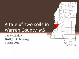
Initial Comparisons 25 miles apart
Initial Comparisons Soil 2 Soil 1
Soil One Landscape • Valrico • Candler fine sand, 0-5% slope • Upland (ridge) • Marine deposit • SHWT >200cm • High infiltration • Low water capacity • Well drained
Soil One Topography • Yellow star • Soil One • Yellow Circle • Candler 7 • Red Circles • Elevations • Red Lines • Topo lines • Black Arrow • Direction of slope
Soil One • A 0-18cm, gradual boundary, sand, structureless, single grain, loose, 10YR 3/1 • E1 18-37cm, diffuse boundary, sand, structureless, single grain, loose, 10YR 4/2 • E2 37-71cm, diffuse boundary, sand, structureless, single grain, loose, 10YR 5/3 • E3 71-136cm, clear boundary, sand, structureless, single grain, loose, 10YR 6/3 • E4 136+cm, sand, structureless, single grain, loose, 10YR 7/6 A E1 E2 E4 E2 E3
Soil One A • Upland soil • Few trees, mostly grasslands • Marine parent material • Nearly Level • Medium surface runoff • Low erosion potential • Ochric epipedon • No subsurface horizon • Order: Entisol 18cm 37cm E1 71cm E2 E3 136cm 200cm+ E4
Soil Two Landscape • Tampa (Northdale) • Myakka fine sand • Depression (surrounded by wetlands) • Marine deposits • SHWT<30cm • Moderate infiltration • Low water capacity • Poorly drained
Soil Two Topography • Yellow star • Soil One • Yellow Circle • Myakka fine sand • Red Circles • Elevations • Red Lines • Topo lines • Black Arrow • Direction of slope
Soil Two Fill Ap Ap 0-14cm, gradual boundary, loamy sand, weak, single grain, very friable, 10YR 2/2 A 14-31cm, clear boundary, loamy sand, weak, single grain, very friable, 10YR 3/1 E 31-60cm, diffuse boundary, sand, structureless, single grain, loose, 10YR 5/1 Bh1 60-65cm, gradual boundary, silty loam, moderate, angular blocky, firm, 10YR 3/2 Bh2 65-73cm, gradual boundary, sandy loam, moderate, angular blocky, firm, 10 YR 4/4 B 73-100cm, gradual boundary, loam, weak, single grain, very friable, 10YR 5/4 C 100cm+, sand, structureless, single grain, loose, 10YR 6/3 A E Bh1 Bh2 B C
Soil Two Ap 14cm • Depression • Many hardwoods and ornamentals • Marine parent material • Nearly level • Very slow surface runoff • Very low erosion potential • Mollic/Histic epipedon • A histic epipedon consisting of mineral soil material can also be part of a mollic or umbric epipedon (Soil Taxonomy) • Albic Horizon overlaying the Spodic Horizon • Spodic subsurface horizon • Order: Spodosol A 31cm SHWT E 60cm 65cm Bh1 73cm Bh2 B 100cm 125cm+ C
Comparisons and Observations • Soil one – OSTDS can be placed directly in the ground • Soil two – OSTDS must be 24” above the SHWT (top of the E horizon) • Soil one – Almost no limitation for basements or roads • Soil two – severely limited for basements, moderately limited for roads due to a greater possibility for ponding/flooding of water.