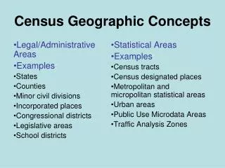
Geographic Concepts
Geographic Concepts. Unit One Ms. Taylor’s Human Geography. Geographic terms. Scale. The relationship between a portion of the earth you are looking at and the Earth as a whole.


Geographic Concepts
E N D
Presentation Transcript
Geographic Concepts Unit One Ms. Taylor’s Human Geography
Scale • The relationship between a portion of the earth you are looking at and the Earth as a whole. • The smaller the scale, the larger the area covered (eg. Globe = small scale representation of the earth. Map of CSS campus = larger scale)
Place • A specific point on Earth identified by a unique location (described by its place name, site, situation, or mathematical location)
Situation (relative location) • “We’re the house situated next to the one with all the funky statues, near the entrance to Cheyenne Canyon.” (Helps find an unfamiliar place) • Chipotle’s situation so close to Cheyenne Mountain HS and CSS guarantees a brisk lunchtime visit. (Helps illustrate importance)
Mathematical Location • Latitude • Longitude • Township and range coordinates (Land Ordinance of 1785)
What is the location of CSS? • Using toponyms • Situationally speaking • Describe the site • Mathematical location http://www.findlatitudeandlongitude.com/find-address-from-latitude-and-longitude.php
Region • Area distinguished by distinctive physical and/or cultural characteristics. • Examples: The American South; the Rocky Mountain West; Southern California; the Northwest; the Midwest; Africa; the Middle East
Formal Region • Also called uniform or homogenous region • An area in which everyone shares one or more distinctive characteristic. (e.g. states, countries) • Or in which one characteristic dominates all others (Red: Republican vs. Blue (Democrat) states, wheat belt or “breadbasket”
Functional Region • Also “nodal” regions • Organized around a “node” or focal point—center of service, circulation, or “hub” • Eg. Newspaper circulation
Vernacular Region • Also called “perceptual region” • A place people believe exists as part of their cultural identity • Name often evokes clear pictures or stereotypes: “Dixie” or “the South,” “The North Country” • Not formal geographic region
Space • Physical gap or between two objects • How much space is there between you and your neighbor? • How are the buildings on the CSS campus distributed across space? • Population across a given space gives you density
Map Scale • The relationship between a distance on a map, chart, or photograph, and the corresponding distance on the Earth. • How do we know how far distances are from A to B on any given map? • Why does a map of Colorado take up the same amount of paper as a map of Rhode Island?
Map Scale: Written • “One inch equals a mile” • “One centimeter equals 1000 kilometers”
Connections • “relationships among people and things across space” • Examples: language ties, commercial connections, travel, common religions, the Internet
Global Positioning System (GPS) • Uses satellites to reference location on the ground place in orbit by U.S. military • Navigation tool (planes, motorists, geocachers) • Tracking device (parents of errant adolescents) • www.OpenStreetMap.org
Geographic Information System (GIS) • Computer can store, manipulate, layer geographic information • “Mashups” layers of various data sets • Highly pragmatic, flexible • Real Estate Applications: Zillow http://www.zillow.com/homes/80906_rb/#/homes/Southwest-Colorado-Springs-Colorado-Springs-CO-80906/93584_rid/38.872116,-104.612716,38.681548,-105.085128_rect/10_zm/ • What kind of a mash-up would you like to create and for what purpose?
Remote Sensing • Using satellites that transmit digital data to s receiving station on earth in pixels (based on radiation emitted from tiny area on Earth). • For true geeks, check out this NASA tutorial! ( • http://rst.gsfc.nasa.gov/
Hi. I’m Mundo. Did you know that how we “see” the world depends on how we project the world?
Sometimes our point of view creates some interesting distortions….
Africa U S A. South America
The Earth is a sphere. Therefore, it cannot be projected on a flat map without distortion. The question is, which kind of distortion?
Map Projections--Distortions inevitable: have to decide what aspects are most important to preserve: distance, shape, direction, area, and proximity--Match the projection with task at hand
Gerardus Mercator (1512-1594)Frontispiece to Mercator's Atlas siveCosmographicae, 1585-1595. Courtesy of the Library of Congress, Rare Book Division, Lessing J. Rosenwald Collection.
On a Mercator projection, invented by Gerardus Mercator in 1569, any straight line is a line of constant compass bearing. This enables a navigator to plot a straight-line course.