Download
1 / 21
230 likes | 267 Vues
Learn about NLR's advanced traffic monitoring methods using SAR technology, current requirements, road pricing, checking and enforcement procedures, and the application of airborne platforms for efficient traffic management.

E N D
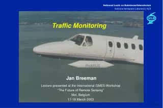
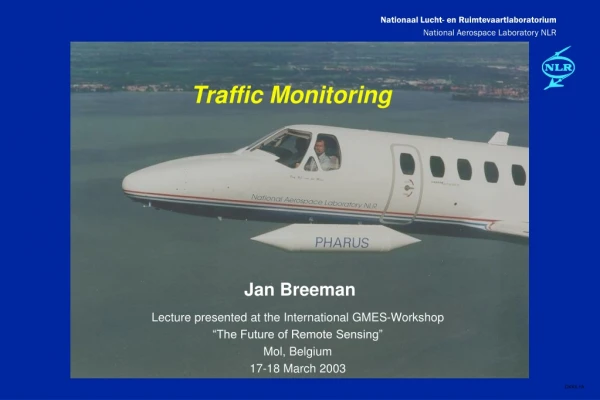
Traffic Monitoring Jan Breeman Lecture presented at the International GMES-Workshop “The Future of Remote Sensing” Mol, Belgium 17-18 March 2003
Contents • Introduction to NLR • Traffic monitoring • Traffic monitoring in the Netherlands • Current requirements • Application of Synthetic Aperture Radar • Road pricing • Description • Checking and enforcement • Application of airborne platform • Conclusions
Introduction to NLR • Central institute for aerospace in the Netherlands • Involved in many international research projects • Staff of ~900 (of which ~700 scientists and engineers) • Technical assets • large windtunnels • research simulators • research aircraft • supercomputers • test facilities • calibration facilities
Information and Communication Technology Division activities • information systems for physics simulation, dynamics of multi-body systems, control engineering • command, control, communication and intelligence systems • information (sub)systems for air traffic management • knowledge engineering and computer-based training • computer networking and co-operative environments • end-to-end data processing systems • software for spacecraft development and operations
Why Traffic Monitoring? • Less traffic accidents (2001, all roads) • 993 deaths • 11,029 injured • Less time lost in traffic (2002) • number of traffic jams: 32.897 • length of traffic jams: 104,000 km • Less environmental pollution • Better travel information promises 40% improvement in total trip time based on choice of route, modality, time of departure
evolution Goals • Collision warning • Incident detection and object control • Information gathering for policy decisions • Traffic information for drivers • Route planning and multimodal traffic advisory • Dynamic traffic management
Current organisation • Roadside equipment and sensors along all main roads (~ 1100 km) • Regional traffic centres • Central traffic information centre • Information providers (private enterprise)
Current requirements Note: requirements are strongly dependent on specific application! • Speed 1% accuracy • Vehicle flow 1% accuracy • Sample rate once per minute, every 500m • Vehicle type 3 length categories • Information per lane • Timeliness maximum three minutes • Availability ~ 99.9% all-weather operation!
Traffic monitoring using Synthetic Aperture Radar Example: PHARUS SAR • co-operation between FEL-TNO, NLR, TUD • 5.3 GHz coherent pulse radar • 48 dual polarised patches • 3m x 3m resolution • full polarimetric Reference: van Rossum, van Halsema, Otten, Visser, Pouwels, “The PHARUS familiarisation program”, 4th international airborne remote sensing conference, Ottawa, 1999.
Zoetermeer A12 west • Moving Target processing: • doppler processing based on nominal traffic speed to focus moving vehicles • deviation from known track yields velocity component lateral to flight vector • transformation to road axes gives vehicle speed • Accuracy speed ~ 1% • Accuracy vehicle detection seemed reasonable, but was not verified
Evaluation • Accuracy vehicle speed is sufficient • Accuracy vehicle detection is promising motorcycles? • All-weather operation is possible • Per lane information is a problem incidents! • Timeliness is a problem depending on flight pattern (only lateral velocity component) • Availability could be a problem
Research into driving behaviour from a helicopter • TU Delft Civil Engineering sponsored by Adviesdienst Verkeer en Vervoer • 95% detection and tracking rate • UAV is considered for follow-up
evolution Road pricing • Toll plazas • Electronic toll collection • fixed lane • multi-lane • Kilometre charging • charge per kilometre driven • tariff differentiation based on time and place • issues: privacy and fraud
Checking and enforcement • Checking • set-up communication with vehicle On-Board Unit via secure DSRC link • check correct operation based on: • OBU status history • comparison of reported position with known position • check of speed • in case of discrepancy notify back-office • Enforcement • register license plate of offending vehicle
Issues • Checking at fixed locations can be avoided by driver • by using alternate routes • by sending faked information during check • Checking at varying locations can be detected and the location can be broadcast via Internet or GSM/GPRS • Checking from moving vehicles in traffic is inefficient Needed the element of surprise Solution a low-flying airborne platform ! (manned/unmanned) Reference: Prof. Wiebren de Jonge (Vrije Universiteit Amsterdam)
Example: FlyCAM • Small unmanned helicopter with gimballed camera • Co-operation between RDM-NLR-TUD • Specifications: • Endurance ~3-4 hours • Gyro Stabilised Sphere • Length: 1.80 m • Height: 0.75 m • Engine: 60 cc • Rotor diameter: 2.14 m • Weight: 9.0 kg • Payload+fuel: 10 kg
Problem areas • Power needed for DSRC transmitter • infrared communication needs less power • Short range of DSRC radio communication (~30 m) • range of infrared communication is larger (~300 m) • Short range is also required for license plate readout • lighting could be a problem • Environmental concerns noise! • Collision risk at low altitude • Protection of privacy real and perceived!
Conclusions • Traffic Monitoring • High/medium altitude UAV/SAR for traffic monitoring is technically feasible • It does not add significantly to existing infrastructure on main roads, but could be a viable solution for secondary roads • Road Pricing • Low altitude UAV with DSRC and camera could be a good solution for checking and enforcement for Road Pricing • Several problems remain to be solved