Download
1 / 18
180 likes | 355 Vues
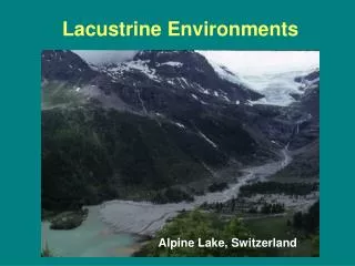
Lake Drukšiai/Drisviaty basin. Institute of Ecology of Vilnius University. Trans boundary lake. L argest lake in L ithuania. Total area 4900 ha. 4200 ha belongs to Lithuania, 700 ha to Belarus. Lake Drūkšiai is protective area according EU Habitat directive Appendix I.

E N D
Lake Drukšiai/Drisviaty basin Institute of Ecology of Vilnius University
Transboundary lake. Largest lake in Lithuania. Total area 4900 ha. 4200 ha belongs to Lithuania, 700 ha to Belarus
Lake Drūkšiai is protective area according EU Habitat directiveAppendix I Code 3140 - lakes with chara algae communities Dominant species in underwater flora - Chara rudis, Chara filiformis, Chara aspera, Nitellopsis obtusa State of habitat – under threat
Lake Drūkšiai is protective area according EU Habitat directiveAppendix II • Numerous population of Otters (Lutra lutra) In Lake Drūkšiai • Numerous population of Spined loach (Cobitis taenia) In Lake Drūkšiai Population size up to 20 000 mature individuals.
Lake Drūkšiai is protective area according EU Birds directive • Numerous population of great bittern(Botaurus stellaris) In Lake Drūkšiai Population size – 10 pairs • Numerous population of great white heron (Egreta alba) and common tern (Sterna hirundo) In Lake Drūkšiai Main populiation of common tern is in Belorus part of lake Population size of great white heron – 4 pairs, common tern – 20 pairs
Other species from the EU Habitat and Bird directives Insects – 3 species: Leucorrhinia pectoralis,Leucorrhinia albifrons,Lycaena dispar Fish – Coregonus atbula Amphibia - 2 species:Triturus cristatus and Bombina bombina Birds – 15 species: Gavia arctica, Haliaetus albicilla, Circus aeruginosus,Circus pygargus, Grus grus,Porzana porzana, Porzana parva, Crex crex,Haematopus ostralegus, Larus minutus, Chlidonias niger ,Alcedo atthis, Luscinia svecica
Habitat management plan tomaintainmost important habitats inLake Drūkšiai • Two main goals: • Maintain habitats suitable for great bittern Botaurus stellaris • Secure population of otter (Lutra lutra) protecting important habitats and individuals. • Additional goal: maintain and secure habitats of all species included in EC Habitat and Bird directives
Strong points of Lake Drūkšiai habitat management plan • First comprehensive complex study of plants and animals. • First comprehensive evaluation of state of protective habitats • Suggested measures to maintain or improve existing situation • Specified important habitat teritories
Weak points of Lake Drūkšiai habitat management plan • Short term study (except fish), long term changes are not evaluated • Study was done only in Lithuanian part of Lake • Study done only in lake territory, no comprehensivedata about Lake Drūkšiai basin
Necessary studies • Repeated comprehensive assessment of plants and animals in Lake Drūkšiai to evaluate long term changes • Comprehensive study plants and animals of Lake Drūkšiai Basin • Comprehensive transboundary GIS system of Lake Drusiai basin with particular emphasis on biodiversity and nature protection areas as well as environmental conflicts/risks zones.
Main potencial areas of interest • From the botanical point of view the most valuable are area valleys of the Drukša and Smalva rivers, Smalvos bog complex with several protected plant species and natural habitats of EU importance as well as LakeApvardai with the vital population of Aldrovanda versiculosa.
Main potencial areas of interest • From the ornithological point of view, basing on existing scare data from previous years or related with inventory of few species only, the most valuable are: Smalvos transitional bogs, euthrophic lakes of the Smalva River valley, islands of Lake Drūkšiai and its shore zone, wet meadows of the Drūkša River and shore zone of Lake Apvardai includingparticular natural fens in the close surroundings.
Implementation of EU Water framework directive, monitoring of • Existing comprehensive fish and other hydrobionts population data. • Monitoring of all fish species every year in different seasons • Two main areas of investigation – “cold water” zone and “warm water” zone • Main shifts in population parameters, growths, species composition and community structure since start of Ignalina Nuclear Power plant
Joint methodology and monitoring • For the fauna complex, first step should be preparation of the joint methodology for biodiversity surveys (including surveys in selected standard plots) and detail monitoring program of the most important populations of the protected species.
Inventory of fauna • Detail inventory of different fauna groups should be organized on Lake Drūkšiai and its on shore areas, valleys of the rivers Drūkša and Smalvaincluding surrounding wetlands, Smalvos bog complex and Lake Apvardaiwith surrounding natural fens. Field surveys should cover crustaceans,moluscs, fish, waterbirds and birds of the bog complexes, and semi-watermammals.
Comprehensive transboundary GIS system of Lake Drūkšiai basin • Preliminary specifications of the GIS system: • A uniform and seamless map base - pan-sharpened satellite imagery mosaic (Landsat ETM,14 m pixel resolution, reference year 2000); • A uniform and seamless Digital Terrain Model - SRTM version 2 DTM (data type - integer, pixel resolution - 90 m); • Delineation of the boundary of the Lake Druksiai catchment area on the basis of SRTM Digital Terrain Model and the available ancillary data; • Standard European coordinate reference system (ETRS89-LAEA); • Base map and thematic vector layers - scale 1:50,000, compliant to OGC standards;
Comprehensive transboundary GIS system of Lake Drusiai basin • Seamless trans-boundary generic land cover and land cover changes databases of Lake Drūkšiai basin - compliant with CORINE Land Cover standards, covering at least the last two decades; • Implementation of INSPIRE database model for corresponding thematicdata types; • Implementation of Web Map Services (WMS) and Web Feature Services (WFS) for on-line delivery of the GIS database. • Modeling of the relationship between the land cover changes and changes in the hydrology parameters of Lake Drukšiai basin system.
Implementation of EU Water framework directive? Ecological assesment of transboundary water bodies, water management plans, etc.