Download
1 / 25
250 likes | 343 Vues
Explore algorithmic methods for marine geomorphology analysis to uncover habitat proxies. Includes data acquisition techniques, shape analysis, roughness measurements, and habitat modeling with ecological classification schemes. Rich in examples and research insights.

E N D
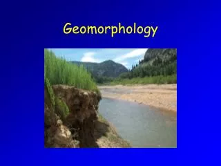
Thoughts on Algorthmic Approaches to Reveal Marine Geomorphology as a Proxy for Habitat Dawn Wright Dept. of Geosciences, Oregon State University Will Heyman Department of Geography, Texas A&M University Presentation IT13B-01 2010 Ocean Sciences Meeting Portland, OR
Primary Data Acquisition: Visual NOAA CRED Hawaii Undersea Research Lab
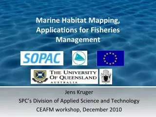
Primary Data Acquisition: “Shallow” Ikonos satellite (Image from SatMagazine) R/V Acoustic Habitat Investigator w/ RESON 8101, NOAA Portable, pole-mounted EM3000 Multibeam sonar, 200 m and shallower Ikonos, shoreline to 15 m
Primary Data Acquisition: “Deep” Image from Lost City Expedition (2003) Multibeam sonar, regional scale, 200 m and deeper
Shape: Bathymetric Position Index Broad scale Fine scale (from TPI, Jones et al., 2000; Weiss, 2001; Iampietro & Kvitek, 2002)
Zone and Structure Flow Chart Emily Lundblad, OSU Thesis
Structure Classification Decision Tree Emily Lundblad, OrSt M.S. Thesis
http://dusk.geo.orst.edu/djl/samoa Benthic Terrain Modeler
Ecosystem-Based Mgmt Tools Network www.ebmtools.org
Roughness: Rugosity Measure of how rough or bumpy a surface is, how convoluted and complex Ratio of surface area to planar area Surface area based on elevations of 8 neighbors 3D view of grid on the left Center pts of 9 cells connected To make 8 triangles Portions of 8 triangles overlapping center cell used for surface area Graphics courtesy of Jeff Jenness, Jenness Enterprises, and Pat Iampietro, CSU-MB
Benthic Complexity Ardron and Wallace, in Wright and Scholz, Place Matters: Geospatial Tools for Marine Science… 2005
Benthic Complexity Ardron and Wallace, in Wright and Scholz, Place Matters: Geospatial Tools for Marine Science… 2005
Ecological Habitat Modeling GLM, GAM, classification/regression trees, etc. Iampietro, Kvitek et al., Marine Geodesy, 2008
Bayesian Approaches Simons and Snellen, Applied Acoustics, 2009
Classification Schemes: CMECS Coastal and Marine Ecological Classification Standard Madden et al., NatureServe, NOAA
EUNIS eunis.eea.europa.net EEA/European Environmental Information Observation Network
EUSeaMap EUNIS classification is a common language for habitat. Propose modifications to EUNIS where appropriate (Baltic or Med) Natalie Coltman, JNCC, UK, www.jncc.gov.uk/EUSeaMap
EUSeaMap Methodology O2/POC/Chl Ice cover Natalie Coltman, JNCC, UK, www.jncc.gov.uk/EUSeaMap
Geoscience Australia Heap, Nichol et al., AAG, 2008