Download
1 / 21
210 likes | 328 Vues
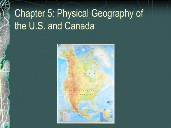
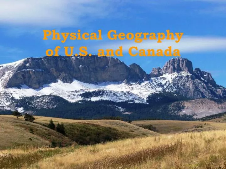
Physical Geography of U.S. and Canada. Landforms of the U.S. 5 Different Regions From East to West Coastal Plains Appalachian Mountains Interior Plains Mountains and Basins Pacific Coast. Coastal Plains. What does Coastal mean ? The flat or gently sloping land near a shore. Two areas

E N D
Landforms of the U.S. • 5 Different Regions • From East to West • Coastal Plains • Appalachian Mountains • Interior Plains • Mountains and Basins • Pacific Coast
Coastal Plains • What does Coastal mean? • The flat or gently sloping land near a shore. • Two areas • Atlantic Coastal Plain • Gulf Coastal Plain
What is a Megalopolis? A continuous line of Settlement
Appalachian Mountains • Over 1,500 miles long • From eastern Canada to Alabama • Mountains are about 300million years old. (**Notice their shape.)
Appalachian Trail Piedmont area is very fertile, good for farming. In 1937 became a National Scenic Trail
Interior Plains 500 miles wide, from Appalachian Mts. To the Rocky Mts.
Interior Plains Central Lowlands Great Plains Western plains Grassy Pastures, Prairie lands • Eastern plains • Flatlands, grassy hills, and thick forests • Soil is rich in nutrients
Mountains and Basins Rocky Mountains • Longest mountain range in North America • Extends from Alaska to Mexico • Formed from Tectonic Plates
Basins Mountains and Basins • West of the Rocky Mts. • Three large plateaus • Columbia • Great Basin • Colorado • What is a Plateau?
Mountains and Basins Plateaus The Great Salt Lake Why is it called the Great Salt Lake?
The Pacific Coast • Two mountain ranges • Cascade Range • Sierra Nevada • Nevada means “snow capped” • East of the mountain ranges are fertile lands, great for farming
Alaska and Hawaii Alaska Hawaii Made up of 8 large islands and 120 small islands Volcanoes erupted and formed the islands Coral Reefs surround part of the island • Mountain ranges surround most of the state • Mt. McKinley, the tallest mountain in the U.S. 20,320 feet • Borders the Arctic Ocean
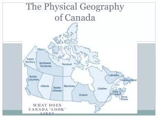
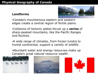
Landforms of Canada • Canada is divided into 10 provinces and 3 territories. • Provinces are political divisions, similar to states in America • Nunavut is the newest territory Created in 1999 Serves as a territory for Canada’s indigenous people
Glaciers • Glaciers are giant ice sheets that are slowly moving • Glaciers moved across Canada thousands of years ago, and made the landforms that are present today, like mountains and lakes
Shield and Tundra • The Canadian Shield is formed from ice sheets that depressed the land surface and scooped out thousands of lake basins. It carried away much of the region's soil. Drainage is generally very poor on the shield. The southern part of the shield has thick forests while the north is covered with tundra. • Tundra is a treeless plain where the soil beneath a few inches is permanently frozen. Located in Canada’s far north.