Download

1 / 19
200 likes | 465 Vues
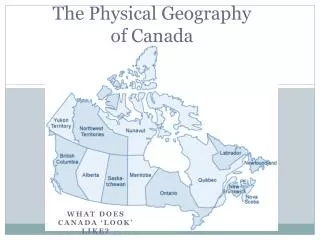
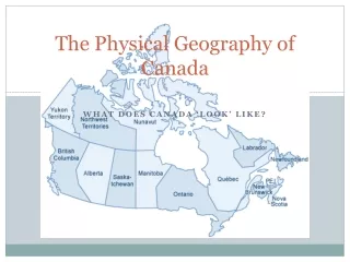
Physical Geography of the United States and Canada. Chapter 4. Physical Features. Section 1. Major Landforms. United States and Canada Form a region that covers most of North America Canada Second-largest country in the world Russia is first. Major Landforms. United States

E N D
Physical Geography of the United States and Canada Chapter 4
Physical Features Section 1
Major Landforms • United States and Canada • Form a region that covers most of North America • Canada • Second-largest country in the world • Russia is first
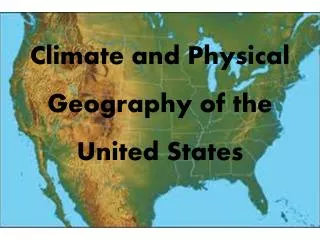
Major Landforms • United States • The 48 states in this part of the country are contiguous, or joined together inside a common boundary.
Major Landforms • Eastern Lowlands and Highlands • A fertile, hilly area called the Piedmont stretches inland from the coastal plain. • Coastal Plain • Cities include Houston and New Orleans
Major Landforms • Eastern Lowlands and Highlands • Appalachians • The oldest mountains in North America
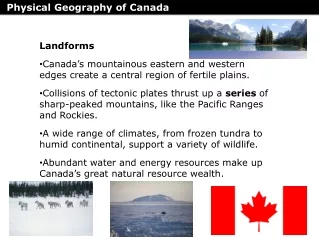
Major Landforms • Interior Lowlands • Canadian Shield • a horseshoe-shaped area of rocky hills, lakes, and evergreen forests • wraps around the Hudson Bay
Major Landforms • Interior Lowlands • Chicago, Detroit, and Toronto are located here • Great Plains • Once provided food for millions of buffalo and the Native Americans who lived there
Major Landforms • Western Mountains and Plateaus • At the eastern edge of the cordillera, the Rocky Mountains begin in Alaska and run south to New Mexico.
Major Landforms • Western Mountains and Plateaus • Mount McKinley • Alaska Range • rises to 20,320 feet (6,194 m), the highest point in North America
Major Landforms • Western Mountains and Plateaus • Canyons • Deep valleys with steep sides
Bodies of Water • The Great Lakes • Formed thousands of years ago by glaciers (large sheets of ice) • The waters of these connected lakes flow into the St. Lawrence River, which empties into the Atlantic Ocean. • One of Canada’s most important rivers
Bodies of Water • Mississippi River • North America’s longest river • Begins as a stream in Minnesota
Bodies of Water • The Continental Divide • The high ridge of the Rocky Mountains is called the Continental Divide. • divide • a high point that determines the direction that rivers flow • West of the divide • Rivers flow toward the Pacific Ocean
Natural Resources • Energy and Mineral Resources • Texas • Ranks first in oil and natural gas reserves in the U.S.
Natural Resources • Energy and Mineral Resources • Coal • Mined in the Appalachian Mountains, Wyoming, and British Columbia • The region has enough coal to supply energy for about 400 years
Natural Resources • Energy and Mineral Resources • Niagara River • Flows north from Lake Erie to Lake Ontario