Download
1 / 23
230 likes | 352 Vues
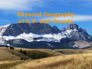
Physical Geography of the U.S. and Canada. Unit 2 Chapter 5. Landforms.

E N D
Physical Geography of the U.S. and Canada Unit 2 Chapter 5
Landforms Two of the best known volcanoes are contained within the lower 48 states- Mount Rainier and Mount Saint Helens are both in Washington State. Mount Rainier has been dormant for over a century and Mount Saint Helens erupted last in 1980, killing 57 and damaging an area of about 70 sq. miles.
Mt. Rainier Mt. Saint Helens
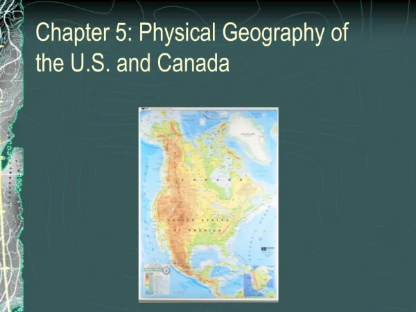
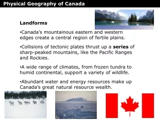
Landforms • Pacific Ranges- the western mountains of North America. • Mount McKinley- in Alaska, highest point on the continent. • Rocky Mountains- link the U.S. and Canada, stretch from New Mexico to Alaska. Dry basins and plateaus, like Death Valley and the Grand Canyon, fill the are between the mountain ranges.
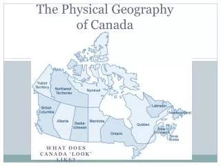
Landforms • Midwest- the area east of the Rocky Mts., which is flat and flattens into the Great Plains. • Appalachians- oldest mountain chain in North America, stretches from Quebec to Alabama. • Islands- North American islands include Manhattan, the Hawaiian Islands, and Greenland.
Water and Importance Water flows west of the Rockies toward the Pacific Ocean and east into the Mississippi River and Gulf of Mexico. -Mississippi River- one of the longest rivers; covers 2,350 miles beginning in Minnesota and ending at the Gulf of Mexico. Drains 31 states and 2 Canadian provinces. St. Lawrence River- forms part of U.S. and Canada border and developed Quebec, Montreal, and Ottawa. Niagara Falls- well-known landmark located on a river connecting Lake Ontario and Lake Erie.
Water • The Great Lakes- Superior, Erie, Michigan, Ontario, and Huron are all basins created by glacial activity. Making Connections What is the importance of the Mississippi River, along with other waterways in U.S. History and Economics? Think- Huckleberry Finn
Natural Resources • Minerals- gold, silver, and copper are all found in the Rocky Mountains. • Timber- forestry and logging continue to be big business for the country, even though forests cover less than 50 percent of Canada and about 1/3 of the U.S. • Fishing- coastal waters of the Atlantic and Pacific and the Gulf of Mexico are important sources of fish and other sea animals.
Varied Regions • Two-thirds of Canada and the U.S. state of Alaska experience long, cold winters and brief, mild summers. • Most of the continental U.S. and the southern 1/3 of Canada enjoy temperate climates, depending on elevation. • Hawaii- located in the South Pacific, has a tropical climate.
Climates • Northern Climates- include large parts of Canada and Alaska; sub arctic climate zones with very cold winters and lows of –70 degrees Fahrenheit • Marine West Coast- nearly 100 inches of rainfall every year to the Pacific coast from California to southern Alaska. • Prairies- naturally treeless expanses of grass spread across the middle of North America. Up to 12 feet high grass, 10 to 30 inches of rainfall yearly.
Dust Bowl When farmers settled the Great Plains, they plowed up the sod formed by prairie grasses, leaving the soil without protection. During the 1930’s, several seasons of drought and dry winds blew the soil away, and the area was nicknamed the Dust Bowl. Question- What have farmers done today to prevent future dust bowl-disasters?
Climates • Eastern Climate- Southeastern U.S., humid subtropical climate with mild winters and long, muggy summers. (Hurricane Activity) • Northeastern U.S. and Canada- humid continental climate, prone to winter blizzards, snowstorms with high winds, heavy and blowing snow. • In which region would you prefer to live? Why? • Tropical Climates- Hawaii, Puerto Rico, and the southern tip of Florida, with tropical savannas and rain forests.