Download
1 / 15
150 likes | 316 Vues
Overview of Model Construction and Calibration. Richard McDonald and Jonathan Nelson, USGS Geomorphology and Sediment Transport Laboratory Golden, CO. Department of the Interior U.S. Geological Survey. Overview. Computational model requirements for flow modeling

E N D
Overview of Model Construction and Calibration Richard McDonald and Jonathan Nelson, USGS Geomorphology and Sediment Transport Laboratory Golden, CO Department of the Interior U.S. Geological Survey
Overview • Computational model requirements for flow modeling • Current model data collection • Model construction and calibration • Some initial results
Model requirements • Grid • Grid attributes • Topography • Roughness • Grain-size • Bed forms • Vegetation • Other larger scales • Grid Resolution • Boundary Conditions • Downstream – stage • Upstream - discharge
Model requirements • Grid • Grid attributes • Topography • Roughness • Grain-size • Bed forms • Vegetation • Other larger scales • Grid Resolution • Boundary Conditions • Downstream – stage • Upstream - discharge
Model requirements • Grid • Grid attributes • Topography • Roughness • Grain-size • Bed forms • Vegetation • Other larger scales • Grid Resolution • Boundary Conditions • Downstream – stage • Upstream - discharge
Model requirements Discharge • Grid • Grid attributes • Topography • Roughness • Grain-size • Bed forms • Vegetation • Other larger scales • Grid Resolution • Boundary Conditions • Downstream – stage • Upstream - discharge Stage Elevation
Current Model Data Collection • LiDAR Topography
Current Model Data Collection • LiDAR Topography • Bathymetry
Current Model Data Collection • LiDAR Topography • Bathymetry • LiDAR Vegetation
Current Model Data Collection • LiDAR Topography • Bathymetry • LiDAR Vegetation • Measured Water-Surface Elevations
Current Model Data Collection • LiDAR Topography • Bathymetry • LiDAR Vegetation • Measured Water-Surface Elevations • Synoptic Water-Surface Elevations
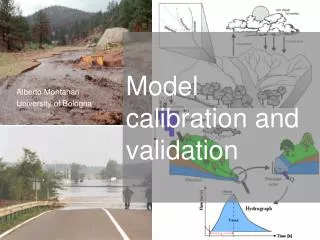
Model Construction and Calibration • Map measured values to the grid • Assign boundary conditions • Calibrate
Model Construction… • Retrieve synoptic water-level data following potential high flows (Mid-April) • Incorporate vegetation roughness • Calibrate model to the collected range of flows • Identify any remaining data gaps