Download
1 / 21
210 likes | 331 Vues
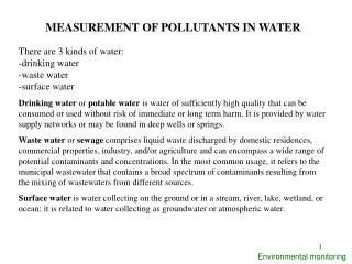
C ritical A ssessment of available R adar P recipitation E stimation techniques and D evelopment of I nnovative approaches for E nvironmental M anagement. Founded in 1995 Main Tasks Environmental monitoring Control of pollutants in : air, ground and water

E N D
Critical Assessment of available Radar Precipitation Estimation techniques and Development of Innovative approaches for Environmental Management
Founded in 1995 • Main Tasks • Environmental monitoring • Control of pollutants in : air, ground and water • Technical support to National Health Service • Weather forecasts and supporting during critical episodes
European EnvironmentalAgency Emilia Romagna Region Local Governments USERS ANPA (National Environmental Agency) AUSL(National Health Service)
ARPA - Servizio Meteorologico Regionale • Starting its activity in 1985 as an Office of ERSA (Regional Institute for Agricultural Development), since the beginning SMR focused on: - Local scale (mesoscale ) - Short range weather forecasts - Support to agriculture • 1989 - Start of Numerical Weather Prediction (LAMBO) • ‘90 - Implementation of C-Band Dual Polarisation Doppler Radar • Middle of ‘90 - Increase and development of user support activity - Operational assistance to Civil Protection Departments • 1996 - Moving to ARPA (Regional Agency for Protection and Environment)
WP 1 - Project Management Objective: To provide the necessary management throughout the project, to safeguard the objectives of the study, and optimise the co-operation between the participants. Activities: The coordinator shall be the intermediary between partners and the Commission. He is responsible for transmitting to the Commission all documents. The coordinator shall transfer to the partners the funds paid by the Commission. (Annex II)
WP 2 - Extraction of information from Doppler winds • Dual/Multiple Doppler • Extraction of profile information from Clear Air data
WP 5 - ASSESSMENT OF IMPROVEMENTS IN NWP • Developing and testing of a Very Short Range Forecasting system (VSRF) • Severe weather case study • Use of Satellite data (Partner 8 - CNR ISAC )
Local Analisys and Prediction System • Developed at FSL/NOAA - Forecasting System Laboratory • Mesoscale analysis system • Exploitation of standard data (Synop, Metar, Temp) • Surface data (local mesoscale network) • Exploitation of unconventional data (Radar Z & V, Satellite, Profiler, aircraft report) • Use of LAM products as “background”
Albers, S.C,. 1995: The LAPS wind analysis. Wea.Forecasting, 10, 342-352
1.4° 06-10-1998 00:04 UTC 1.4° 9.6° 4.1°
LAPS LAMBO • Purpose: Updating forecasts for operational use • Solution: Developing of a continuous assimilation system. Full exploitation of different types of available data • Technical Implementation: Use of LAPS coupled with the actual LAM used (LAMBO). • Future: Operational test with forecast updating every 6 hours. Use of non-hydrostatic model (LM).
LAPS LAMBO 32 lev. Hourly data & BC LAMBO ECMWF T0-Sup 32 T1-Sup 32 T6-Sup 32 LAPS LAPS LAPS DATA INPUT Sup 21P Sup 21P Sup 21P BC BC BC LAMBO HR LAMBO HR LAMBO HR +6/+18 Operational Chain
Severe weather case study – ARPA-SMR together with CNR-ISAC –Identification of severe weather cases. Analysis of cases identified. Studies of the impact of the remote sensing data on the analysed fields. Test on MAP dataset. Work done - Ingest Routine Work in progress - use of LAPS on all IOPs to test the effect of different data (Mesonet, Profilers, dropsonde …)
Scattered convection over Emilia Romagna and Veneto LAMBO +28 LL3 +04 18/09 1600 UTC IR 1530 utc
WP 10 - Optimal use of radar, NWP and raingauge data in precipitation forecasts for improving flood forecasts in urban and rural catchments Objectives : To develop a robust methodology for the incorporating gauges and radar rainfall estimates in NWP forecasts in order to improve flood predictions in urban catchments.