Download
1 / 5
50 likes | 164 Vues
This document outlines the implementation of JPEG 2000 Interactive Protocol (JPIP) for raster data delivery, as part of the Information Solutions and Data Distribution efforts at the USGS Earth Resources Observation and Science (EROS) Center. The project includes the development of streaming capabilities, mobile client enhancements, and performance testing. The goal is to facilitate the access and distribution of imagery data holdings using advanced protocols. Cost for the project is $97,592. Various standards and technical specifications related to JPIP and GIS services are discussed.

E N D
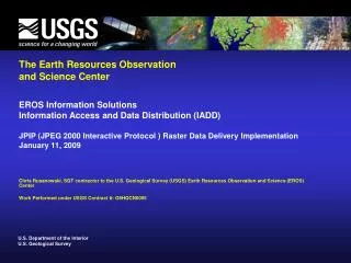
The Earth Resources Observation and Science Center EROS Information Solutions Information Access and Data Distribution (IADD) JPIP (JPEG 2000 Interactive Protocol ) Raster Data Delivery Implementation January 11, 2009 Chris Rusanowski, SGT contractor to the U.S. Geological Survey (USGS) Earth Resources Observation and Science (EROS) Center Work Performed under USGS Contract #: O8HQCN0005
What – Current State and New Proposal • ArcSDE with ArcIMS • WMS, ArcIMS, Extraction/Download • ArcSDE with ArcGISServer • WMS, WCS, KML, ArcGIS, Cached Services, Extraction/Download • ImageServer with ArcGISServer • WMS, WCS, KML, ArcGIS, Cached Services, Extraction/Download, ImageServer Plugins • JPEG2000 with JPIP Streaming • http://www.jpeg.org/ • ISO/IEC 15444-1:2000 • Part 2 became an International Standard (ISO/IEC 15444-2) in November 2001 • Multiple resolution representation • Progressive transmission • Random code-stream access and processing • Part 9 became an International Standard (ISO/IEC 15444-9) in October 2004 • JPEG 2000 Interactive Protocol
Who and Why – Mobile Implementation Demo • Original Data Size • 5.71 GB • Internet Browse (WMS) • 150 – 800 KB per request • Broadband, Internet Browser • Local Analysis (Download) • Up to full 5.71 GB • GIS Software, Broadband/Disk • KML Access • 150 – 800 KB per request • KML Software, Broadband • Online Analysis (WCS) • 150 – 800 KB + per request, up to full 5.71 GB • AGS = WCS 1.1.1 c1 • WCS Client, Broadband • Download Data • 571MB • Internet Browse (JPIP) • 5MB • http://iasdemo.ittvis.com/ • Benefits: • Disconnected View • Mobile Client • Bandwidth • Specify Quality
Notes from Original JPIP Proposal • Objectives • The objective of this task is to provide some amount of IADD imagery data holdings as a (JPEG 2000 Interactive Protocol (JPIP) service and create a handheld client to use it. • Deliverables include • Development of an in-line JPIP streaming capability • Identify a Nokia smart phone device and enhance JPIP client for the same • Test and Document Performance • Status Reporting • Cost • $97,592